
Recreation
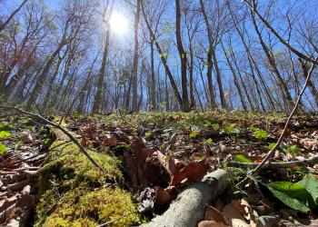
The Daniel Boone National Forest offers an abundance of outdoor recreation opportunities. Camping, hiking and fishing are just a few of the many attractions that draw more than one million visitors to the forest each year. Abundant wildlife, lush vegetation, magnificent scenery and numerous recreation opportunities offer visitors much to enjoy.

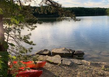
Cave Run Lake is nestled among the rolling hills of northeastern Kentucky. This 8,270-acre lake provides flood protection and a clean water…

The Central Forest region of the Daniel Boone National Forest surrounds the centermost trailhead of the Sheltowee Trace National Recreation Trail in…
Laurel River Lake features 5,600 acres of clear, deep water and nearly 200 miles of tree-lined shore. The quiet coves and cliff-lined shores offer…

The Red River Gorge is a unique, scenic natural area that attracts thousands of visitors each year. Spectacular rock features,…
The Redbird Purchase has many recreational opportunities from hiking, fishing, picnicking, backpacking, horse riding and OHV trail riding. The area…

The Cumberland River flows north through the heart of the Daniel Boone National Forest and offers great canoeing and rafting opportunities. The river…

Much of the Stearns Ranger District lies within the South Fork of the Cumberland River, located in the remote foothills of the Jellico Mountains.…

Recreation
Alfrey Boat Ramp
Site Open
Alfrey Boat Ramp is located along Twin Knobs Road just off KY 801 on the eastern shore of Cave Run Lake. Fishing is not allowed from the boat ramp, but once you are in the water, you will find a wide…
Alpine Loop Trail
At just over a mile, Alpine Loop Trail is a great way to walk off a picnic lunch at the nearby Alpine Picnic Area. The trail loops back into the Forest following an old roadway and historic…
Alpine Picnic Area
Site Open
Located off US 27 in Pulaski County, Alpine Picnic Area provides a welcoming, family-friendly picnic getaway. The site has a number of individual picnic tables, two first-come, first-served picnic…
Alpine Spur Trail
Alpine Spur Trail is a short 0.25-mile trail and an easy walk for most, with a variety of things to see and hear. The trail cuts across Alpine Loop Trail, creating a shorter inner loop that brings…
Alum Trail
The 2.25-mile Alum Trail leads users from a ridge top on the Daniel Boone National Forest National down to its connection with the Sheltowee Trace National Recreation Trail at the edge of the Big…
Appletree Shooting Range
Site Open
Appletree Shooting Range is located off Appletree Shooting Road (Forest #6152) just east of US 27 in McCreary County. It has two large, sheltered benches with target holders at 25, 50 and 100 yards.…
Bald Rock Picnic Area
Site Open
Bald Rock Picnic Area is located off KY 192 north of Laurel River Lake and offers a great place for picnicking as a group. From 1936 to 1970, the Bald Rock Fire Lookout Tower stood on this site.…
Bangor Boat Ramp
Site Open
Bangor Boat Ramp is located on Bangor Boat Dock Road just off KY 1274 and provides access to a narrow portion of Cave Run Lake. Fishing is not allowed from the boat ramp, but once you are in the…
Barren Fork Heritage Trailhead
Site Open
Barren Fork Heritage Trailhead is located off Barren Fork Road just behind the Stearns Ranger District Office and provides access to the Accessible Barren Fork Heritage Trail #621. This 3/4 mile…
Barren Fork Horse Camp
Site Open
Barren Fork Horse Camp is located off Barren Fork Road (#684) about 1 mile past US 27 and the Stearns Ranger District Office. From 1881 to 1935, the area was the site of a coal mining town operated…