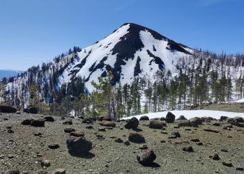
Recreation


mountain side with red flowers

Discover an Area by Activity

Select an activity to find an area to visit.


The Six Rivers National Forest offers nearly one million acres of forest for your enjoyment, relaxation, and exploration. Within a six-hour drive north of the Bay Area, you can experience the solitude of hiking in the wilderness on over 100 miles of trails, enjoy camping near others in developed campgrounds, or the solitude of camping in the backcountry. The forest is also a prime location for plenty of world-class fishing, as well as home to one of most barrier-free fishing locations in the nation. The forest’s ranger district offices from north to south include:

Recreation Map

Map showing recreational areas. Map Information

Current Recreation Conditions

Area Name Status Area Conditions
Aikens Creek West Campground Closed Closed
Bailey Canyon Campground Closed Closed
Bear Basin Butte Lookout / Pierson Cabin Temporarily Closed Temporarily Closed
Big Flat Campground Closed Closed
Boise Creek Campground Closed Closed
Devil's Punchbowl Trail Temporarily Closed Temporarily Closed
Dillon Creek Campground Closed Closed
Doe Flat Trail (#4E04) Unreachable Unreachable
E-Ne-Nuck Campground Closed Closed
East Fork Campground Closed Closed Estimated open date June 2023 through September 25, 2023. Dates may vary due to wet weather and Port-Orford-cedar root disease.
Fir Cove Campground Closed Closed
Fish Lake Campground Closed Closed Open June 2nd, 2023 through September 25, 2023. Dates may vary due to wet weather and Port-Orford-cedar root disease. Closed for winter months. 
Grassy Flat Campground Closed Closed
Island Lake Closed Closed Gate is open all year. Vehicle access to the trailhead may be blocked by snow during the wet season, usually November to mid-June.
Island Lake Trail (#4E05) Unreachable Unreachable
Mad River Campground Closed Closed
Nordheimer Campground Temporarily Closed Temporarily Closed
Nordheimer Group Campground Temporarily Closed Temporarily Closed
North Fork Campground Closed Closed
Oak Bottom Campground Closed Closed Closed due to infrastructure reapirs from downed power lines from winter storms. No estimated time of re-opening. 
Old South Kelsey (Historic Kelsey) Trail (#2E23) Open Open
Panther Flat Campground Closed Closed
Patrick Creek Campground Closed Closed
Pearch Creek Campground Closed Closed
Sanger Lake Closed Closed

Spotlights

Smith River National Recreation Area

A kayak floats the jade-green waters of the Smith River at the confluence of the middle &south forks

Recreational activities abound in the Smith River National Recreation Area or NRA. The beautiful Smith River offers fishing for steelhead, trout, and salmon. During the summer months, the pure, clean waters of the Smith River are perfect for swimming, rafting, or fishing and the forested mountainsides present occasions for hiking, bird watching, wildflower walks, or perhaps just lounging in the sun.

Winter temperatures drop into the 40s and 50s, with an occasional snow storm. The rainy season normally runs from October through April with an average annual rainfall of 92.55 inches. Summers are dry with highs in the 80-100°F degree range. Contact the NRA Headquarters at the Gasquet Ranger Station for current weather conditions.


Klamath National Wild and Scenic River

[Photograph]: Relaxing on the Klamath River.

The spectacular Klamath River is both the second largest and second longest river in California. The river makes its way through over 200 miles both the Cascade and Coast Mountain Ranges offering many recreation opportunities to its visitors. Summer months bring rafters to the area and jet boat rides are offered out of the town of Klamath. The river is renowned for its fishing opportunities of Chinook (King Salmon), coho (Silver Salmon), and steelhead. The river is easily accessible off of Highway 96. Several ramps exist to provide easy launching for your boat.

Recreation Areas