

Piecing Together the Geologic Puzzle at the Flat Tops, Colorado
By Lorraine Negrón, Geologist and GIS Technician Resource Assistant, White River National Forest
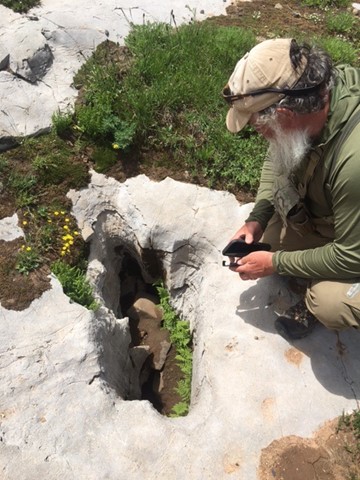
In July 2022 a team of cave specialists from the White River National Forest had the opportunity to bring in Honorary Doctor Jim Baichtal, retired Forest Geologist for the Tongass National Forest in Alaska, to explore the White River National Forest and hunt for the abundant undiscovered karst features on the Flat Tops in Colorado. During the course of the week-long expedition, the team used research previously conducted by a former GeoCorps intern, Alex Lyles, who compiled a mosaic of cave and karst LiDAR data in ArcGIS for most of the White River National Forest in order to see depressions on topographic maps. These depressions are of high interest because they could indicate possible sinkholes, caves, or other karst features that characterize the area’s geology and hydrology.
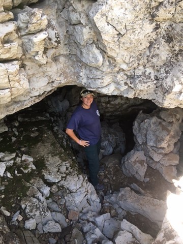
The purpose of the expedition was to ground truth these features from the LiDAR data, and to our amazement, the LiDAR data were spot on, down to the contours! The team also encountered basalt fields with basalt bombs, and on the last day discovered sand dunes. Jim was quite excited by this discovery and wanted to grab some umbrellas, chairs, drinks, and a beach ball and have a beach day. The discoveries of both the basalt formations and the dunes both complicated the team’s interpretation of the area’s geology and hydrology and helped the team piece together the area’s geologic puzzle.
Since the expedition, the team has been using those same LiDAR data to ground truth other areas for karst features in various locations around the forest. The team has started using GPS to get accurate and precise positions on caves and karst features in the Lime Park area, Flat Tops, Fulford area, and other areas of interest that suffered burn scars from fires in recent years. Overall, it has been quite the productive summer with lots of exciting research and exploration that will continue as an ongoing project for the next several years.


Photo: Left to Right: Volcanic bomb, lava flow, igneous rock with quartz veins.
Since the expedition, the team has been using those same LiDAR data to ground truth other areas for karst features in various locations around the forest. The team has started using GPS to get accurate and precise positions on caves and karst features in the Lime Park area, Flat Tops, Fulford area, and other areas of interest that suffered burn scars from fires in recent years. Overall, it has been quite the productive summer with lots of exciting research and exploration that will continue as an ongoing project for the next several years.