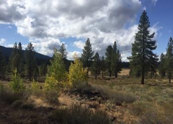
Ecology
Effective beginning 5/20/2025
This website, and all linked websites under the control of the agency is under review and content may change.
The Region 5 Ecology Program (REP) is a boundary-spanning organization that provides expertise fundamental to sustainable, science-based, multiple-use land management in the Pacific Southwest Region. REP staff work closely with other ecologists, resource specialists, and managers across the region and country.
Who We Are
- To provide leadership and program direction that incorporates the best available ecological science in the Agency's multiple-scale approach to managing natural resources for sustainability and diverse human needs.
- To facilitate understanding, development and appropriate use of ecological science in Agency activities such as landscape analysis and assessment, land management planning, inventory and monitoring, and project implementation.

The Ecology Program staffs Ecologists in five geographic provinces in the Region (across four zones), with each province serving 3-4 National Forests. Each Province hosts two ecologists, a Province Ecologist and an Associate Province Ecologist. Additionally, the Regional Ecologist and Assistant Regional Ecologist are stationed at the Regional Office in Vallejo, California.
Our Work
Application of Climate Data and Tools
The Ecology Program analyzes and interprets climate data to develop climate mitigation and adaptation strategies.
- The Ecology Program provides climate science interpretation support to help forest managers plan for, and where possible, mitigate climate related ecosystem vulnerabilities.
The Ecology Program also provides climate interpretation and expert support to utilize the most recent climate data and tools.
The Cal-Adapt webpage enables the visualization and download of downscaled climate datasets developed for California’s Fourth Climate Assessment. It provides tools that allow users to explore data on temperature, precipitation, snowpack, and wildfire by geographic location.
Forest Service Climate Risk Viewer
This viewer illustrates the overlap of multiple resource values with climate exposure, vulnerability, and management direction on National Forest System lands. It is available for assessing the need for climate adaptation and to identify gaps between current practices and needed adaptation practices.
A Quick Guide to Adaptation Planning for Natural Resources Professionals (usda.gov)
The Quick Guide by the Northern Institute of Applied Climate Science provides a streamlined approach to the 5-step project planning process laid out in the original Adaptation Workbook. Both the Adaptation Workbook and Quick Guide are designed to enable integration of specific climate adaptation actions into management for both pre- and postfire forest health and hazard reduction projects and have been applied to a variety of projects across California.
CA Forest Adaptation Strategies and Approaches
This menu by the California Climate Hub guides managers through options for climate-adapted forest management across California. Recognizing that there is no one-size-fits all management solution, the menu provides a range of strategies and approaches for consideration, including management to support resistance or build resilience, as well as more transformative options for locations experiencing high levels of exposure to climate and disturbances.
Climate Engine offers a collection of ready-to-use Earth systems data derived from satellites and sensors. Climate Engine App enables cloud computing and visualization of climate and satellite Earth Observation data for academic and non-commercial research.
The Ecology Program has developed Climate Change Trend Summaries for the National Forests in Region 5.
Angeles and San Bernardino
Cleveland
Eldorado
Inyo
Klamath
Lake Tahoe Basin
Lassen
Los Padres
Mendocino
Modoc
Plumas
Sequoia
Shasta-Trinity
Sierra
Six Rivers
Stanislaus
Tahoe
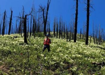
Ecological Restoration
The Ecology Program uses current ecological science to develop, implement, and monitor ecological restoration efforts across the region.
- Provide ecological information for forest and project planning through the development of products such as the Natural Range of Variation (NRV) assessments. These assessments provide baseline information on ecosystem conditions for a range of vegetation types across the Region and are used in forest planning, development of restoration projects, and as a communication tool.
- Provide Forests with post-fire ecological assessments and guidance for the restoration of key natural resources and ecosystem services. Heading the development of the Post-fire Restoration Framework for National Forests in California (GTR-270) provided Forests with a science-based standard to identify post-fire ecosystem needs to implement appropriate restoration activities.
- Provide opportunities to balance ecological, social, and economic priorities through landscape assessments to assist Forests with planned processes that aim to regain ecological integrity and enhance human well-being in deforested or degraded landscapes.
NRV assessments can be used to develop broad, science-based management goals and desired conditions.
What is the Natural Range of Variation (NRV)?
Ecosystems are dynamic. One tool that managers use to address and apply this concept is a Natural Range of Variation (NRV) assessment. These assessments identify a range of ecosystem conditions that fluctuate, over long time periods and across multiple spatial scales, in response to changes in climate, disturbance regimes, and human influence. They can be used by land managers as a foundation for the development of broad, science-based management goals and desired conditions.
NRV Reports and Publications (PDF)
Aspen - Sierra Nevada and Southern Cascades
Chaparral - Sierra Nevada and Southern Cascades
Hardwoods - Sierra Nevada and Southern Cascades
Red Fir and Subalpine - Sierra Nevada and Southern Cascades
Red Fir and Subalpine - Northwestern California and Southwestern Oregon
Meadows - Sierra Nevada and Southern Cascades
Pinyon-Juniper - Sierra Nevada and Southern Cascades
Riparian - Sierra Nevada and Southern Cascades
Riparian - Northwestern California and Southwestern Oregon
Sagebrush - Sierra Nevada and Southern Cascades
Yellow Pine and Mixed Conifer - Sierra Nevada and Southern Cascades
Yellow Pine and Mixed Conifer - Northwestern California and Southwestern Oregon
This framework provides a science-based process for strategic restoration planning on national forests in California and elsewhere. California’s landscapes are becoming dramatically altered by wildfires. The postfire restoration framework (PSW-GTR-270) and related postfire interventions (PSW-GTR-278; forthcoming) reports provide land managers with a science-based process for restoration planning on national forests in California. The framework is rooted in ecological restoration principles and includes a landscape assessment process and tools that set the stage for planning large-scale restoration projects.
Postfire Assessments and Strategies by Province
Northern Province
Sierra Cascade Province
- California Spotted Owl on the Plumas National Forest
- Conifer Forest on the Plumas National Forest
- California Spotted Owl in the 2021 Dixie and Sugar Fires
- Conifer Forest in the 2021 Dixie and Sugar Fires
- Conifer Forest, Plumas National Forest Fires 2017-2020
Central Sierra Province
Southern Sierra Province
- Conifer Forest and Sagebrush Steppe in the Western Glass Mountain Range
- Giant Sequoia and Pacific Fisher in the 2021 Windy Fire, KNP Complex and French Fire
Southern California Province: Chaparral and mixed conifer/Bigcone Douglas Fir in the 2020 Bobcat Fire (in progress).
Additional Postfire Resources and Information
Integrating science into planning at large scales in a collaborative setting.
Where in Region 5 do we work on large landscapes?
- Collaborative Forest Landscapes encourage the collaborative science-based ecosystem restoration of forested landscapes. In Region 5, there are four active Collaborative Forest Landscape Restoration (CFLR) projects and one in the monitoring phase.
How does Region 5 contribute to landscape assessments?
The North Yuba Landscape is one of the "largest contiguous unburned landscape remaining in the Sierra Nevada" and is both a priority landscape as well as a CFLR. The Ecology Program has been working with the North Yuba Partnership to develop a robust project plan, a funded CFLR proposal and continues to collaborate on a monitoring plan.
The Lake Tahoe West Restoration Partnership is a proposed project located on the Lake Tahoe Westshore that aims to restore forests, meadows, streams and wildlife. The Ecology Program worked with the partnership to develop a resilience assessment, restoration strategy and is in the process of developing a monitoring plan.
The Burney-Hat Creek Basins project was established as a CFLRP in 2012 on the Lassen National Forest. Although this project was completed in 2022, the Ecology Program continues to work with the collaborative to coordinate and implement monitoring activities that address the questions identified in the multiparty monitoring strategy. The results of these monitoring efforts can be found here.
The Dinkey Landscape Restoration Project is a group of stakeholders representing diverse public interests and California Native American Tribes, who are working with the USDA and other agencies to implement the CFLR on the Sierra National Forest.
The Amador-Calaveras Consensus Group was a CFLR established in 2012. This project was completed in 2022 but continues to provide critical monitoring information. The Ecology Program has worked with this collaborative to develop a monitoring strategy and continues to coordinate the monitoring workgroup reporting on critical outcomes from treatment effectiveness.
The Eastern Sierra Climate and Communities Resilience Project is planning for ecological forest restoration on 56,000 acres on the Inyo National Forest lands surrounding the town of Mammoth Lakes. The Ecology Program works with the group to assist with project planning and monitoring efforts.
The Giant Sequoia Lands Coalition is a group of member agencies that oversee response to emergency treatments within giant sequoia groves throughout its range. The Ecology Program provides extensive support to inventory and monitoring work providing critical information to aid in critical management decisions.
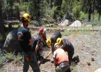
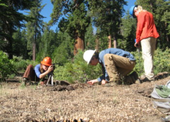
Inventory and Monitoring
- To facilitate science-based decision making, the Ecology Program works closely with managers to identify key monitoring, inventory and analysis needs. Inventory and monitoring projects range from treatment effectiveness to status and trend monitoring for key resources across the region;
- The Ecology Program serves as a repository of monitoring protocols developed through partnerships to address numerous monitoring questions;
- The Ecology Program assists with the application of new technology in the form of tools, data sets and modelling to answer pressing land management questions.
The Ecology Program works closely with managers to quantify the effects of management activities on natural resources. Treatment effectiveness monitoring informs whether managers are meeting project objectives and moving the landscape closer to desired conditions. The Ecology Program provides effectiveness monitoring for a variety of projects and is well versed in developing monitoring protocols, collecting data, and interpreting and applying monitoring results.
What have we learned through effectiveness monitoring?
Fuel treatment effectiveness has been studied at the regional-level and has been conducted in partnership with forest units to assess project-level outcomes as they relate to wildfire resilience.
The Ecology Program has also evaluated treatment effectiveness related to drought-induced tree mortality both at larger and smaller scales.
In addition to field monitoring, the Ecology Program conducts literature syntheses for key management topics like fuels reduction and restoration treatment effectiveness.
In addition to designing monitoring plans to address the effectiveness of different management actions, the Ecology Program conducts inventory and assessment monitoring of numerous special status species and important ecological resources across the Pacific Southwest Region. A few select examples are provided below.
Highlights
Whitebark pine
Whitebark pine (Pinus albicaulis) is an important tree species in high-elevation ecosystems of western North America that was recently federally listed as threatened because of significant threats from climate change, fire regime alteration and disease. The Ecology Program has evaluated the status of whitebark pine throughout the Pacific Southwest Region.
Statewide Assessment of Whitebark Pine Ecosystems in California
Understanding and Managing Whitebark Pine in California
Ecological Integrity of Whitebark Pine Ecosystem's in California's National Forests
Mortality, Structure, and Regeneration in Whitebark Pine Stands
Meadows
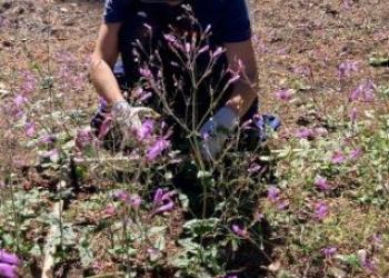
Although meadows make up a small proportion of California landscapes, they play a large role in maintaining ecosystem function and biodiversity. The Ecology Program is an integral member of both the Sierra Meadows Partnership and the Klamath Meadows Partnership. The Ecology Program was integral to the creation and maintenance of the Sierra Nevada Meadows Data Clearinghouse, and we have worked across the region to conduct meadow inventory, classification, monitoring, restoration, and to assess climate change vulnerability. We recently published a comparison of existing meadow assessment protocols to help managers choose between them.
Sierra Meadows Wetland and Riparian Area Monitoring Plan
Meadow Vulnerability Assessment
Meadow Sensitivities to Interannual Climate Variability in the Sierra Nevada
The Ecology Program works to develop and apply decision support tools, datasets, and modelling to help answer pressing land management questions and inform planning and implementation across the Pacific Southwest Region.
Climate-wise Reforestation Toolkit
The Climate-wise Reforestation Toolkit provides three resources that can be used individually or together to inform reforestation decisions in the context of tree mortality and climate.
Post-Mortality Reforestation Prioritization Tool (shinyapps.io)
Fire Return Interval Departure (FRID)
Departures in fire frequency provide a basis to identify areas on the landscape that are at high risk of type conversion or threshold-type responses owing to either too much fire or not enough fire.
Postfire Conifer Reforestation Planning Tool (PostCRPT)
PostCRPT predicts the probability of conifer regeneration under different climate and seed production scenarios to help inform land management decisions after large wildfire events.
Postfire Conifer Reforestation Planning Tool | Reforestation Tools
Postfire Restoration Prioritization (PReP) Tool
The PReP tool helps resource managers to detect and prioritize degraded chaparral landscapes in need of restoration after wildfire.
Appendix 5: Postfire Restoration Prioritization Tool for Chaparral Shrublands (usda.gov)
Our Provinces
The Northern Province Ecology Program serves the Six Rivers, Klamath (incl. Butte Valley National Grassland), Shasta-Trinity, and Mendocino National Forests and the Berryessa Snow Mountain National Monument. The Province is very diverse geologically, encompassing portions of several different mountain ranges including the Klamath Mountains, the North Coast Range, and the southern Cascades. The topography and proximity to the Pacific Ocean creates a notable level of geographic variation in climate. The Province’s geophysical complexity strongly influences the distribution of vegetation types as well as the structure and productivity of vegetation throughout the area.
Partners and Northern Province spotlights
- Klamath Meadows Partnership
- Firescape Mendocino
- Dr. Erik Jules – Department of Biological Sciences - Cal Poly Humboldt
- Northern California Prescribed Fire Council
Contact Information
Ramona Butz, Province Ecologist
Location: Six Rivers National Forest Supervisor’s Office, 1330 Bayshore Way, Eureka, CA 95501
Email: ramona.butz@usda.gov, Office: 707-601-4332
Gabrielle Bohlman, Associate Province Ecologist
Location: Mendocino National Forest Supervisor’s Office, 825 N Humboldt Street, Willows, CA 95988
Email: gabrielle.bohlman@usda.gov, Office: 530-643-3712
The Sierra Cascade Province includes the Plumas, Lassen and Modoc National Forests. The Province is geologically diverse, spanning the Modoc Plateau, southern Cascades and northern Sierra Nevada. The Modoc Plateau is characterized by high-elevation basalt flows between the Warner Mountains and the Medicine Lake Highlands with eastside pine forests and sagebrush steppe. Landscapes of the southern Cascades are stippled with volcanic peaks that shelter the headwaters of the Feather River watershed. The steep, granitic slopes of the northern Sierra Nevada sustain productive mixed conifer and mixed evergreen forests. Distinct habitats such as vernal pools, fens, montane meadows, aspen stands, low sagebrush flats, oak woodlands, Baker cypress stands, and serpentine outcrops are dispersed across the Province.
Fire Ecology
- Fire is an essential ecosystem process throughout California, creating and maintaining a mosaic of species and successional patterns across the landscape. We work to return fire regimes to within the natural range of variability and to restore postfire landscapes.
Biological Hotspots
- The Sierra Cascade Province is rich with unique habitats characterized by high levels of endemism or species diversity. Our program seeks to maintain and promote landscape-scale heterogeneity by studying the effects of management activities on biological hotspots across the Sierra Cascade Province.
Rare Plants
- We have worked with botanists across the Sierra Cascade Province to conduct large-scale monitoring of rare plant populations in response to management activities, including prescribed fire, fuel reduction, and timber harvest.
Contact Information
Kyle Merriam, Province Ecologist
Plumas National Forest Supervisor's Office, 159 Lawrence Street, Quincy, CA 95971
Email: kyle.merriam@usda.gov, Office: 530-283-7777
Michelle Coppoletta, Associate Province Ecologist
Plumas National Forest Supervisor's Office, 159 Lawrence Street, Quincy, CA 95971
Email: michelle.coppoletta@usda.gov, Office: 530-283-7822
The Central Sierra Province covers the Tahoe, Eldorado and Stanislaus National Forests and the Lake Tahoe Basin Management Unit. The Central Sierra Province is part of the Region 5 Ecology Program and provides support across three major goals - ecological restoration, climate change adaptation, and monitoring & inventory. The Province Ecologist is based on the Eldorado National Forest in Placerville and the Associate Ecologist is based on the Lake Tahoe Basin Management Unit in South Lake Tahoe. The Province spans a range of habitat types from low elevation oak woodlands to high elevation subalpine vegetation. The Province also covers the more common vegetation types such as Sierra mixed conifer and red fir forests. These varying vegetation types provide habitat for a number of wildlife species in including sensitive species such as California Spotted Owl. The Province also has three wilderness areas, three experimental forests (Onion Creek, Sagehen, and Stanislaus-Tuolumne) and nine Research Natural Areas which provide excellent opportunities for scientific study and monitoring. The Ecology Program is committed to working with partners to form science-based land management decisions that will help to improve the resiliency of our forests.
Project Highlights
Caples Ecological Restoration Project
- The Caples Creek Ecological Restoration Project is a collaborative approach to managing large landscapes with fire of which the Central Sierra Ecology Program has played an integral role.
- Historical Range of Variability
- The historic range of variability and current landscape departure was summarized on six watersheds in the Tahoe Central Sierra Initiative landscape.
- The historic range of variability and current landscape departure was summarized on six watersheds in the Tahoe Central Sierra Initiative landscape.
Contact Information
Becky Estes, Province Ecologist
Eldorado National Forest Supervisors Office, 100 Forni Road, Placerville CA 95667
Email: becky.estes@usda.gov; office: 530-642-5161
Associate Province Ecologist, vacant
The Southern Sierra Province Ecology Program is part of the Region 5 Ecology Program and serves the Inyo, Sequoia, and Sierra National Forests and Giant Sequoia National Monument. The province is topographically and ecologically diverse, spanning from high elevation alpine and subalpine environments to foothill woodlands on the west slope and arid shrublands and woodlands on the eastern escarpment and Basin and Range. The Southern Sierra Province contains many unique vegetation types including giant sequoia groves, extensive east-side Jeffrey pine forests, and high-elevation bristlecone pine and foxtail pine woodlands. Much of the province occurs in wilderness areas where fires are often managed as a natural ecological process.
The program is helping work to restore beneficial fire to forest landscapes and highlighting the intrinsic ecological value in unique ecosystems, such as Giant sequoia groves, aspen stands, and subalpine forests and woodlands.
Contact Information
Marc Meyer, Province Ecologist
Inyo National Forest Supervisor’s Office, 351 Pacu Lane, Bishop, CA 93514
Email: marc.meyer@usda.gov, Office: 760-873-2447, Cell: 559-676-7431
Travis Sowards, Associate Province Ecologist
Sierra National Forest, High Sierra Ranger District Office, 29688 Auberry Rd, Prather, CA 93651
Email: travis.sowards@usda.gov, Office: 559-855-5355, ext 3354, Cell: 559-575-613
In Southern California, the Regional Ecology Program serves the Angeles, Cleveland, Los Padres and San Bernardino National Forests. These forests span over 3.5 million acres and touch the Pacific Ocean in Big Sur in the north and the Sonoran Desert in the south. This province boasts incredible ecological diversity, including chaparral, coastal redwood forest, oak woodland, subalpine, mixed conifer forest, riparian forest, sage scrub and grassland habitats. Southern California is home to the endemic bigcone Douglas-fir, Tecate cypress, Engelmann oak, Santa Lucia fir, Cuyamaca cypress and southern California black walnut. In addition, the southern-most distribution of many well-known and abundant species is located in Southern California, including California buckeye, black oak, madrone, grey pine and California bay.
The Southern California forests provide numerous ecosystem services (clean and abundant water, recreation, sediment retention, etc.) to the 20 million residents of the region. Despite their importance and incredible biodiversity, the ecological integrity of these ecosystems is challenged by regional and global threats that include growing human populations, warming temperatures, multiyear droughts, air pollution, and altered fire regimes. The Regional Ecology Program integrates the best available science into management activities with the goal of promoting the long-term persistence and function of these highly valued landscapes.
Contact Information
Nicole Molinari, Province Ecologist
Los Padres National Forest Supervisor’s Office, 1980 Old Mission Dr., Solvang, CA 93463
Email: nicole.molinari@usda.gov, Office: 805-968-6640
Sarah McCullough Hennessy, Associate Province Ecologist
Cleveland National Forest, Alpine Ranger Station, 3348 Alpine Blvd., Alpine, CA 91901
Email: sarah.hennessy@usda.gov, Office: 619-445-6235