
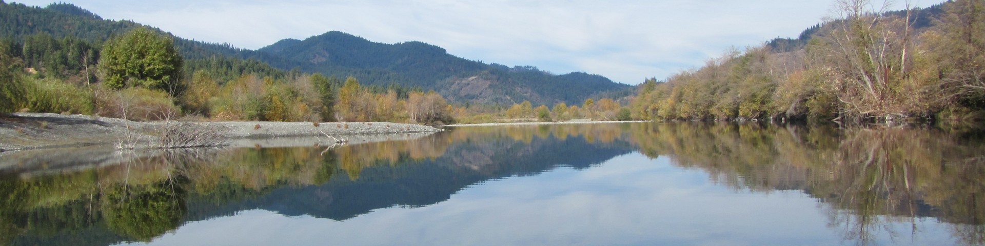
South Fork Trinity River
The South Fork of the Trinity River is a rich resource with its serene beauty and its many recreational opportunities.
The South Fork Management Unit (SFMU) is based in Hayfork and contains the Hayfork and Yolla Bolla Ranger Districts. The SFMU encompasses over 590,000 acres. Three major streams from the primary watersheds within this area; the South Fork of the Trinity River, Hayfork Creek and Beegum Creek.
The SFMU is bounded along its western side by South Fork Mountain, one of the longest continuous ridgelines in North America. At the southern end of the unit are the Yolla Bolla Mountains and one of two wilderness areas with the unit, the Yolla Bolly-Middle Eel Wilderness. Situated along the eastern side of the SFMU is the Chanchelulla Wilderness. The northern end of the unit is bounded by a series of ridgelines and peaks that include Pattison Peak, Hayfork Bally and Hayfork Divide.
The large variety in terrain and ecosystems that exist on the SFMU provide for a wide range of recreational opportunities.
You can rent an historic cabin, camp in a wide variety of campgrounds, both developed and undeveloped, hike into either the Yolla Bolly or Chanchelulla Wilderness area, or enjoy a 40+ mile wild and scenic river corridor. With this wide range of recreational opportunities, you should be able to find just the right one for your interests.
Chanchelulla Wilderness
The Chanchelulla Wilderness is the second of the two wilderness areas in the South Fork Management Unit, which provides opportunity for wilderness hiking and camping. Chanchelulla Wilderness is a relatively small wilderness area located about 50 miles west of Red Bluff. The Chanchelulla Wilderness was created in 1984 by Congress. The Wilderness features rugged terrain with steep, chaparral and tree covered slopes. Chanchelulla Peak is the highest point at 6,401 feet. This area is popular during hunting season.
Access to Chanchelulla Creek Trail is near Deer Lick Springs on the eastern side of the Chanchelulla Wilderness. The road to Deer Lick Springs is well signed and accessible in 2WD vehicles, although high-clearance and 4wd can be helpful in areas where there are potholes or during inclement weather.
Travel west on Hwy 36 to Harrison Gulch Road, 1/4 mile west of the district office. This paved county road is 5 miles long and connects with Forest road 30N44 north of Knob. Road 30N44 is only 1/10 mile in length and merges with the Forest Road 01 five miles from Deerlick Springs Campground.
Yolla Bolly-Middle Eel Wilderness
The Yolla Bolly-Middle Eel Wilderness is roughly oval in shape, being about 19 miles long in the north-south direction and 24 miles wide in the east-west direction. The majority of the Wilderness lies in two districts of the Mendocino National Forest (Covelo and Grindstone Ranger Districts). The far northern portion of the Wilderness is in the Yolla Bolla Ranger District of the Shasta-Trinity National Forest. To the far west, a part of the Wilderness is in the Mad River Ranger District of the Six Rivers National Forest, and the Bureau of Land Management has a small portion of the Wilderness (also on the western edge).
Some areas in the Yolla Bolly-Middle Eel Wilderness have been affected by recent wildfires; for more information, please call the Hayfork Ranger Station at (530) 628-5227.
In the Wintun Indian language, "Yo-la" meant "snow covered", and "Bo-li" meant "high peak." The second part of this Wilderness' name refers to the headwaters of the Middle Fork Eel River, which originates in this remote and rugged land. This area was first protected in 1931 when it was classified as a primitive area. Further protection was given when this area became part of the National Wilderness Preservation System, created by the passage of the Wilderness Act of 1964. The Wilderness Act of 1984 added another 2,000 acres to the Yolla Bolly-Middle Eel Wilderness, for a total of about 151,626 acres.
General Information
Chanchelulla Wilderness Trailheads
Potato Creek
Midas Gap