
Wilderness
Castle Crags Wilderness
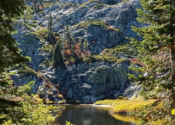
The Castle Crags Wilderness was established in 1984 with the passage of the California Wilderness Act. This 10,500 acre addition to the National Wilderness Preservation System, along with lands within Castle Crags State Park, contains towering granite spires, steep sided canyons, and a few alpine lakes. Most of the area is covered by high brushfields and rocky outcrops with a few wet meadows in the creek headwaters. Mixed conifer forests can be found on the north, east and west facing slopes.
Chanchelulla Wilderness

Chanchelulla Wilderness is a relatively small wilderness area located about 50 miles west of Red Bluff. The Chanchelulla Wilderness was created in 1984 by Congress. The Wilderness features rugged terrain with steep, chaparral and tree covered slopes. Chanchelulla Peak is the highest point at 6,401 feet. This area is popular during hunting season.
Mount Shasta Wilderness
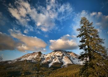
Mount Shasta's upper slopes are designated as the Mount Shasta Wilderness. The United States Congress designated the Mount Shasta Wilderness in 1984 and it now has a total of 36,981 acres. Mount Shasta is a snow and glacier capped volcano that rises 14,179 feet, dominating the view in all directions. On a clear day, the mountain can be seen from the floor of the Central Valley over 100 miles to the south. Mount Shasta is the highest peak on the Shasta-Trinity National Forest, second highest peak in the Cascades, and fifth highest in the state. Mount Shasta is a popular destination for a wide spectrum of visitors. Some come for the challenge of climbing to the mountain’s summit, some are spiritual seekers drawn to the mountain, and some come for the floral displays of meadows or sweeping panoramas of vista points.
Trinity Alps Wilderness

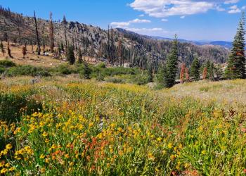
The second largest wilderness area in California, the Trinity Alps Wilderness nearly doubled in size by the 1984 California Wilderness Act. In that same year, it was added to the National Wilderness Preservation System. It currently has over 600 miles of trails and embraces over 500,000 acres of land.
Yolla Bolly-Middle Eel Wilderness
In the Wintun Indian language, "Yo-la" meant "snow covered", and "Bo-li" meant "high peak." The second part of this Wilderness' name refers to the headwaters of the Middle Fork Eel River, which originates in this remote and rugged land.This area was first protected in 1931 when it was classified as a primitive area. Further protection was given when this area became part of the National Wilderness Preservation System, created by the passage of the Wilderness Act of 1964. The Wilderness Act of 1984 added another 2,000 acres to the Yolla Bolly-Middle Eel Wilderness, for a total of about 151,626 acres.