
Marys Peak Day Use
Perched near the summit of the highest peak in the Oregon Coast Range, Marys Peak Day Use Area offers excellent views of the Cascade Mountains, the Willamette Valley and even the Pacific Ocean on clear days. Mt. Hood, Mt. Jefferson and Mt. Saint Helens are only a few of the peaks that you may be able to observe. Wildflower displays abound in the open meadows from late spring through the summer months.
Three trails lead from the Day Use Area: North Ridge Trail, Summit Trail, and Tie Trail. When there's snow, cross country skiing, snowshoeing and other non-motorized winter recreation are available, although the road is not maintained for winter travel and caution is advised.
In 2015, the Siuslaw National Forest began a meadow restoration project on Marys Peak. Through carefully planned tree removal, native planting, and other management activities, we are working to restore scenic views and historic meadows.
General Information
Open Year Round, 6am-10pm daily, Road Seasonally Closed during Winter Months
Recreation Passes may be used as a form of fee payment.
Day Use: $5/vehicle/day.
Northwest Forest Passes are Honored: $30/annual.
https://www.fs.usda.gov/detail/r6/passes-permits/recreation/?cid=fsbdev2_027010
Interagency Recreation Passes are Honored.
store.usgs.gov/recreational-passes
Purchase a Digital Day Use Pass: https://www.recreation.gov/sitepass/74427
OR
Please be prepared to pay with CASH or CHECK.
$5/vehicle/day
Within developed recreation sites, dogs must be on a leash no longer than 6 feet, or otherwise under physical restrictive control. 36 CFR 261.16(j)
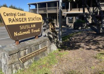
Address: 1130 Forestry Lane Waldport , OR 97394
Phone: (541) 563-8400
Hours: Monday–Friday, 8:00 a.m. – 4:00 p.m. (Closed on federal holidays)
Office Email: r6_siuslaw_wwweb_front_desk@usda.gov
Getting There
Latitude / Longitude
Latitude: 44.510379
Longitude: -123.55083
Directions
From Corvallis, Oregon drive 14 miles west on Highway 34, then turn right onto Marys Peak Road and drive 9 miles up to the Marys Peak Day Use Area. The Marys Peak Road is paved all the way to the Day Use Area.
Facility and Amenity Information
Accessibility
Restrooms
Restrooms are available at this site.
Water
Potable water is not available at this site.
Picnic Tables
Picnic tables are available at this site.
Horse/Pack Animal Information
Horse/Pack animals are not allowed at this site.