





McKenzie River Trailhead - Upper
This trailhead provides access to McKenzie River National Recreation Trail #3507, Santiam Wagon Road #3413, and Clear Lake Loop Trail #4341.
General Information
Open year-round.
Within developed recreation sites, dogs must be on a leash no longer than 6 feet, or otherwise under physical restrictive control. 36 CFR 261.16(j)
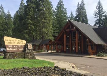
Address: 57600 McKenzie Highway McKenzie Bridge, OR 97413
Phone: (541) 822-3381
Hours: Monday-Friday, 10:00 a.m. - 4:30 p.m. (Closed on federal holidays)
Office Email: sm.fs.mf@usda.gov
Getting There
Latitude / Longitude
Latitude: 44.39444444
Longitude: -122.00166667
Directions
From McKenzie Bridge, OR, take Highway 126 east 17 miles to the north side of Clear Lake Resort. Turn right (east) on Forest Road 777 to find Upper McKenzie River Trailhead at the end of the road.
Facility and Amenity Information
Restrooms
Seasonaly availible PotipottyWater
Potable water is not available at this site.
Picnic Tables
Picnic tables are not available at this site.
Horse/Pack Animal Information
Horse/Pack animals are not allowed at this site.
Nearby Trails
Recreation Opportunities


Recreation Groups

The upper portion of the McKenzie River is popular for fishing, rafting, drift-boating, and kayaking.