
O'Leary Mountain Trail #3321
On this 9.1 mile trail hikers are afforded excellent views of the McKenzie Valley, Three Sisters peaks and Cougar Reservoir. The trail crosses McLennon, McDuff, and O'Leary Mountain. There are some unique rock formations (pinnacles) along the way.
Beginning at O'Leary / Castle Rock Trailhead, O'Leary Mountain Trail #3321 heads east, switching back steeply up a large ridge through an old growth conifer forest. The trail continues uphill, following Forest Road 3321 until it passes below a panoramic viewpoint on Macduff Mountain. Passing the mountain, the trail drops into a saddle, then side hills east below McLennan Mountain. The trail occasionally breaks out of forest into rock outcroppings, then hooks north to reach its terminus at Olallie Trail #3529.
When combined with other trails in the area, the O’Leary Trail Complex makes for a world class mountain biking trail. The trail is a 22 mile, single-track loop with an intense backcountry feel. The IMBA has designated it an ‘Epic Ride,’ a ride that is “technically and physically challenging, more than 80 percent single track and at least 20 miles in length.”
Specific Trail Information
Trail Number
General Information
Close to:
None
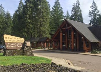
Address: 57600 McKenzie Highway McKenzie Bridge, OR 97413
Phone: (541) 822-3381
Hours: Monday-Friday, 10:00 a.m. - 4:30 p.m. (Closed on federal holidays)
Office Email: sm.fs.mf@usda.gov
Getting There
Trailhead/Starting Points
Directions
From Blue River, OR, travel east on Highway 126 for 4 miles to Forest Road 19 (Aufderheide). Turn left (south) on Forest Road 19, continuing straight past the Y onto Forest Road 410. Continue south on Forest Road 410 to the bottom of Cougar Reservoir and turn left (east) onto Forest Road 411. Continue up Forest Road 411 for 3 miles to a roadside parking area on the right side of the road. O'Leary / Castle Rock Trailhead is across the road from the parking area.