
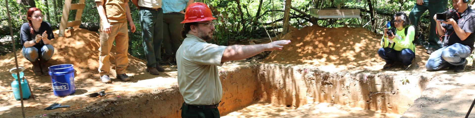
Archaeology and Cultural Resources
Kisatchie National Forest is rich in cultural resources and history. Thousands of archaeological sites are scattered throughout Kisatchie's 604,000 acres. And each and every one of these sites is protected by the Archaeological Resources Protection Act of 1979. Digging, collecting, removing any cultural resources (for example, arrowheads, pottery sherds, antiquities, etc.) is strictly prohibited and may be prosecuted in a court of law. Punishment may result in severe fines and time in prison.
Native American Time Periods and the Kisatchie National Forest
It is important to note that environmental conditions during this period were defined by the presence, advance, and retreat of the Laurentide ice sheet that covered large expanses of the continent. Periods of major climatic fluctuation, landscape remodeling, and subsequent biotic reorganization were common throughout the Pleistocene, and persisted into the late Pleistocene. While the ice never approached Louisiana, its effects were nevertheless profound.
Although little archaeological information is available in Louisiana regarding Paleoindian groups, we may draw from the broader archaeological record to make informed inferences regarding Paleoindian lifeways in Louisiana. Paleoindian people are typically viewed as highly mobile, specialized hunters and gatherers who initially focused on large game animals such as mammoth and mastodon, and later bison and smaller game.
It is unclear whether lithic stylistic changes reflect chronological differences or regional variations in manufacture. If post-Pleistocene climatic transformations led to the extinction of megafauna, then changes in projectile point styles may suggest a change in hunting strategies. Available evidence tends to suggest more reliance upon plant resources took place. At Site 16GR58, Keller (1981) found a grinding stone and a San Patric point in what appeared to be direct association. Other grinding implements have been found in association with San Patrice culture materials. As a whole, Paleo Indian settlement patterns or systems are not fully understood or represented in Louisiana.
The early Archaic, identified in the southeastern United States by the presence of Kirk, Palmer and Big Sandy projectile points, appears to be poorly represented in central Louisiana. Edgewood and Yarbourgh point types are suggested identifiers of early Archaic components in this area (Servello 1983). Points almost identical to the Palmer type have been reportedly recovered at sites in Louisiana (Perino 1986:62).
The middle Archaic in Louisiana is best known in the southern and southeastern areas of the state, principally along the central coast and on the Amite River. Aspects of the middle Archaic in these areas have been referred to as the Monte Sano and Amite River phases. Gregory and Curry (1978) have suggested the Gorum phase for central Louisiana. Material cultural items which emerge during the middle Archaic are celts, atlatl weights(bannerstones), axes and projectile points of the Evans, Yarbourgh, Williams and Lange types.
Late Archaic occupations are best represented by the Pearl River phase in extreme eastern Louisiana and western Mississippi along with the La Harpe Aspect in east Texas. Artifacts typical of late Archaic occupations are steatite(soapstone) vessels and projectile points of the Gary, Kent, Ellis, Ensore, Motely, Marcos, Morhiss and Palmillas types.
While early and middle Archaic sites are not well represented in the central part of Louisiana, late Archaic occupations are relatively frequent. These Archaic occupations are best known from excavations at 16GR58 (Keller 1981), 16VN24 (Guderjan and Moorehead 1980), 16VN80 (Servello 1983) and from 16VN338, 16VN340 and 16VN396 (Cantley and Kern 1984).
Early Woodland/Tchefuncte Stage
Across the Eastern Woodlands, the Early Woodland period is seen as ushering in such technological innovations as ceramic vessels, burial mounds, and horticulture. The nature of Early Woodland was once thought to be poorly understood, but test excavations in recent years have offered a better understanding. Early Woodland sites are small, and no features have been identified.
The Early Woodland period is usually identified by the presence of Tchefuncte Plain, Tchefuncte Incised, and Tchefuncte Stamped pottery (Phillips 1970). This pottery has also been classified as being part of the late Gulf Formational ceramic tradition by Walthall and Jenkins (1976). It is dated 1000-300 B.C. This pottery is usually temperless with pastes that are contorted and/or laminated, although grog tempering and fine sandy pastes also occur (Campbell and Weed 1986). It is generally believed that the decorative motifs present on Tchefuncte vessels are forerunners of later Marksville decorated ware and that a technological continuum exists between Tchefuncte and Marksville ceramics (Campbell and Weed 1986).
Middle Woodland Stage
Whiskey Chitto Phase
The Whiskey Chitto phase (c. 300 B.C. - A.D. 300) has been defined for Middle Woodland components at Fort Polk (Campbell et al. 1987; Morehead et al. 2002). Diagnostics of this phase are Marksville Stamped and Marksville Incised (var. Goose Lake). Marksville ceramic pastes are usually sandy with grog inclusions. Projectile point/knife types thought to be associated with Whiskey Chitto phase components include Dooley Branch, Birds Creek, Ellis, Gary, Godley, and Kent. Bifacial implements dominate the lithic assemblage and projectile point/knives are the most common formal tool type. Other common tools include perforators, denticulates, notches, end scrapers, “celts”, and ground stone implements (Thomas et al. 1997), while side scrapers, multiple-use tools, and serrated pieces occur less frequently. Core reduction is present with both flake cores and blade cores represented. Anderson et al. (1999:188) have noted that the presence of Marksville ceramics indicates that local populations were participating at some level in the interregional exchange system that is characteristic of Middle Woodland societies in the Eastern Woodlands (the Hopewell Interaction Sphere). They indicate that procurement of lithic materials such as Citronelle gravel, Eagle Hill chert, and Fleming Opal may have been the focus of Middle Woodland exchange.
Middle to Late Woodland Transition (Troyville and Baytown)
Marksville occupation is followed by the introduction of Troyville and Baytown ceramics that occurred between circa a.d. 300-600 (Anderson et al. 1999:188). Projectile point/knives thought to be associated with Baytown period occupations include Dooley Branch, Kent-like, Godley, Gary, var. Maybon, Colbert, Alba-like, and crude arrow points (Thomas et al. 1997). Very little is known of Baytown period subsistence and settlement practices.
Late Woodland Stage
Holly Springs Phase
The Late Woodland period in west-central and northern Louisiana is represented by both Coles Creek and early Caddo sites. Large villages are present and the development of plazas and temple mound centers along the Red River is well documented (Anderson et al. 1999:189). The overriding consensus is that early Caddo culture emerged from a Coles Creek base in the Red River drainage sometime shortly before 1000 a.d. Late Woodland sites are usually identified by the recovery of Coles Creek Incised sherds including vars. Coles Creek, Greenhouse, Hardy, Mott, Blakely, and Stoner, as well as French Fork Incised. Other miscellaneous incised grog, sand/grog, and sandy paste ceramics occur–perhaps signaling greater interaction with, or population movement from, the Red River Valley to the north or areas further east in the Mississippi River drainage (Anderson et al. 1999:189). Arrow point types that are associated with Late Woodland Coles Creek and early Caddo-related sites include Catahoula, Alba, Hayes, Friley, and Livermore (cf. Thomas et al. 1997). Projectile point/knife types such as Gary, Kent, Godley, and Ellis are thought also to possibly remain in use. Bifaces predominate over unifaces in the lithic assemblages.
The Holly Springs phase (ca. 500-900 A.D.) has been described for Coles Creek occupations (Campbell et al. 1990; Morehead et al. 2002). Most of the Coles Creek occupations recorded are small and probably represent short term occupations such as hunting camps (Thomas et al. 1993e:110-111).
Plaquemine
These occupations are interpreted as short term hunting camps; major villages have not been found (Thomas et al. 1997). Diagnostic ceramics include Coles Creek Incised, var. Hardy, Mazique Incised, var. Manchac, L’Eau Noire Incised, and Bossier Brushed and/or Plaquemine Brushed. Bassett arrow points appear to be associated with Plaquemine sites at Fort Polk. The lithic assemblage associated with Plaquemine occupation is not well understood, but end scrapers and notches are present as well as other flake tools, bifaces, and cores (Thomas et al. 1997:28-29). These components appear to overlap in time with early Caddo sites.
Evidence suggest the adoption of the complete Mississippian lifestyle throughout the Southeast did not occur uniformally but occurred through adoption of traits little by little. The Mississippian culture is best represented by the use of major chiefdom centers throughout the Southeast, such as those at Moundville in west Alabama and Etowah in northeast Georgia. No such sites have currently been identified in Louisiana. There appears to be two regional variants of the Mississippian culture in Louisiana. The Plaquemine culture occurs in the southeastern portion of the state, while the Caddoan culture occurs in the northwestern portion.
Plaquemine Culture (A.D. 1000 - Historic)
The Plaquemine culture appears to have evolved from the Coles Creek culture. The culture is represented by monumental ceremonial centers, complex political systems and an art style with graphic symbolism. Although undecorated ceramics were used in most ordinary tasks, and those with highly stylized designs, such as engraved curvilinear patterns, are believed to have been used by revered individuals.
Evidence of Plaquemine occupations in central Louisiana is presently rare with the best representation from three minimal components found at Fort Polk (Anderson et al. 1997:170). It has been suggested that central Louisiana may have acted as a buffer or overlap zone between the Caddoan groups of the northwest and the Plaquemine groups in the southeast (Anderson et al. 1997, Keller 1984).
Caddoan Culture (A.D. 700 - Historic)
Loci of Caddoan culture in Louisiana occur predominately in the northwestern part of the state. Caddoan culture is marked by the emergence of a decorative style of pottery, typically globular wares with dark, polished surfaces and angled rims. Exteriors were decorated with engraved curvilinear designs. Ceremonial centers with mounds and central plazas that had emerged during the Coles Creek Culture continue in Caddoan Culture.
Caddoan cultural development appears to have been one of complex changes characterized by the oscillation of chiefdoms that apparently reintegrated in tribal confederacies by historic times (Cantley and Kern 1984). However, there is debate as to how Caddoan Culture developed, and under what influence.
Caddoan settlement patterns in the Red River bottom area tended to consist of villages along secondary streams, with clusters of smaller sites located in peripheral floodplain settings (Girard 1997). Research at Fort Polk suggests that the Caddoan settlement pattern in the Red River Valley did not occur in the upland settings of the Fort (Thomas et al. 1992). This appears to be the case on much of the area that is now Kisatchie National Forest. Caddoan sites, although not abundant, occur on most districts of the Kisatchie National Forest. Present evidence suggests that small bands of Caddo, probably represented by nuclear family or extended family groups, moved into the area of the Forest along the larger interior drainages (Jon L. Gibson, personal communication).
Historic Native Americans Associated with the Kisatchie National Forest
Caddo occupation on the forest appears to differ from that of the Red River Valley to the north in that large mound and village sites are lacking (Anderson et al. 1999:191; Thomas et al. 1997). Instead, the majority of Caddo sites appear to be primarily short term occupations related to hunting/collecting or other task-specific work stations. The lithic assemblages at these sites are dominated by bifacial arrow points made of flakes.
The Caddo Nation contains a number of tribally distinct groups that shared a common language and strong cultural affiliations over a geographical area covering northwestern Louisiana, southwestern Arkansas, northeastern Texas, and southwestern Oklahoma. The historic Caddo in Louisiana were composed of the Adaes, Doustioni, Natchitoches, Ouachita, and Yatasi who were primarily concentrated around Natchitoches, Mansfield, Monroe, and Robeline, Louisiana (Webb and Gregory l978). The Caddo were the principal indigenous group of the area encountered by the early explorers.
The earliest known contact with a Caddo tribe was by Henri de Tonti who encountered the Natchitoches in 1690 while searching for the LaSalle expedition (Webb and Gregory 1978). Governor Bienville and Louis Juchereau St. Denis, who were most likely seeking trade, visited the Natchitoches, Doustioni, and Yatasi again in 1701 (Gregory 1974).
The French maintained contact with the Natchitoches and in 1714 founded Fort St. Jean Baptiste aux Natchitos, the earliest European settlement in northwestern Louisiana. The Caddo survived the political and economic conflicts between the French and Spanish but American government Indian policies after the Louisiana Purchase in 1803 brought drastic changes. The Caddo were eventually removed to Oklahoma in 1835 (Webb and Gregory 1978).
St. Denis and Penicault encountered the Avoyel in 1714 and referred to them as the Tassenogoula, which in the Muskhogean language means "People of the Rock" (Swanton 1911). LePage Du Pratz also visited the tribe in 1758. Colonel George Morgan reported in 1767 that they were a small tribe living about 50 leagues up the Red River at the rapids. The Avoyel were active in trading horses to the French that were obtained from the Caddo tribes who had "plundered" them from the Spanish (Swanton, 1911). Sibley (1832) reported that the Avoyel were extinct as a tribe by 1805.
The end of the French and Indian War in 1763 resulted in a migration of tribal groups into Louisiana from lands east of the Mississippi River. Fearing reprisals from the English and their Indian allies, the Appalachee, Pascagoulas, Taensa, Biloxi, Alabama, and Choctaw moved into the area. The Appalachee, Taensa, Pascagoulas, and Alabama settled along the Red River in the vicinity of bayous Jean de Jean, D'Arro, and Rigolette (Whittington 1932).
The Peter Walker Survey Map of 1804 shows the location of the Appalachee-Taensa village up river from Bayou Rapides near present day Zimmerman, Louisiana. The 1806 Freeman-Curtis Map also shows the Appalachee village with the Pascagoula village slightly upriver (Whelan and Pearson 1983). The Appalachee and Taensa sold their land to Alexander Fulton and William Miller in 1803 but a few families may have resided on the property until the 1820's (Swanton 1911). The remainder appears to have moved to Bayou Boeuf and settled south of the Choctaw (Whittington 1932).
The Choctaw settled along Bayou Chicot, Indian Creek, and Bayou Boeuf in southern Rapides Parish (Gregory 1977). The influx of white settlement into the region brought about hostilities with the Choctaw, contributing to their removal to Oklahoma in the 1830s. However, some Choctaw did remain in Louisiana after the removal.
In 1682 Rene-Robert Cavalier, Sieur de La Salle led an expedition down the Mississippi River. La Salle reached its mouth that same year and claimed all lands drained by the Mississippi for France. He returned to France in November 1682 to gain support for a second expedition to the mouth of the Mississippi by way of the gulf to establish a permanent settlement (Weddle 1998).
La Salle missed the mouth of the Mississippi River, landing along the southeastern Texas gulf coast where he established a colony in 1685 (Weddle 1998). Misfortune, disease, privation, and hostile Indian attacks forced La Salle to lead a small party overland toward Canada, in an attempt to save the remaining colonists. La Salle was killed by one of his own men early in the attempt; however, six of seventeen men in the party eventually reached Canada (Weddle 1998).
Henri de Tonti, La Salle's captain on the 1682 expedition, reached the Natchitoches village in 1690 before continuing up the Red River in an attempt to find survivors of the failed colony (Swanton 1911). His exploration of the Red River Valley provides some of the earliest and best accounts of the area.
Ten years passed before the next French exploration of the Red River Valley. Jean Baptiste Lemoine de Bienville contacted the Natchitoches and other Caddo groups in 1700, and again the following year (Swanton 1911). Bienville's contacts led to French settlement and trade with Caddo and other groups in the following years.
Spanish Franciscan missionaries are believed to have established a mission at the "Grand Rapides" of the Red River in present-day Pineville (Whittington 1932). When St. Denis found the mission in the early 1700s, he ordered the priests to leave Louisiana and return to Mexico. Whittington (1932) places the location of the mission in the present-day Rapides Cemetery.
Although the French had been in Louisiana since 1682, the first permanent settlement in the state was established at Natchitoches in 1714. In an effort to counter the French threat at Fort St. Jean Baptiste aux Natchitoches, the Spanish established the presidio and mission Neustra Senora del Pilar de Los Adaes west of Natchitoches (Bolton 1962).
In 1720 Diron Dartaguette, inspector of Louisiana troops, reported attacks by the Chicachas (Chickasaw) Indians on travelers delayed at "Grand Rapid." Post du Rapides was established in 1722 at present-day Pineville in order to protect travelers on their way to Natchitoches. However, the greatest conflict between the French and Indians in this area occurred in 1729 when the Natchez, enraged by French incursions in the Mississippi Valley, attacked Fort Rosalie in present-day Natchez, Mississippi. The Natchez warriors killed 250 men and took 300 women and children prisoner (Utley and Washburn 1977). The French and their Choctaw allies retaliated and destroyed the Natchez village. The Natchez then fled into Louisiana and were virtually destroyed outside Natchitoches by combined French and Indian forces (Swanton 1952). The Natchez then broke up and dispersed into areas as far away as the Carolinas (Milling 1969).
Disputes over territories in the New World resulted in military action by European powers during the eighteenth century. France and England fought each other beginning in 1754 during the French and Indian War, and by 1756 the conflict had spread to Europe (Taylor 1976). Spain became embroiled in the conflict toward the end of the war after agreeing to an alliance with France. Despite Spain's support, the French were forced to seek peace with England because of mounting losses and cost. France ceded Louisiana to Spain in 1762 by the Treaty of Fountainebleau as compensation for losses incurred during the war, if not to rid herself of a colony that posed economic strains on the French government (Taylor 1976). The war ended in 1763 with the Treaty of Paris.
Spain ceded Louisiana back to France with the secret Treaty of San Ildefonso of 1800. The United States viewed any foreign control of the Mississippi River as detrimental to its survival. Thus, the United States initiated talks with France for purchase of New Orleans. Negotiations lasted for months, until France unexpectedly offered to sell the entire Louisiana colony. The Louisiana Purchase in 1803 gave control of the Mississippi to the United States, while doubling its geographical area (Taylor 1976).
The population increased greatly following the United States taking possession of the Louisiana colony. With the invention of the cotton gin in 1793, and the process of sugar granulation, plantation agriculture became the dominant economy. Small landholders were eventually pushed out of the fertile alluvial valleys into the surrounding pine hills. This plantation period of prosperity saw the establishment of the Louisiana State Seminary of Learning and Military Academy in 1860. The remains of this institution, known as the Old Louisiana State University site (16RA49), are located on Kisatchie National Forest property in Pineville. The seminary opened under the direction of William T. Sherman who resigned in 1861 to join the Union forces in the Civil War. It was reopened in 1862 but closed in April 1864 at the approach of General Bank's Union forces during the Red River Campaign. It was used intermittently as a Union Army headquarters and a Confederate hospital. The school reopened at the close of the Civil War in 1865 but was destroyed by a kitchen fire on October 15, 1869.
One Union military expedition in particular had severe effects for the Pineville-Alexandria area. With the objective of capturing Shreveport (and along the way as much cotton as possible), a joint naval and land expedition under the command of Major General Nathaniel P. Banks headed up the Red River on March 12, 1864 from their assembly area at the confluence of the Red and the Mississippi rivers. With a force of nearly 30,000 troops, 13 gunboats, and 60 transport vessels, Banks entered Alexandria on March 24 (Smith and Castille 1986).
In their advance to Shreveport, the Union forces were attacked on April 8 at Mansfield by Confederate forces under Major General Richard Taylor. The Union troops were forced back under continuous harassment toward Alexandria. Reaching Alexandria, they found that the river level had dropped 3 feet, trapping the gunboats and transports under the command of Rear Admiral David D. Porter at the rapids. It was at this time that Lieutenant Colonel Joseph Bailey was appointed to construct a dam to raise the water level so that the gunboats could be floated over the rapids. Archaeological investigations at Bailey's Dam (16RA90) revealed the presence of two dams, one of tree construction and another made of stone cribs (Smith and Castille 1986).
The activities of the Union forces in the area destroyed much of the local property as well as the general economy, which became stagnated and did not revive until the 1890s when emphasis was placed on the lumber industry. Central Louisiana became a major lumbering center that resulted in the development of a number of sawmills in the area. One of these was the Fullerton Mill that was created in 1906. The ruins of the mill and the associated town (16VN499) are still visible on the Kisatchie National Forest in Vernon Parish and were placed on the National Register in 1986.
By the 1930s the "cut out and get out" logging methods left vast areas of cutover lands. As mills ran out of wood and employment in the lumber industry began to close, subsistence farming began to increase. The United States Government purchased much of the cutover land leading to reforestation and the creation of the Kisatchie National Forest (Burns 1981).
With the outbreak of World War II, the Kisatchie National Forest played a vital role in the training of U.S. troops. The U.S. Army was authorized the use of a total of 95,315 acres for the establishment of Camp Polk on the Vernon District, Camp Livingston (16RA360) and the Breezy Hill Artillery Range on the Catahoula District, Camp Claiborne (16RA373) on the Evangeline District, and a number of bombing ranges on the Caney, Catahoula, Winn, and Evangeline Districts (Burns 1981). Although the Air Force still maintains a bombing range on the Evangeline District and Fort Polk currently utilizes a portion of the Vernon District, Camps Claiborne and Livingston were abandoned at the close of the war and the buildings were salvaged. These areas are now covered in forest but the remains of the structural foundations are still present.
The creation of the Kisatchie National Forest had it origins in the 1920s. During the timber boom years, the lumber companies cut over most of the pinelands with little regard to the future. In 1928, the U.S. Congress provided the first funds to purchase cutover land that would become part of the Kisatchie National Forest (Burns 1982). Charles A. Plymale was places in charge of finding legally titled lands to purchase, and began buying land in gross “units” for an average of $3 per acre (Anderson and Smith 2003:450). Large tracts of the forest were purchased from the Bodcaw Lumber Company; for example nearly 25,000 a. was bought in one transaction on February 11, 1936 (Kisatchie National Forest 2003:3).
Tenants that occupied land purchased for the National Forest had to relocate, and for this reason the terminal domestic occupations of the Kisatchie National Forest tracts date to the mid-1930s. In late 1934 and early 1935, the USFS conducted a survey of the occupancy and possession of tract No. 107 they were about to purchase from the Bodcaw Lumber Company (Smith 1935). This survey resulted in the compilation of tenants’ names, and counts of houses, outbuildings, and other improvements (fences, gardens, acres under cultivation, etc.). This study demonstrated that there were dozens of dwellings within the company’s cutover land.
The Civilian Conservation Corps (CCC), under Forest Service leaderships, accomplished the reforestation of the cut over lands. The CCC was a “New Deal” agency created in 1933. Anderson and Smith (2003:450-451) report that the CCC operated as many as 53 camps in Louisiana, including eight camps in the Kisatchie National Forest numbered F-1 through F-8. In addition to replanting the forest and fighting forest fires, the CCC crews constructed roads, levees, bridges, fire towers, and recreation areas.