

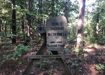
Devils Backbone Wilderness
Visit the land where a steep, narrow, ridge drops away, plunging into deep hollows. Welcome to Devils Backbone Wilderness Area.
The area draws its name from a quarter mile long stretch of trail where the sides of the ridge fall away 10 feet from the path on either side.
With 6,687 acres inside the Wilderness boundary, this is an ideal area for day hiking or overnight backpacking. A long, narrow ridge supports the center of the Wilderness, with 1,020 feet as its highest “vertebra.”
Scattered limestone glades and other openings provide some of the more favorable places to view wildlife. Among the reptiles common to the area are two poisonous snakes, the copperhead and the eastern timber rattler.
The North Fork River stretches over 67 miles from Wright County until it joins the White River and flows into Arkansas. In the middle of its journey, it crosses ~1.5 miles of Devil’s Backbone Wilderness. The river’s flow is fed by Blue, McGarr and Amber Springs within the Wilderness Area.
Devils Backbone Wilderness Area Trails
Thirteen miles of maintained foot and horse trails follow the Devils Backbone and four other ridges, dropping off into surrounding hollows in a forest dominated by oaks, hickories, and shortleaf pines.
The Ozark Trail overlaps with the McGarr and Collins Ridge Trailheads for three miles as part of the North Fork Section of the Ozark Trail.
The Blue Spring Trail connects to the wilderness trails near North Fork Recreation Area.
- Rating Moderate
- Length 13-miles
- Best Seasons Spring and Fall
- Surface Type unsurfaced, native material
- Average Trail Grade 10-12%
- Trail Markers there is limited trail marking
- Elevation 680 feet to 1,020 feet
Camping
North Fork Recreation Area locally known as Hammond Camp adjoins the north edge of the wilderness and provides quality camping and picnic opportunities. There is a designated canoe launch in this Recreation Area.
Dispersed camping is allowed along the trail. There are no toilets, no structures, no trash cans, no treated water, and no fire grates available.
Visit the land where a steep, narrow, ridge drops away, plunging into deep hollows. Welcome to Devils Backbone Wilderness Area.

Thirteen miles of maintained foot and horse trails follow the Devils Backbone and four other ridges, dropping off into surrounding hollows in a forest dominated by oaks, hi
This is one of three trailheads that provide access into the Devil's Backbone Wilderness Area.
McGarr Ridge Trailhead is located on the south side of CC Highway about 4 miles east of Dora, MO. It provides access to the Devil's Backbone Wilderness Area. &nb

This is one of three trailheads that provide access into the Devil's Backbone Wilderness Area. Collins Ridge is located on the south end of the wilderness.
North Fork Recreation Area provides camping, picnicking, boating, canoeing, hiking and fishing access to the beautiful North Fork of the White River, which has a total of n
North Fork Recreation Area provides camping, picnicking, boating, canoeing, hiking and fishing access to the beautiful North Fork of the White River, which has a total of n
This very short walk takes you from North Fork Campground to the beautiful Blue Spring.

This is a trailhead for the Blue Spring Trail within the North Fork Recreation Area and the Devils Backbone Wilderness Area Trails.
Thirteen miles of maintained trails wind along ridgetops and hollows among mixed oak hardwoods and southern pine.
This is southernmost of the five trailheads for the Ridge Runner National Recreation Trail.