
Recreation

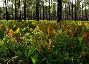
Uwharrie National Forest is a hidden gem in central North Carolina, known for its rolling hills, scenic trails, and rich history.
Nantahala National Forest is composed of 3 different ranger districts:
-Nantahala Ranger District
-Tusquitee Ranger District
Pisgah National Forest is composed of 3 different ranger districts:
-Pisgah Ranger District
-Appalachian Ranger District
Albert Mountain Fire Tower
Site Open
Albert Mountain Fire Tower: Albert Mountain is a mountain in North Carolina's Nantahala Range of the Appalachian Mountains. The Appalachian Trail goes along its summit, which is around 5,200 feet…
Ammons Branch Campground
Site Open
Dispersed camping along Bull Pen Road. Four dispersed sites are available with picnic tables and lantern hangers. A pit toilet is available. Please pack in and pack out.
Ammons Branch TR441
Site Open
Ammons Branch TR441
Andy Cove Trailhead
Site Open
Is now part of the Kids in Parks initiative. This trail offers an interactive experience while fostering increased physical activity for children and their families.
Appalachian TR1
Site Open
This trail follows the mountain crest from Maine to Georgia and passes through Pisgah and Nantahala National Forests for more than 200 miles. Open to hikers only, the trail boasts a chain of shelters…
Appletree TR19b
Site Open
Rated as difficult, the Appletree Trail climbs 1,640 feet and connects with four other area trails. With two stream crossings, the 2.2-mile trail meanders through an array of flowering plants, such…
Appletree Group Campground
Sleep under the Stars. Looking for a campsite for a group of people near the Nantahala River? The four sites at Appletree Group Campground accommodates two sites (A and D) for up to 25 people each…
ARD Bear Canister Program
Bear Resistant Canister ProgramBear resistant canister borrowing program is specifically to educate and assist visitors arriving and recreating on the Pisgah National Forest, via Appalachian Ranger…
Arrowhead Campground
Site Open
Arrowhead Campground has 48 sites for Tent/RV camping. Sites #46-#49 are tent only. All sites, except for site #23, are accessible to people with disabilities. Each site has a table, grill, fire…
Art Lilley Campground
Site Open
The off-highway vehicle (OHV) trail system in the Uwharrie offers a variety of topography and scenery. All trails are designated for all off-highway vehicles and marked with orange diamonds. Stay on…