Special Places
Grand Island NRA: Celebrating 25 Years of Public Stewardship
Twenty-five years ago, in May 1990, with the passages of Public Law 101-292, Congress created Grand Island National Recreation Area. Throughout 2015, the Forest Service will celebrate this important milestone. Learn more
Our entire Forest is a special place!
The Hiawatha's Great Lakeshores, Lighthouses, Islands and Snow set us apart from every other National Forest; we are truly unique.
Visit your "Great Lakes National Forest" to:
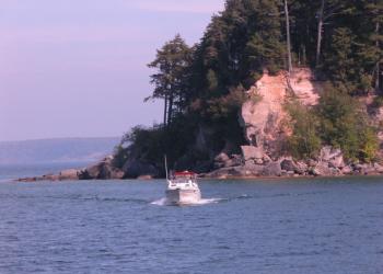
- Explore our islands ...Cross Over to Adventure on Grand Island National Recreation Area
- Discover on our lakeshores ... explore our Great Lakes shorelines on Lakes Superior, Huron and Michigan
- Visit a lighthouse ... Tour the Pt Iroquois, Peninsula Point or Christmas Lighthouses; see Round Island Lighthouse as you travel to Mackinac Island; view North Light and the East Channel Light as you boat around Grand Island.
- Experience the bountiful snow ... Our "lake effect" winters bring with them over 200 inches of snow. Enjoy the Hiawatha's renowned cross country ski trails and snowmobile trails.
In addition, you'll find facilities for many of the outdoor activities you seek:
- build a campfire and visit with friends
- canoe down a river or drive a scenic byway
- hike or ride mountain bikes
- watch birds and see wildlife
- fish or hunt
- ride horses or ATVs
Best of all, we're not that far away from many of our visitors, including people from major urban and rural areas of Michigan, Wisconsin and other nearby states; and increasingly for international visitors.
It's easy to see what makes us special, and we’re ready to share!
Points of Interest
Here are some of the special places that exemplify our niche. Plan to visit one or more.
Munising Ranger District
Rapid River/Manistique Ranger District
St. Ignace/Sault Ste. Marie Ranger District
For those seeking solitude in a non-motorized, non-mechanized setting...
If you are looking for quieter places where group size may be limited and and motors are not to be found, we offer several options. For info about which experience might be right for you...
- Semi-primitive, non-motorized areas - Ask about non-motorized trails and other quiet places, or visit the pages for our trails, dispersed camping areas, and other quiet sports.
- Designated wilderness - Congress set aside six such areas on the Hiawatha. These areas provide solitude without the intrusion of motors or mechanized equipment (anything with wheels).
Highlighted Areas
Point Iroquois Lighthouse
In 1975, The Point Iroquois Lighthouse was placed on the National Register of Historic Places.
The Point Iroquois Lightstation stands high above the waters of Lake Superior at the entry to St. Mary's River. It served passing sailors by marking the narrow channel.
The name Point Iroquois references a battle that took place in 1662 between the local Ojibwa (also known as the Chippewa or Anishinaabeg) and an invading Iroquois war party. The Iroquois had invaded the area in an attempt to gain influence and dominate the fur trade, but the Ojibwa were able to defeat the Iroquois war party, thus halting their westward expansion. According to the Indian agent of scholar, Henry Rowe Schoolcraft, the Ojibwa called Point Iroquois " Nau-do-we-e-gun-ing", which in their native language means "Place of Iroquois Bones."
In 1620, the first white men to the area were French explorers Brule and Grenoble. From that time, Point Iroquois became a familiar landmark for the French explorers, fur traders and the missionaries who were to follow. Sault Ste. Marie was the first white settlement in what was later to become Michigan.
The discovery of copper and iron ore in 1844 necessitated a passage for ore-carrying vessels through the rapids of St. Mary's River to the steel plants of the lower Great Lakes. In 1865, the St. Mary's Falls Canal (commonly known as the Soo Locks) was opened. The locks have since become the most heavily used commercial shipping canal in the world.
The first lighthouse and lightkeepers residence were built in 1855, and the light was exhibited for the first time on September 20, 1857. With the growth of traffic through the locks, the importance of the lightstation increased. In 1870 the wooden tower and residence were replaced with the brick buildings that stand today. The tower is 65 feet high. After 107 years of service, the light at Point Iroquois became history; it was replaced by an automatic light in the channel off Gros Cap, Ontario.
Climb the spiral staircase to the top of the 65-foot light tower. Observe the beauty of Canada, the lake, and the ocean-going freighters plying the river and Lake Superior as they come and go through the Soo Locks. Visit with the volunteer hosts in the museum to learn more about life as it once was in a lighthouse on Lake Superior.
Lighthouse Videos
A Great American Outdoors Act Success Story Spotlight: Point Iroquois Lighthouse Point Iroquois Lighthouse
Interpretive Programs
During the summer months, interpretive programs are periodically provided on site to tell the history of the lighthouse and other related topics. Please see the Forest's events webpage for specifics.
Event/Commercial Permits Policy
To learn more, visit our Event/Commercial Permits page.
Lighthouses
Take a self-guided tour of our Lighthouses via the Hiawatha's OnCell App!
Six historic lighthouses stand on Hiawatha’s Great Lakes shorelines, five of which are owned entirely or in part by the Forest Service. “Lighthouse lookers” eagerly seek out views and interaction with Pt. Iroquois, Peninsula Point, Round Island, East Channel (Grand Island), and Christmas Rear Range Light. The area’s unique maritime history, and the personal accounts of those who ran the lighthouses are interpreted at Pt. Iroquois Lighthouse and museum.
Automated aids to navigation replaced most of these facilities in the mid 1900’s, leaving these unique pieces of our cultural heritage available for other uses. The Hiawatha seeks to increase access to these treasures, while ensuring they are properly cared for.
- Christmas/Grand Island West Channel Front and Rear Range Lights
- Grand Island East Channel Lighthouse
- Grand Island North Lighthouse
- Peninsula Point Lighthouse
- Point Iroquois Lighthouse
- Round Island Lighthouse
Whitefish Bay National Forest Scenic Byway
Located along the shore of Lake Superior on the Hiawatha's Sault Ste. Marie Ranger District, the Whitefish Bay Scenic Byway offers many opportunities for visitors to connect with the natural beauty and cultural history of this impressive Great Lake!
Grand Island National Recreation Area
Bring the family, friends or yourself and check out Grand Island National Recreation Area!
Grand Island is located in Lake Superior, about one-half mile from the mainland community of Munising, Michigan. Munising is about 43 miles from Marquette and 55 miles from Manistique.
Grand Island is the perfect place to spend a day or even just a few hours biking, exploring, and appreciating nature. Please be aware that, in keeping with agency interim direction, the non-motorized trails (e.g. all bike trails) are not open to eBikes. The island is an exciting and secluded destination that offers:
- Breathtaking overlooks
- Pristine sandy beaches
- Fascinating cultural sites
- Deep hardwoods
- Inland lakes
Online maps are available: Grand Island Recreation Area Map.
How to Reach Grand Island:
Visitors can reach the island via passenger ferry or private watercraft.
The ferry departs from Grand Island Landing on the mainland, located on M-28 about 2.5 miles west of the Munising's blinking light. Look for the Grand Island National Recreation Area signs.
Some campsites are conveniently located for kayakers.
History of Grand Island:
If you're interested in the island's history, check out the Grand Island 25th Anniversary Page (archived).