
Incident Information
To stay informed about wildfires throughout the Grasslands, here are a few resources that provide real-time updates, safety information, and links to other resources.
Note: If you detect any signs of fire while visiting the grasslands, please call 911 immediately.
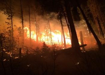
Local Wildfires

To stay informed about local wildfires and natural disasters, click the button below to visit The WildCAD-E MTMCC website to help you prepare and respond.
Nationwide Incidents
To stay informed about wildfires and natural disasters, visit InciWeb, an interagency, all-risk incident information management system that provides a single source of information for the public and news media about wildfires, prescribed fires, and other incidents
ND Fire Declarations and Burn Restrictions

The ND Fire Declarations and Burn Restrictions site provides accurate and timely information about North Dakota fire danger ratings, burn restrictions, and red flag warnings.
South Dakota Grassland Fire Danger Map
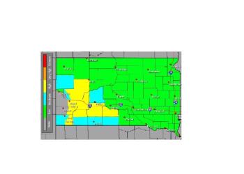
The National Weather Service produces The South Dakota Grassland Fire Danger Map, which forecasts the potential for grassland fires to indicate South Dakota fire danger levels and potential fire behavior.
Miles City Interagency Dispatch Center (MCC)

Located at the Eastern Montana and Dakotas Bureau of Land Management District Office, The Miles City Interagency Dispatch Center (MCC) provides support for wildland fire, prescribed fire, and all-hazard incidents in Eastern Montana and Harding County, South Dakota.
National Wildfire Coordinating Group
The National Wildfire Coordinating Group (NWCG) Glossary of Wildland Fire provides an extensive listing of approved terms and definitions used by the NWCG community.