Recreation

Trails webpages and information will not be available until May 2025. Thank you for your patience while we work through getting the most updated, accurate information for you during this time.

Follow the route of the Lewis and Clark Expedition through the Bitterroot Mountains, catch your limit of trout at a pristine alpine lake, or camp under the stars and listen to the howl of the wolf. Whether you're looking for the rigors of a wilderness trek or an easy drive along a scenic byway, you'll find it here in the National Forests of the Northern Region.

National Forest lands are diverse and great locations for many activities such as hiking, biking, skiing, camping, birding, renting historic cabins and lookouts, driving for pleasure, harvesting mushrooms, and gathering firewood. Many of the facilities and services associated with these opportunities are free. Some do require fees or permits to help maintain, manage, and improve the amenities that you enjoy.

Rent a Room with a View
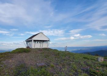
Rental Cabin Card Pic Big Hole LO Lolo

The Northern Region is home to rental cabins and lookouts across Montana and Northern Idaho.  Which one will you visit next?

Recreation Passes

A stack of interagency recreation passes.

Interagency recreation passes provide access to recreation sites managed by a number of Federal agencies.

Recreation Fee Site Accomplishment Reports

Devils Elbow Campground Pay and Information Kiosk Signs provide campers information on fees and payments as well as safety information and rules and regulations.

The Recreation Fee Site Accomplishment Reports highlight recreation accomplishments provided through recreation fee dollars, the revenues and expenditures, and a sampling of planned projects for the Forests and Grasslands in the Northern Region. Your fee dollars continue to do amazing things. Thank you for your support! See how funds are used from the Recreation Fee Sites across Region 1.

Recreation.gov

Recreation.gov is the government's centralized travel planning platform and reservation system for 14 federal agencies, offering the tools, tips, and information needed for you to discover destinations and activities, plan a trip, and explore outdoor and cultural destination across the country.

Showing: 1 - 10 of 1180 results

#1016 Star Gulch Trailhead

Horse Riding and Camping Hiking
Star Gulch Trail #1016 follows Star Gulch and provides access to Star Peak and historic Star Peak Lookout. Pilick Ridge Trail #1036 and Big Eddy Trail #998 take off from Star Peak providing loop…

#1019 Hamilton Gulch Trailhead

Hiking Horse Riding and Camping
Hamilton Gulch Trail #1019 follows Hamilton Gulch for short ways then progresses upslope until the trail ends approximately 1 mile to the northeast of Billiard Table Mountain (6622’).  Some…

#1020 Dry Creek Trailhead

Off Highway Vehicles (OHV) Hiking
Dry Creek Trail #1020 parallels the Bull River on the boundary between USFS and private lands.  The trail is used to access Hamilton Gulch Trail #1019, Star Gulch Trail #1016, and Napoleon Gulch…

#1021 WF Dry Creek Trailhead

Hiking
West Fork Dry Creek Trail #1021 follows an old road prism into the head end of Dry Creek drainage and ends at the Cabinet Ranger District/Three Rivers Ranger District boundary.  Be advised the road…

#1028 Berray Mountain West Trailhead

Hiking
Berray Mountain West Trail #1028 intersects Berray Mountain Trail #967 approximately ½ mile from the historic Berray Mountain lookout tower. This trail enables users the ability to reach the summit…

#1035 Napoleon Gulch Trailhead

Horse Riding and Camping Hiking
Napoleon Gulch Trail #1035 starts at the end of Dry Creek Trail #1020 and follows Napoleon Gulch to Pilick Ridge.  Pilick Ridge Trail #1036 continues up to Star Peak in one direction and down to the…

#1036 Pilick Ridge Trailhead

Pilick Ridge Trail #1036 starts on Highway 56 and follows Pilick Ridge to Star Peak.  Spectacular views of the Cabinet Mountains Wilderness, Scotchman Peaks Recommended Wilderness Area, and the…

#1070 Loveland Peak Trailhead

Off Highway Vehicles (OHV) Hiking
Loveland Peak Trail #1070 follows a major ridgeline to Loveland Peak (5473’).  Fabulous views of the town of  Noxon and the Clark Fork Valley can be seen from the peak.  Smeads Bench Trail #1077…

#1071 Rice Draw

Hiking
Rice Draw Trail #1071 traverses multiple closed roads as it climbs from the valley bottom near the town of Heron to a major ridgeline.  The trail receives very little use, with most use occurring in…

#1077 Smeads Bench

Off Highway Vehicles (OHV) Hiking
Smeads Bench Trail #1077 follows Smeads Creek up to Loveland Peak Trail #1070.The trail crosses Smeads Creek but the crossing is easily negotiated.Smeads Bench Trail #1077