
Recreation

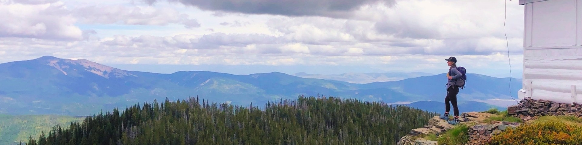
Follow the route of the Lewis and Clark Expedition through the Bitterroot Mountains, catch your limit of trout at a pristine alpine lake, or camp under the stars and listen to the howl of the wolf. Whether you're looking for the rigors of a wilderness trek or an easy drive along a scenic byway, you'll find it here in the National Forests of the Northern Region.

National Forest lands are diverse and great locations for many activities such as hiking, biking, skiing, camping, birding, renting historic cabins and lookouts, driving for pleasure, harvesting mushrooms, and gathering firewood. Many of the facilities and services associated with these opportunities are free. Some do require fees or permits to help maintain, manage, and improve the amenities that you enjoy.

Rent a Room with a View

Rental Cabin Card Pic Big Hole LO Lolo

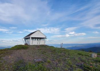
The Northern Region is home to rental cabins and lookouts across Montana and Northern Idaho.  Which one will you visit next?

Recreation Passes

A stack of interagency recreation passes.

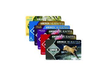
Interagency recreation passes provide access to recreation sites managed by a number of Federal agencies.

Recreation Fee Site Accomplishment Reports

Devils Elbow Campground Pay and Information Kiosk Signs provide campers information on fees and payments as well as safety information and rules and regulations.

The Recreation Fee Site Accomplishment Reports highlight recreation accomplishments provided through recreation fee dollars, the revenues and expenditures, and a sampling of planned projects for the Forests and Grasslands in the Northern Region. Your fee dollars continue to do amazing things. Thank you for your support! See how funds are used from the Recreation Fee Sites across Region 1.

Recreation.gov

Recreation.gov is the government's centralized travel planning platform and reservation system for 14 federal agencies, offering the tools, tips, and information needed for you to discover destinations and activities, plan a trip, and explore outdoor and cultural destination across the country.

Recreation

Showing: 11 - 20 of 1423 results

#1077 Smeads Bench

Off-Highway Vehicles (OHV) Hiking
Smeads Bench Trail #1077 follows Smeads Creek up to Loveland Peak Trail #1070.The trail crosses Smeads Creek but the crossing is easily negotiated.Smeads Bench Trail #1077

#1078 Skeleton Creek Trailhead

Off-Highway Vehicles (OHV) Hiking
Skeleton Creek Trail #1078 climbs from the West Fork Pilgrim Creek drainage to Lone Cliff.  Open roads allow access to both the top and bottom of the trail.Skeleton Creek Trail #1078

#1083 Stevens Ridge Trailhead

Off-Highway Vehicles (OHV) Hiking
Stevens Ridge Trail #1083 starts near Stevens Creek and proceeds up to a ridgeline, past Stevens Peak, and ends on FSR 2214.  Stevens Creek Trail #1099 continues down into the Stevens Creek drainage…

#1084 South Fork Pilgrim Creek

Hiking Off-Highway Vehicles (OHV)
South Fork Pilgrim Creek Trail #1084 travels from the Pilgrim Creek valley bottom and ends at the head end of the South Fork of Pilgrim Creek drainage on FSR 2710. Both the lower and upper trailhead…

#1099 Stevens Creek Trailhead

Hiking Off-Highway Vehicles (OHV)
Stevens Creek Trail #1099 starts near Stevens Creek and proceeds up Stevens Creek drainage to FSR 2214.  From the upper trailhead Stevens Creek Trail #1083 continues out to Stevens Peak and then…

#153 Callahan Historic Trailhead

Hiking
Trail Length: 2 milesThis trail follows the old railroad grade used for mining and logging during the early 1900's. Interpretive signs and benches are located along the trail. Great views of King and…

#196/#553 Arbo/Wee Lake Trailhead

Hiking
This trail leads to Skyline National Recreation Trail #706. The trail follows an old road bed for about 3.5 miles before entering into the Saddle Mountain Inventoried Roadless Area (IRA).  The 1991…

#2 Old Highway 2 Interpretive Trailhead

Biking Hiking
Trail Length: 2.3 milesThis trail is part of the old highway between Libby and Troy. There are many small springs and cascades, and spectacular views of the Kootenai River. The old highway passes…

#323 Shannon Lake Trailhead

Hiking
Trail Length: 0.88 mileA short hike to a small lake between Old Highway 2 and the Grambauer Trail #319. The lake lies in a low lying mostly timbered basin with little elevation gain. The lake is…

#405 Ross Creek Nature Trailhead

Hiking
Trail Length: 1 mileThis self guided nature trail, will loop you through and old-growth forest environment. The wide path will lead you past informative signs telling you the history and ecology of…