





Campbell Mesa Loop Trails System
The Campbell Mesa Loop Trail System includes five loops:
- Anasazi Loop Trail
- Campbell Mesa Loop Trail
- Continental Loop Trail
- Sinagua Loop Trail
- Walnut Meadows Loop Trail
The Anasazi Loop shortcuts the west end of Campbell Mesa Loop to make a 2.7-mile sub-loop.
The longest trail includes the 5.7-mile Campbell Mesa Loop, which swings around the northern and eastern perimeter of the mesa.
Continental Loop makes a short 2-mile tour to the northwest side of the mesa overlooking Walnut Canyon Lakes, Continental ball fields, and the course of the Rio de Flag.
Sinagua Loop takes the shortest jaunt, just over a mile from the trailhead and back.
Walnut Meadows Loop swings 4 miles around the southwest end of the mesa, affording panoramas of Anderson Mesa on the far side of Walnut Canyon and distant Mormon Mountain. From Walnut Meadows Loop, a half-mile connector crosses Old Walnut Canyon Road to the Arizona Trail and Fisher Point.
All five loops of Campbell Mesa trail interconnect with each other and the Campbell Mesa trailhead.
Campbell Mesa lies within a non-motorized use area that provides solitude for visitors and shelter for wildlife. Walkers, hikers, cyclists, skiers, and snowshoers enjoy the trails in all seasons.
General Information
- Difficulty: Easy.
- Trailhead Elevation: 6,780 ft.
- Elevation Gain/Loss: 147 ft.
- Length: Various, depending on which loop you choose.
- Time: Varies from 40 mins. to 2+ hours.
- Trail Etiquette: Hikers and mountain bikers should yield the trail to equestrians, and mountain bikers should yield the trail to hikers.
Motorized vehicles are not allowed on the Campbell Mesa system of trails.
Dogs must be on a leash at all times, and owners must pick up after their pets. DO NOT leave bags of poop from your pets along the trail/trailhead. If your pet defecates, you must bag the poop and take it with you—not leaving it for picking up later. If you do not want to do this, do not bring your pet on these trails.
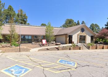
Address: 5075 N. Highway 89, Flagstaff, AZ 86001
Phone: 928-526-0866
Hours: Monday-Friday, 8 a.m. - 4 p.m. (Closed on federal holidays)
Office Email: SM.FS.Cof_Webmail@usda.gov
Getting There
Latitude / Longitude
Latitude: 35.19982
Longitude: -111.56319
Directions
Location: East of Flagstaff, Ariz., along Old Walnut Canyon Road atop Campbell Mesa.
Access: Take Interstate 40 east toward Albuquerque and get off exit #201 (Country Club). Turn right (south) on Country Club and travel for 0.9 miles to E. Old Walnut Canyon Road on your left (east). Travel on E. Old Walnut Canyon Road for 0.9 miles to the Campbell Mesa Loop Trails parking lot on your left. From the parking lot, walk 0.2 miles up the road to kiosks that direct you on which loop you want to use.
GPS (Map): 35°11'59.4"N 111°33'47.3"W
Facility and Amenity Information
Water
Potable water is not available at this site.
Picnic Tables
Picnic tables are not available at this site.
Horse/Pack Animal Information
Horse/Pack animals are allowed at this site.


