
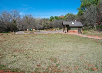
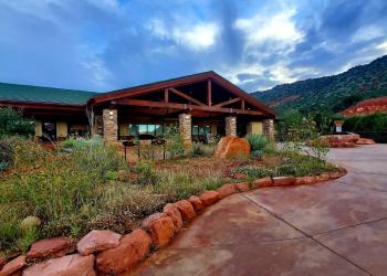
Crescent Moon Picnic Site
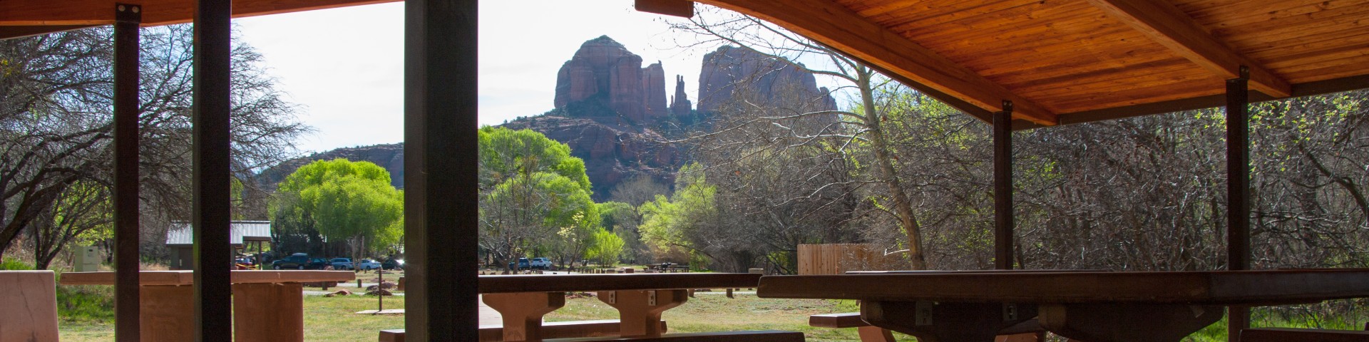
One of the most photographed scenes in the southwest is towering Cathedral Rock reflected in the waters of Oak Creek at Red Rock Crossing. It should come as no surprise, then, that the picnic area located at that same site is as popular as it is beautiful. People come here to fish, swim, and wade in the creek, as well as to picnic and photograph the scenery. At times it can become quite crowded. If you want the world-class beauty of Red Rock Crossing all to yourself (or nearly so) visit early in the morning or on a weekday.
Photo Gallery


Reservations
Make Reservations HereGeneral Information
Can I hold my wedding at Crescent Moon?
Yes! However, due to high demand, weddings at Crescent Moon are by reservation only. See Wedding Policy for Crescent Moon Picnic Site
The Exit gate is open till dusk on days the site is open.
- April 1 - September 30
- 7 a.m. to 7 p.m.
- October 1 - November 30
- 8 a.m. to 6 p.m.
- December 1 - March 31
- 9 a.m. to 5 p.m.
Visitors can either use a Coconino Pass for entrance or pay the daily rate at the gate.
Day use only. Camping is not permitted at this site.
Day Use (Coconino Pass):
$15 per vehicle per day (up to 5 people)
$25 per week
$50 per annual
$4 per person for walk-in, bicycle, bus, or extra person
If a visitor does not have a valid pass, an entrance fee is required. Cash, checks and credit cards are accepted.
Day Use
- Day Use: $15 per vehicle (up to 5 people)
- Walk-ins, buses, extra passengers: $4 per person, per day
Weddings
- Small Wedding (up to 15 people)
- $114 Weekday Time Slot Reservation
- $130 Weekend/Holiday Time Slot Reservation
- Three parking spaces for up to two hours
- Large (up to 50 people)
- $182 Group Ramada Reservation
- $114 Weekday Time Slot Reservation
- $130 Weekend/Holiday Time Slot Reservation
- Ten parking spaces for entire day
- Three additional parking spaces for up to two hours
Pets must be controlled or on a leash at all times.
Contact Name: Coconino Hospitality
Contact Phone: 928-203-0624
Address: 8375 State Route 179, Sedona, AZ 86351
Phone: 928-203-2900
Hours: Wednesday 12 p.m.-4:30 p.m. All other days, open 9 a.m.-4:30 p.m. Closed Thanksgiving, Christmas and New Year's Day.
Office Email: SM.FS.Cof_Webmail@usda.gov
Getting There
Latitude / Longitude
Latitude: 34.82605
Longitude: -111.80742
Elevation
3958 ft.
Directions
Location: 37 miles south of Flagstaff, 7 miles southwest of Sedona.
GPS (Map): 34°49'35.7"N 111°48'25.5"W
Access: Drive west from Sedona on state Route 89A. Just outside town, turn south on Upper Red Rock Loop Road (Forest Road 216). Drive about 1.5 miles and follow the signs to Red Rock Crossing. All roads are paved.
Facility and Amenity Information
Restrooms
Restrooms are available at this site.
Water
Potable water is available at this site.
Picnic Tables
Picnic tables are available at this site.
Horse/Pack Animal Information
Horse/Pack animals are not allowed at this site.