

A. B. Young Trail No. 100
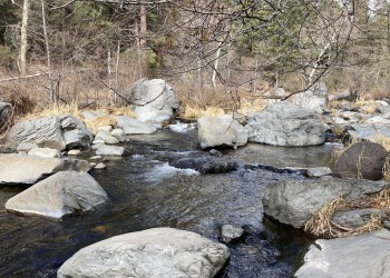
The A. B. Young Trail leaves from the southernmost end of the Bootlegger Picnic Area. Take steps down to the creek, find a suitable place to "boulder hop" or wade the stream, cross the creek and find an old metal sign indicating the trailhead.
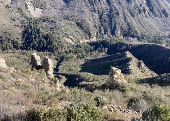
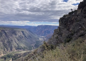
It immediately begins a moderately steep ascent and enters wilderness area. Due to its steepness, horses are not recommended. The shade of the creek area is quickly lost and nice views of the canyon and some interesting rock formations open up. The trail climbs 1,600 feet in 1.6 miles over the 33 switchbacks to the rim of Oak Creek Canyon. At this point, the trail enters the shade of ponderosa pine and heads west for 0.8 miles on a gradual ascent (this portion of the trail not well marked), ending at the East Pocket Fire Lookout Tower.
The trail is believed to have been built originally by C. S. (Bear) Howard in the 1880's and it was reconstructed in the 1930's by the Civilian Conservation Corp and supervised by A. B. Young.
Photo Gallery


Specific Trail Information
Trail Number
Trail Type
General Information
- Difficulty: Very strenuous.
- Trailhead Elevation: 5,202 ft.
- Elevation Gain: 2,082 ft.
- Length: 5.2 miles roundtrip.
- Time: 3.5 hours one way.
Red Rock Pass or America the Beautiful Pass required to park at the trailhead.
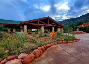
Address: 8375 State Route 179, Sedona, AZ 86351
Phone: 928-203-2900
Hours: Wednesday 12 p.m.-4:30 p.m. All other days, open 9 a.m.-4:30 p.m. (Closed on federal holidays)
Office Email: SM.FS.Cof_Webmail@usda.gov
Getting There
Directions
Location: 20 miles south of Flagstaff (10 miles north of Sedona) on paved roads in scenic Oak Creek Canyon.
Access: Drive into Oak Creek Canyon to Milepost 383.3. The trail starts across the creek from Bootlegger Picnic Area. After crossing the creek, a short climb will bring you onto an old road and telephone line above the creek. The trailhead starts at the old metal sign which is within 300 feet of your crossing. From most crossings, the sign will be just downstream (it's upstream from the stairs leading down to the creek, where a shallow crossing can be waded).
GPS (Map): 34°58'10.6"N 111°45'03.0"W