
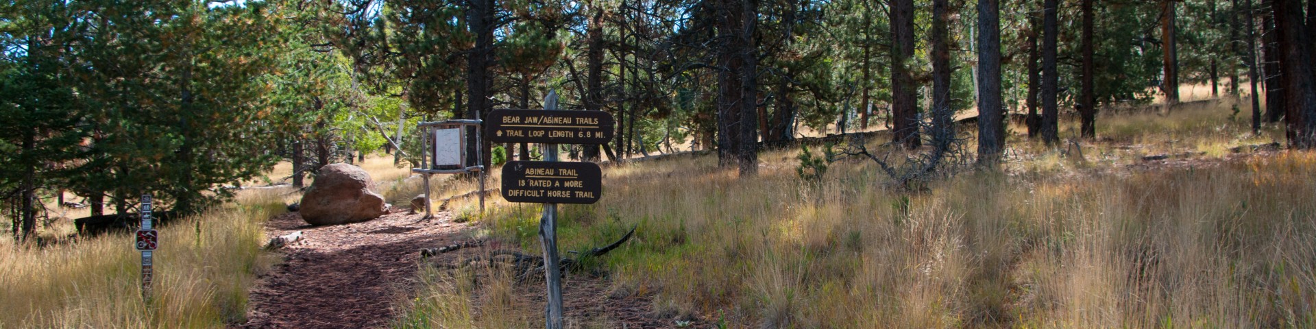
Bear Jaw Trail No. 26
From the Abineau and Bear Jaw trails, on the north slope of the San Francisco Peaks, you can see the Grand Canyon 70 miles away. These two trails make a scenic loop through forested canyons. Both end at the Waterline Trail along the base of a long talus slope topped by Humphreys Peak, Arizona's highest point.
The climb along either trail is steep and steady through stands of mixed conifer and aspen. The Waterline Trail completes the loop by connecting the top of one trail to the other, ascending 600 ft. over 2 miles from the top of Bear Jaw Trail to the top of Abineau Trail.
From this high perspective the Grand Canyon cuts a wide gap in a the plateau stretching from the mountain to the horizon. With the almost half-mile connector trail from the trailhead to the loop (where Bear Jaw and Abineau split to follow different routes up the mountain), the entire hike is approximately 7 miles long.
Specific Trail Information
Trail Number
Trail Type
General Information
- Difficulty: Strenuous.
- Trailhead Elevation: 8,530 ft.
- Elevation Gain/Loss: 1,312 ft.
- Length: 2.8 miles.
- Time: Several hours.
Address: 5075 N. Highway 89, Flagstaff, AZ 86001
Phone: 928-526-0866
Hours: Monday-Friday, 8 a.m. - 4 p.m. (Closed on federal holidays)
Office Email: SM.FS.Cof_Webmail@usda.gov
Getting There
Directions
Location: 24 miles north of Flagstaff on graveled Forest Roads.
Access: Drive north out of Flagstaff on U.S. Highway 180 for 18.7 miles till you see Forest Road 151 on your right. Take FR 151 east for approximately 1.6 miles and stay to the left at the fork of the road, where you will now be on FR 418. Take FR 418 for 3 miles to FR 9123J and turn right on FR 9123J. Drive a little under 3/4 mile on FR 9123J to the parking lot.
GPS (Map): 35°23'12.2"N 111°40'38.4"W