

Brins Mesa Trail No. 119
This trail begins right at the edge of the town of Sedona and is as picturesque as it is convenient. Instead of keeping you tucked away in a deep canyon or clinging to the side of a steep slope as do a lot of other trails in this area, it leads you right out into the open where you can enjoy unobstructed views of the spectacular red rock formations for which the Sedona area and Oak Creek Canyon are famous. Bring along a map to help you identify Coffee Pot Rock, Wilson Mountain, Chimney Rock and more.
The hike is not too steep and not too long, but it can be a bit hot during summer. No matter, you'll be glad you braved the heat when you see the views. An alternate approach to the Brins Mesa Trail is to start from the Jim Thompson Trailhead and hike it from that end — same trail, same great views.
Photo Gallery


Specific Trail Information
Trail Number
Trail Type
General Information
- Difficulty: Easy to moderate
- Trailhead Elevation: 4,632 ft.
- Elevation Gain: 649 ft.
- Length: 3.5 miles one way.
- Time: 1 hour 45 mins one way.
Red Rock Pass or America the Beautiful Pass is required to park at the Jim Thompson trailhead.
No mechanized vehicles (including mountain bikes) in Wilderness.
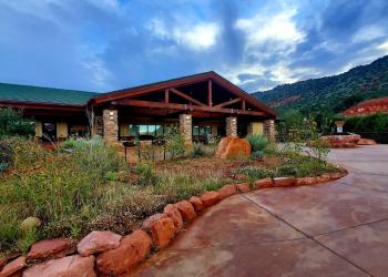
Address: 8375 State Route 179, Sedona, AZ 86351
Phone: 928-203-2900
Hours: Wednesday 12 p.m.-4:30 p.m. All other days, open 9 a.m.-4:30 p.m. Closed Thanksgiving, Christmas and New Year's Day.
Office Email: SM.FS.Cof_Webmail@usda.gov
Getting There
Directions
Location: 28 miles south of Flagstaff (1 miles north of Sedona) on paved and dirt Forest roads in scenic red rock country.
Access:
- Brins Mesa Trailhead: From the 'Y' intersection of state Routes 89A and 179 in downtown Sedona, drive west on SR 89A for 3.2 miles to Dry Creek Road on your right. Take Dry Creek Road 2 miles north until it breaks off to the right (going straight will turn the road into Boynton Pass Road). Turn right on Dry Creek Road (Forest Road 152) and drive 0.2 miles to the parking lot on your left. You can park here and hike another 2.24 miles up FR 152 to the Brins Mesa Trailhead, or continue to drive to it as long as you have a high-clearance vehicle (this section is no passable for passenger vehicles).
- Jim Thompson Trailhead (Map): From Flagstaff, drive 27 miles south on state Route 89A to Sedona and turn west (right) on Jordan road. Follow it about a mile to the trailhead. The last 1/4 mile of Jordan Road can be a bit rough, but passable by passenger cars. A Red Rock Pass or America the Beautiful Pass is required to park at this trailhead.
GPS (Map): 34°55'01.3"N 111°48'31.6"W