





Cockscomb Trail System
This interconnected series of trails lies at the northern edge of Sedona near Dry Creek. Trails in this system include Girdner, Arizona Cypress, Dawa, Cockscomb, Rupp, OK, Anaconda, and Snake Trails. These trails may be reached using the Arizona Cypress, Dawa, Cockscomb, or Girdner trailheads. Various loop hikes can be made by combining all or parts of several trails and a number of one-way hikes can be made using arranged transportation at a second trailhead. In general, these trails are well-suited to biking, have easy to moderate grades with little overall elevation change, are well signed, but have sparse shade.
- Arizona Cypress Trail: Begins at its trailhead by the old borrow pit and goes southwest over the level, sandy ground of a closed jeep road beside Dry Creek. At 0.7 miles, it intersects the south end of the OK Trail and continues southwest for another half mile where it meets the end of the Dawa Trail. Here, the Arizona Cypress Trail turns southeast and continues 0.7 miles to its end at the Girdner Trail. There are nice views along the way. (Note: There is a target shooting pit near the trailhead. This trailhead is not appropriate for pets and horses that are easily spooked by gunfire and loud noises.)
- Dawa Trail: Goes south a short way before bending to the west along a closed jeep road with some good views. It meets the Cockscomb Trail at 0.9 miles and turns sharply southeast to follow it for 100 feet. The Cockscomb Trail then splits off to the southwest and the Dawa Trail continues southeast for 0.8 miles before ending at the Arizona Cypress Trail beside Dry Creek.
- Cockscomb Trail: Goes south from its trailhead along a jeep road for 0.3 miles, bends west for 0.2 miles, then goes southeast along a closed jeep road skirting the face of Doe Mountain. It intersects the Dawa Trail at 1 mile, turns to the southwest, and ends at 1.8 miles near the Cockscomb.
- Rupp Trail: A continuation of the Cockscomb Trail along the old road, the Rupp Trail bends to the east and there are nice views all around as it crosses a broad, open expanse before ending at 1.2 miles as it drops down into the Dry Creek drainage and meets the Girdner Trail.
- Anaconda Trail: Runs 1.7 miles from Arizona Cypress Trail east to Girdner and Snake Trails.
- Snake Trail: Runs 0.4 mile north back to the Arizona Cypress Trailhead.
- OK Trail: This is a short connector which can provide variety in making up various routes.
General Information
- Difficulty: Easy to moderately strenuous.
- Trailhead Elevation:
- Elevation Change:
- Length: 2.5 to 16-plus miles, depending on route used
- Time: 1 to 6 hours, depending on route used
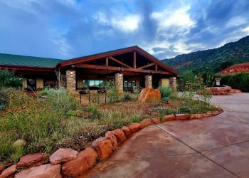
Address: 8375 State Route 179, Sedona, AZ 86351
Phone: 928-203-2900
Hours: Wednesday 12 p.m.-4:30 p.m. All other days, open 9 a.m.-4:30 p.m. See "Additional Office Information" below for holiday hours.
Office Email: SM.FS.Cof_Webmail@usda.gov
Getting There
Directions
Location: 38 miles south of Flagstaff, Arizona, approximately 6 miles northwest of Sedona, Arizona, in scenic Red Rock Country.
Access:
- Dawa: from the junction of Routes 89A and 179, take 89A west 3.2 miles to Dry Creek Road on the right. Go north 2.9 miles to a "T". Turn left and go 0.5 miles to a small turnout on the left. The trailhead is at the gap in the fence.
- Cockscomb/Fay Canyon: from the junction of Routes 89A and 179, take 89A west 3.2 miles to Dry Creek Road on the right. Go north 2.9 miles to a "T". Turn left on Boynton Pass Road and go 1.6 miles to another "T". Turn left and go for 0.6 miles. Trailhead parking for Cockscomb Trail System and Fay Canyon Trail is on the left.
- Arizona Cypress: from the junction of Routes 89A and 179 (the "Y"), take 89A west 3.2 miles to Dry Creek Road on the right. Go north 2.8 miles to a small, dirt road on the left just before the road crosses Dry Creek and comes to a stop sign. Follow the dirt road for 1/4 mile and park at the old borrow pit. The trailhead is at the southwest end of the pit. (Note: Arizona Cypress trailhead is not recommended for horses or pets spooked by loud noises. A target shooting pit is located near the trailhead on FR 9589. Shooting at this nearby pit is legal and allowed provided users follow shooting laws and safety guidelines.)
- Aerie: Drive past the Cockscomb/Fay Canyon trailhead on Boynton Pass Road (described above) for approximately a quarter mile. Turn left on Aerie Road and drive approximately a half mile to the trailhead on the right.
- Girdner/Cultural Park: from the intersection of Routes 89A and 179, take 89A west 4.2 miles to Cultural Park Place on the right at the traffic signal. Go north 0.2 miles to the picnic ramada and interpretive displays on the right.
GPS


