
Visitor Maps and Guides
Avenza Maps App

Avenza Maps is a mobile mapping application that allows users to view, create, and navigate offline maps using their smartphones or tablets. It supports a wide range of map formats, including geospatial PDFs and TIFFs, making it popular among outdoor enthusiasts that may require offline access to detailed maps for activities like hiking, fieldwork, and navigation.
Recreation Maps
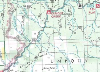
The Land of Umpqua Recreation Map shows the Umpqua National Forest and the Roseburg District Bureau of Land Management. It is ideal for general trip planning and navigating main roads.
Ranger District Maps
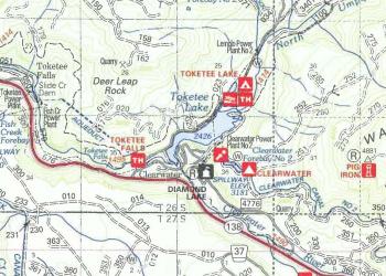
Ranger District Maps are ideal for detailed trip planning and navigating secondary roads. They display trails, roads, and recreation sites for specific Ranger Districts on the Umpqua National Forest
Wilderness Maps
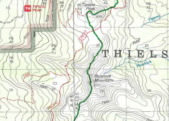
Wilderness Maps are essential for planning and completing trips into designated Wilderness areas. They display all trails and trailheads and show topographic contour lines and relief shading.
Quad/Topo Maps

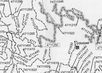
Quadrangle Maps provide the most detailed depiction of terrain on the Umpqua National Forest. They display a small area of 50 to 70 square miles and are ideal for backcountry or cross-country travel by foot.
Motor Vehicle Use Maps
Motor Vehicle Use Maps, or MVUMS, display the roads and trails that are open to motorized travel on the Umpqua National Forest. Only the routes shown on the MVUM are open to motorized vehicles.