
Chimney Peak Trail #3382
Starting from the trailhead on Forest Service Road 2041-646 spur, the trail rapidly descends for 0.75 mile to the Middle Santiam River. You can enjoy exploring Shedd Camp Shelter and a nearby swimming hole.
The trail continues across the Middle Santiam River (no bridge) and travels north through majestic old growth forests. The trail crosses Pyramid Creek (no bridges) before rising to Forest Service Road 2041 (closed in winter.)
Trail crosses Forest Service Road 2041, enters Middle Santiam Wilderness and reaches Donaca Lake in less than three miles. Beyond Donaca Lake, through the heart of the wilderness, the trail gradually gains elevation to the base of Chimney Peak.
Adventurous explorers might want to ascend the rocky peak to the place where a fire lookout once stood.
Specific Trail Information
Trail Number
General Information
Close to:
Wilderness Self-Issue Permit required for both day use and overnight stays from June 15 through October 15. Free permits are self-issued at the trailhead.
Water from streams and lakes should be filtered or treated.
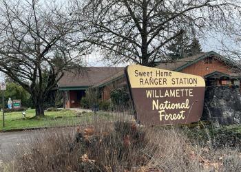
Address: 4431 Highway 20 Sweet Home, OR 97386
Phone: (541) 367-5168
Hours: Monday-Friday, 8:00 a.m. - 4:30 p.m. (Closed on federal holidays)
Office Email: sm.fs.mf@usda.gov
Getting There
Trailhead/Starting Points
Access from Chimney Peak Trailhead
Directions
From Sweet Home, Oregon, travel east on Highway 20 for 23.3 miles; turn left on Forest Road 2041 (Soda Fork). Stay on 2041 for 12 miles to spur road 646 and turn right.
The trailhead is at the end of the spur road.
You may also reach a mid-point in the trail by continuing down 2041 for an additional 3 miles to the road closure. Travel by foot 2 miles further along 2041 to the original trailhead. This route shortens the total hike by approximately 3 miles and bypasses the need to wade the Middle Santiam River and Pyramid Creek.