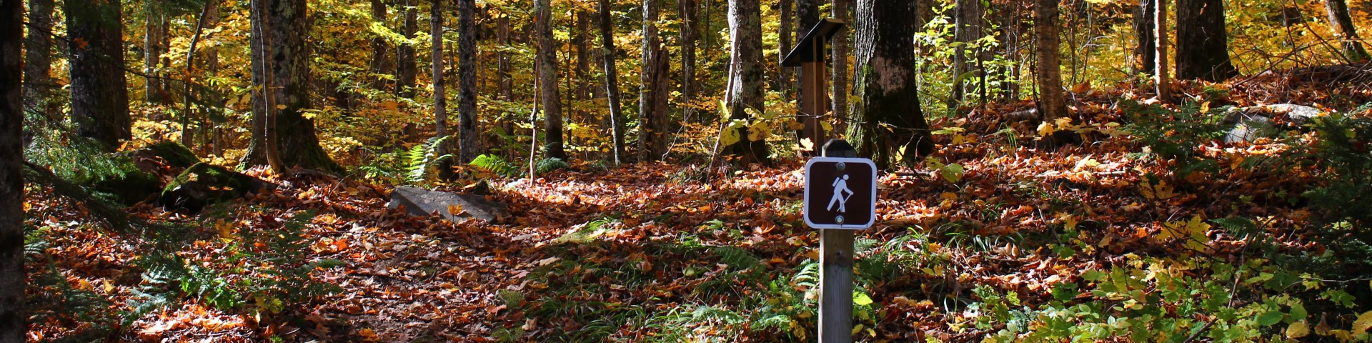
Recreation

From vast wildernesses to stunning waterfalls, exploring the Ottawa takes you into a different world. With an average annual snowfall of 200", winter sports enthusiasts will find Alpine and Nordic skiing, snowmobiling, dog-sledding and ice fishing for most months the year.
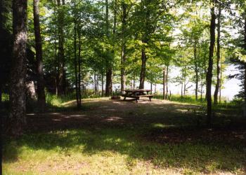
Lightly used campgrounds and far-flung trails make it easy to find solitude no matter what time of year you visit. Although the forest is home to many furry friends, including bear, coyotes, wolves and deer so you'll never be alone.
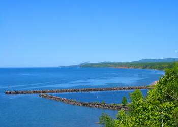
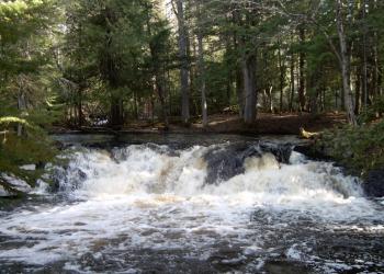
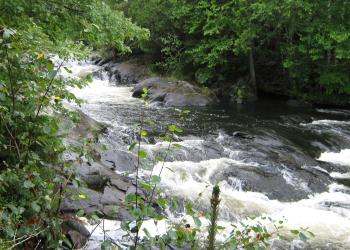
With over 500 named lakes and 2,000 miles of rivers and streams it's a fisherman's paradise, from walk-in lakes, streams and rivers, to access to the depths of Lake Superior at Black Harbor Recreation Area.
Get started by exploring one of the activities below. Can't find what you're looking for? Select an activity from the list above, or use the drop-down on the right to find an area within each Ranger District.
2023 Fee Free Days
Days where Day Use Fees* are waived on National Forest Service System lands:
- Martin Luther King, Jr. Day: Jan 6, 2023
- Presidents Day: Feb 20, 2023
- National Get Outdoors Day: June 10, 2023
- Juneteenth: June 19, 2023
- National Public Lands Day: Sept. 23, 2023
- Veterans Day: Nov. 11, 2023
*Does not apply to camping, OHV or concession sites.
**Note: the Michigan Department of Natural Resources Free Fishing Weekend dates for 2023 are: Feb. 18 and 19 and June 10 and 11. All fishing license fees will be waived for two days.
I want to...
Discover My National Forest
-
Camping
-
Sylvania Wilderness
-
Waterfalls
Know Before I Go
Current Recreation Conditions
Area Name | Status | Area Conditions |
---|---|---|
Ajibikoka Falls | Open | |
Black River Harbor Recreation Area | Closed | The site is open year round to use by the public. Fees are in place from May 1st through September 30th. No flush toilets or potable water available at pavilion this year. Gogebic County plows some of the site. FS recreation staff will be plowing a portion of the parking lot and entrance road into it during the winter of 2023-2024. Plowing will stop when spring conditions make it difficult to move snow. |
Bob Lake Campground | Open | |
Bobcat Lake Campground | Open | FS recreation staff will be plowing the boat launch area if roads to the site are plowed open. Reduced services after 10/10/2023 but visitors can use during the fall hunting seasons or until the snow closes access roads. Gates get closed as soon as snow start to accumulate. |
Burned Dam Campground | Open | Developed dispersed recreation site is open until snow closes access. Camping stay limits apply. |
Camp Nesbit Environmental Center | Open | |
Conglomerate Waterfalls | Open | The parking area and access roads are being plowed during the winter of 2023-2024. Plowing will stop when spring conditions make it difficult to move snow. |
Cooks Run Trail Head | Open | |
Courtney Lake Campground | Open | No water is available yet. Please plan accordingly. The campground will still have open and stocked bathrooms, as well as trash disposal. |
Ge-Che Hiking Trail | Open | Trail and parking area in Lake Ottawa Recreation Area is open year round. The parking lot is not plowed at this time. |
Golden Lake Campground | Open | Will be open free of charge until the ample down vegetation is addressed. The toilets are cleaned and available for use. The boat landing is open for use. |
Hagerman Lake | Open | The boat landing and picnic area are open. There is a vault toilet located adjacent to the boat landing. Pack-in, pack-out garbage. |
Henry Lake Campground | Open | Reduced services after 10/9/2023- no water or garbage service provided into hunting season. FS recreation staff will be plowing out the boat launch area if the roads to reach this site are plowed open. |
Imp Lake Campground | Open | Reduced services after 10/09/2023 and no fees. The permit holder leaves the second loop open for hunters to use until the snow closes it. The first loop gate is shut on the last day of operations. The boat ramp will be plowed if the road into the site is also plowed. |
Kakabika Falls | Open | |
Lake Ottawa Recreation Area | Closed | The Lake Ottawa Pavilion will be closed for the 2023 season due to rehabilitation work needed to the interior and exterior of the building. Please check back frequently for updates and the status of this facility. We thank you for your patience and support as we complete this much needed work to the Lake Ottowa Pavilion. |
Lake Ste Kathryn Campground | Closed | |
Langford Lake Boat Launch | Open | Campground has been permanently closed. The boat ramp is open and available for use. |
Little Falls | Open | |
Marion Lake Campground | Open | |
Mex-i-mine Falls | Open | This site is maintained 5/22 - 9/30. |
Moosehead Lake Campground | Open | Camping is allowed with reduced services after October 9th. Open for camping until November 30th or until the snow closes the roads to access the site. If the road to the boat launch area for Moosehead is plowed open, we will plow the boat landing. |
Morrison Creek Hunter Trail Head | Open | |
Norway Lake Campground | Closed | |
Ottawa National Forest Visitor Center | Open | The Bear Den is permanently closed. |
Paint River Forks Campground | Open | Developed dispersed recreation site is open until snow closes access. Camping stay limits apply. |
Perch Lake Campground | Closed | |
Pomeroy Lake Campground | Open | Camping is allowed with reduced services after October 9th. The campground is available for hunters to use until 11/30/2023 or until the snow closes the roads to the site. |
Potawatomi and Gorge Waterfalls | Open | The parking area and access roads are being plowed during the winter of 2023-2024. Plowing will stop when spring conditions make it difficult to move snow |
Rainbow Falls | Open | The parking area and access roads are being plowed during the winter of 2023-2024. Plowing will stop when spring conditions make it difficult to move snow. |
Robbins Pond Campground | Open | Developed dispersed recreation site is open until snow closes access. Camping stay limits apply. |
Sandstone Falls | Open | The parking area and access roads are being plowed during the winter of 2023-2024. Plowing will stop when spring conditions make it difficult to move snow. |
Sparrow Rapids Campground | Open | |
Stateline-Miles Post Zero Trail | Open | |
Sturgeon River Campground | Open | |
Sylvania (Clark Lake) Campground | Open | Concessionaire operated site. Only parking area at information station is plowed in the winter. The pressurized water system and gates in campground will be closed by 10/2/2023. The pavilion is operated by the FS and closes on 9/30/2023. |
Sylvania Wilderness Backcountry Camping | Open | Reservation for permits required from May until Sept. 30th. Registration is still required prior to entering the wilderness area. |
Timber Lake Trail Head | Open | |
Wolf Mountain | Open | |
Yondota Falls | Open |
Spotlights
Sylvania Wilderness Backcountry Camping
The Sylvania Wilderness encompasses 18,327 acres of primitive lands and is part of the National Wilderness Preservation System.
Visitors can camp in 50 designated campsites within the Sylvania Wilderness. Visitors enjoy endless canoeing, fishing, hiking and wildlife viewing opportunities.
Natural Features: The old-growth forests and pristine lakes in the region provide habitat for a wide range of animal and plant life, including rare orchids, bald eagles, loons and osprey. The wilderness contains 34 named lakes, some with sandy beaches and others surrounded by record-size red and white pines.
The Ottawa National Forest is comprised of nearly 1 million acres and is located in the western reaches of Michigan's Upper Peninsula. The forest's rolling, forest covered hills extend from the south shore of Lake Superior to the Wisconsin border. Lakes, rivers and waterfalls are found throughout this beautiful landscape.
Recreation: Sylvania's abundant lakes provide plentiful non-motorized boating, canoeing, kayaking and fishing opportunities. Other popular activities include hiking and viewing wildlife.
Facilities: Sylvania Wilderness Backcountry Camp is not a physical campground located at one location. The 50 individual sites are located along eight lakes within the Sylvania Wilderness. Camping is allowed only at designated sites. Campsites are primitive, but each is equipped with a campfire ring and a wilderness latrine.
Camping is permitted at designated sites by permit only. Permits MUST be reserved by visiting Recreation.gov (see details below). No first-come, first-serve walk in sites available in 2020.
Fish Your National Forests: Fish available include: Trout, Native Trout, Bass, Walleye, Panfish, Pike; Types of fishing available include: Wade, Shore, Non-motorized boat, Float tube, Fly, Spin, Ice;
Maps:
2022 SYLVANIA WILDERNESS AND RECREATION AREA UPDATES
Ottawa National Forest Visitor Center

Welcome to the Ottawa National Forest! Start your visit to the Forest with a trip to the Ottawa Visitor Center, here you will find recreation information, maps, and much more. The facility is packed with interpretive exhibits and animal mounts explaining the Forest's natural and cultural history. We offer a large selection of educational videos to be viewed in our auditorium; Thursday Evening Programs throughout the summer months; group conservation education programs, upon advanced request; as well as an interpretive nature trail. The Visitor Center and interpretive trail are fully accessible, and no fees are charged for admission to the Center, or to attend our interpretive programming.
Available at the Ottawa Visitor Center:
- Forest Information
- Visitor/Recreation Information
- Forest Product Permits (Please call ahead for availability of permits.)
- Interagency Passes
- Potable water is available through the bathroom faucet
- Interpretive exhibits and ¼ mile trail
- Auditorium
- Children's classroom
Phone number: 906-358-4724
Sturgeon River Gorge Wilderness

The Wild and Scenic Sturgeon River rushes out of the northern portion of this wilderness, over the 20 foot volcanic outcroppings of Sturgeon Falls, and through a gorge that reaches 350 feet in depth and a mile in width. Throughout this rugged, steep Wilderness, the Sturgeon and Little Silver Rivers and their tributaries have carved falls, rapids, ponds, oxbows, and terraces. Stunning views are possible from the eastern rim of the gorge. Except for a few naturally bare slopes, most of the land is forested with pine, hemlock, aspen, sugar maple, birch, and basswood. When the leaves of the hardwoods change color in the fall, they form a vivid tapestry. There are few established trails in Sturgeon River Gorge Wilderness, and the few overgrown logging roads are hard to find and follow. The North Country National Scenic Trail parallels the northern and eastern boundaries for about eight miles. Sturgeon River Campground offers seven sites on the southeastern boundary. In spring and during peak runoff, kayaking and white water canoeing are challenging, and only recommended for advanced paddlers.
Sturgeon River Gorge Wilderness Map
McCormick Wilderness

Three generations of McCormicks, the descendants of Cyrus McCormick, inventor of the reaping machine, held the deed to this area before Gordon McCromick willed the land to the U.S. Forest Service. McCormick Wilderness has recovered from the logging era that ended in the early 1900's. Today, you'll find a mixture of northern hardwoods and lowland conifers interspersed with small patches of towering white pine, Michigan's State Tree. Straddling the divide between Lake Superior and Lake Michigan, this region ranges from nearly level terrain to rocky cliffs. McCormick's water is what draws most visitors, with the Huron, Dead, Pahokee, and the Wild and Scenic Yellow Dog Rivers all have part of their headwaters within the wilderness. Many cascading waterfalls on the Yellow Dog make it unnavigable. The Yellow Dog is one of a few Eastern rivers designated "Wild". Eighteen small lakes add sparkle to the landscape. Trout, pike, and bass live here, but only in small numbers due to the less-than-fertile-waters. The three mile White Lake Trail connects County Road 607 to White Deer Lake where the McCormick Estate once stood. Remnants of old, unmaintained trails can sometimes be found, but the rest of the Wilderness is fairly rugged, isolated, unspoiled, and relatively difficult to access.
McCormick Wilderness Map
Camp Nesbit Environmental Center
Nestled in the beautiful northwoods of the Upper Peninsula of Michigan, Camp Nesbit Environmental Center is the perfect setting for exploring the natural world. Built by the CCC, this residential camp blends a rustic feel with many modern conveniences. For more information on the facilities and reserving your spot read below or print out the brochure (pdf).
Camp Nesbit was built in 1938 by the Civilian Conservation Corps and exists today much as it did when construction was completed in the late 1930’s. The facilities blend a rustic feel with many modern conveniences.
The 12 dormitory-style cabins can accommodate up to 144 people and are readily accessible to Lake Nesbit—an 18-acre lake perfect for fishing, canoeing and swimming. A recreation hall, kitchen and dining hall, nurse’s cabin, and fire circle complete the Center.
Amenities such as an archery range, shooting range, hiking trails, low ropes course, volleyball courts, ball field, and swimming beach provide for outstanding recreational opportunities.