

Aviation Aerial Survey
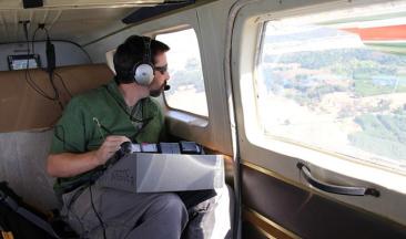
Insect and disease aerial detection surveys (ADS) are conducted annually using a variety of light fixed and rotor wing aircraft. Forest Service, state and other federal cooperators work together to complete overview surveys in order to map current year forest injury. Some regions have been conducting ADS for more than 60 years; others have become more active within the last decade. Data collected during these surveys has proven useful in early detection of invasive species, rapid response actions such as quarantine, control or eradication. The effects of endemic pest outbreaks are also recorded and provided to national and local area land managers, referenced in a variety of conditions and congressional reports to aid decision making.
National data sets and map images are available through the FHP Mapping and Reporting
Local data sets and map images are available through Regional FHP Aviation Websites
The Aerial Survey Working Group (ASWG) was established to facilitate nationally the quality, efficiency and safety for all agencies and personnel involved in this important detection and monitoring effort. For more information about the ASWG and its membership, please review the Charter and previous year’s reports. See below for standards, collection methodology, and additional ADS products.
Aerial Survey Working Group

Standards & Products