

Recreation

Follow the route of the Lewis and Clark Expedition through the Bitterroot Mountains, catch your limit of trout at a pristine alpine lake, or camp under the stars and listen to the howl of the wolf. Whether you're looking for the rigors of a wilderness trek or an easy drive along a scenic byway, you'll find it here in the National Forests of the Northern Region.

National Forest lands are diverse and great locations for many activities such as hiking, biking, skiing, camping, birding, renting historic cabins and lookouts, driving for pleasure, harvesting mushrooms, and gathering firewood. Many of the facilities and services associated with these opportunities are free. Some do require fees or permits to help maintain, manage, and improve the amenities that you enjoy.

Rent a Room with a View
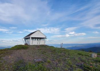
Rental Cabin Card Pic Big Hole LO Lolo

The Northern Region is home to rental cabins and lookouts across Montana and Northern Idaho.  Which one will you visit next?

Recreation Passes
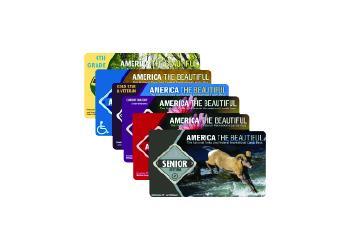
A stack of interagency recreation passes.

Interagency recreation passes provide access to recreation sites managed by a number of Federal agencies.

Recreation Fee Site Accomplishment Reports

Devils Elbow Campground Pay and Information Kiosk Signs provide campers information on fees and payments as well as safety information and rules and regulations.

The Recreation Fee Site Accomplishment Reports highlight recreation accomplishments provided through recreation fee dollars, the revenues and expenditures, and a sampling of planned projects for the Forests and Grasslands in the Northern Region. Your fee dollars continue to do amazing things. Thank you for your support! See how funds are used from the Recreation Fee Sites across Region 1.

Recreation.gov

Recreation.gov is the government's centralized travel planning platform and reservation system for 14 federal agencies, offering the tools, tips, and information needed for you to discover destinations and activities, plan a trip, and explore outdoor and cultural destination across the country.

Recreation

Showing: 201 - 210 of 1578 results

Bighorn Campground

Site Open
Fishing Outdoor Science and Learning Hiking
Located in the Rock Creek drainage, this campground is situated right on Rock Creek in an old growth Ponderosa Pine and Douglas Fir forest. This area is known for its blue ribbon trout stream and…

Billy Garret Memorial Bridge Access

Water Activities Fishing
This access site is on Forest Road #895 ( west side reservoir road) at mile marker # 55. This is a popular take out for trips originating further up the South Fork. It is also a good put in for…

Birch Creek Cabin

Site Open
Fishing Outdoor Science and Learning Hiking Winter Sports
Birch Creek Cabin is a historic log cabin with electricity. It provides access to a variety of hiking, OHV, and for cross-country skiing and snowshoe trails (depending on the season). A vaulted…

Birch Creek Civilian Conservation Corps Camp

Nestled amid the Pioneer Mountains, the Birch Creek Civilian Conservation Corps (CCC) Camp was constructed in 1935 as part of President Franklin D. Roosevelt's "New Deal." It operated for 6 years…

Birnt Hills Loop

Hiking Biking Outdoor Science and Learning
The Birnt Hill Loop is a 3.1-mile trail that takes users from the top of the hill down to the edge of the Missouri River. The trail is considered moderately challenging and offers stunning views of…

Birnt Hills Overlook

Site Open
Outdoor Science and Learning
The Birnt Hills Overlook marks the approximate location where Meriwether Lewis and William Clark's expedition, also known as the Corps of Discovery, camped in 1805.The Lewis and Clark Expedition is…

Bishop Park (Olson/Miles Creek Trailheads)

Multiple trailheads and connector routes for loop or out and back hiking, mountain biking and OHV riding.Refer to Forest Maps and Motor Vehicle Use Maps for seasonal riding and designation dates.

Bitterroot Big Springs Trail # 147

Hiking
The Bitterroot Big Springs trail is 3.1 miles long. It begins at Road #321 and ends at Trail #313. The trail is open for the following uses: Horseback Riding

Bitterroot Flat Campground

Site Open
Fishing Outdoor Science and Learning
Located in the Rock Creek drainage, this campground is adjacent to Rock Creek, situated amongst ponderosa pine and Douglas-fir trees. This area is known for its blue ribbon trout stream and rugged…

Bitterroot-Rock Creek Divide Trail # 313.1

Hiking Horse Riding and Camping Hunting/Shooting
The Bitterroot-Rock Creek Divide trail is 78.9 miles long. It begins at Deer Lodge Trail #9 and ends at Road 601.1. The trail is open for the following uses: Horseback Riding