

Around the Peaks Loop
This drive takes you all the way around Arizona's highest mountain, winding through a land of pine forests and aspen groves, open prairies and rustic homesteads. Anytime is a good time to enjoy this drive, although the roads are closed through much of the winter (you might want to ski or snowmobile it then).
In the spring, wildflowers follow the retreating snow up the mountain. They color the meadows and decorate the forests reaching a climax just as summer comes to a close. Autumn then turns the mountain to gold, filling forest roads and trails with visitors come to enjoy the colorful display.
There are a number of places along this route where you can stop to take a hike, enjoy a lunch or even set up a primitive camp. That way you can take more than one day to do this drive or combine it with one or more of the other scenic drives in the vicinity of the San Francisco Peaks.

General Information
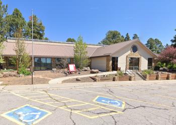
Address: 5075 N. Highway 89, Flagstaff, AZ 86001
Phone: 928-526-0866
Hours: Monday-Friday, 8 a.m. - 4 p.m. (Closed on federal holidays)
Office Email: SM.FS.Cof_Webmail@usda.gov
Getting There
Directions
From the heart of Flagstaff, drive northeast about 15 miles on state Route 89 until you see a "Forest Access" sign at mile marker 430.4 directing you to turn left (west).
Once you cross SR 89, you will enter Forest Road (FR) 552 which will come to a "T" about a half mile down the road. Following FR 552, turn right (north) to head towards FR 418.
After driving for about a mile, you will see a sign that directs you to take another right on to FR 418.
Follow FR 418 approximately 12 miles to FR 151 where you can either go right or left. If you go right on FR 151, it's only a couple of miles until you get to U.S. Route 180. If you decide to go left on FR 151, it's about 8 miles to U.S. Route 180, but this section of the drive is very beautiful and cuts between Hart Prairie and Snowbowl.
Travel Considerations
Road Conditions: FRs 418 and 151 are gravel. Portions of FR 418 are rough and rocky, requiring a high clearance vehicle (four wheel drive not required). The roads are closed when the winter weather season arrives.
Facility and Amenity Information
Restrooms
Restrooms are not available at this site.
Water
Potable water is not available at this site.