

Mogollon Rim Ranger District
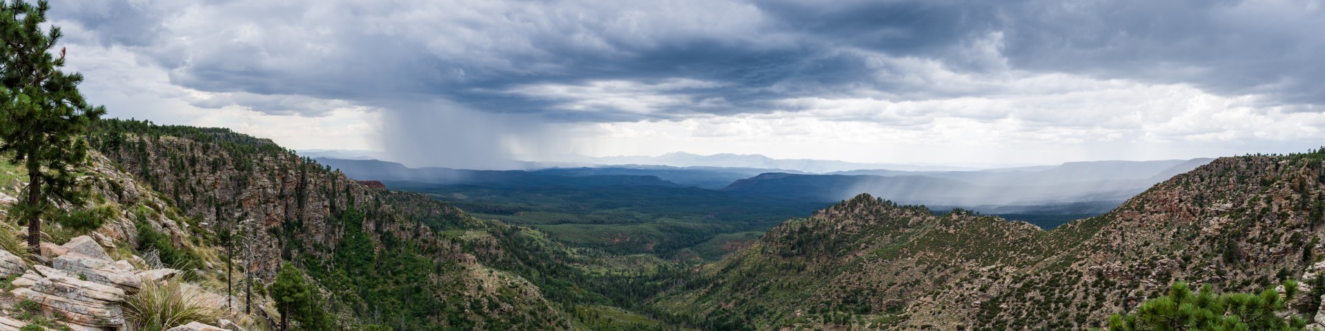
At 506,840 acres, the Mogollon Rim Ranger District is a rugged escarpment that forms the southern limit of the Colorado Plateau. It extends across the entire forest and provides excellent views within Plateau Country and Desert Canyon Country as well. Dropping as much as 2,000 feet in some areas, the Rim provides some of the most far-reaching scenery in Arizona. Views stretch from its rocky precipice to Four Peaks of the Mazatzals northeast of Phoenix.
Needless to say, sightseeing is a favorite activity along the Rim, but this forest area also boasts a historic system of hiking and horseback trails, a couple of picturesque lakes for boating and fishing, and backcountry skiing for wilderness adventurers. The Mogollon Rim is home to Camp Colley, an outdoor adventure camp at Little Moqui, run by the City of Phoenix, Parks and Recreation.
Complexes
Fed by three watersheds, this narrow, winding body of water looks more like a canyon-bound river than a lake. Given the steep canyon walls that create the C.C.
The Cabin Loop Trail System is the link between the earliest fire guard cabin network in this area of the Mogollon Rim and has its roots in the beginning of the Forest Service era here. The trail was developed between the General Springs Cabin, Pinchot Cabin, and Buck Springs Fire Guard Station.
Administratively, the cabins were part of the Bly Ranger District, now the Blue Ridge Office (Mogollon Rim Ranger Station) of the Mogollon Rim Ranger District. The Bly Ranger District had a winter administrative headquarters at the Old Bly Ranger Station located about 10 miles north of the present Blue Ridge Office. The summer headquarters for the Bly District was the Blue Ridge cabin near Rock Crossing Campground. These two cabins are no longer in existence.
The trail passes through some of the most spectacular country in Arizona and you will encounter a variety of landforms, vegetative communities, and a number of springs and perennial water sources. It is important to remember that trails such as those that make up the Cabin Loop Trail System provide the only access to the country in the early days. These and other trails were used and maintained by early forest rangers, ranchers and settlers. Livestock was driven up the Rim from the Tonto Basin and grazed during the summer up on the Rim. Portions of the trails are still used by ranchers for moving livestock. Historic accounts tell us that the old timers who made and used the trails blazed them to a height of 6 or 7 feet so the trails could be followed even after a deep snow. Maintenance and repair of the old telephone line was a priority for the rangers each spring. Their accounts indicate that snow lasted late here and it wasn't uncommon for them to have a ride over 4-foot drifts during spring rounds.
The Cabin Loop Trail is made up of the following five trails:
- Houston Brothers Trail: Aspen Spring and Pinchot cabins
- Barbershop Trail: Buck Springs cabin
- U-Bar Trail: Dane Spring, Pinchot, and Buck Springs cabins
- Fred Haught Trail: Pinchot and General Springs cabins
- General Crook Trail: General Springs cabin, Mogollon Rim views
The Arizona Trail Blue Ridge Passage 28 follows Fred Haught Trail from General Springs Cabin north for approximately 3 miles. It splits off near the confluence of Fred Haught and General Springs Canyons to head north over Battleground Ridge and passing near Battle of Big Dry Wash Historical Monument before crossing Clear Creek just west of C.C. Cragin (Blue Ridge) Reservoir.
Barbershop Trail meanders through a pleasant region of open forests and shallow canyons. This trail is an excellent place to enjoy a woodland stroll or a weekend backpack.
U-Bar Trail requires some route-finding and map skills, and perhaps a GPS tool to help you along the way since there is no apparent footpath on sections of the trail.
