
Spring Mountains National Recreation Area
Congress established the Spring Mountains National Recreation Area in 1993. Located in Clark and Nye Counties in southern Nevada, it's one of 40 National Recreation Areas in the country and just a short drive from the Las Vegas metropolitan area. Every year, more than a million visitors visit the area to escape the desert heat in the summer and ski in the winter.
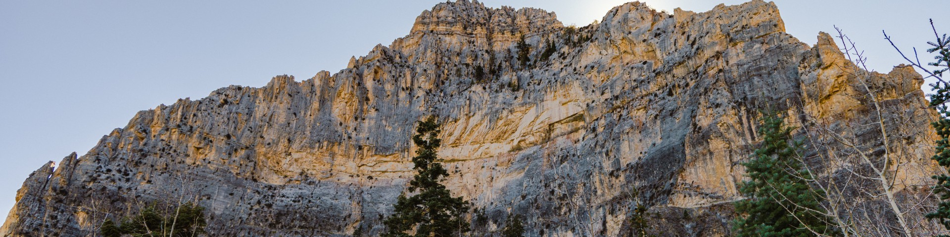
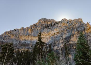
Spanning 317,000 acres, the area features rugged mountains with towering cliffs, steep hillsides, and deep narrow canyons, all surrounded by a desert landscape dominated by widely-scattered creosote bush, white bursage and Mojave yucca. The area’s elevation ranges from 3,000 feet in the valleys to 11,918 feet at the top of Charleston Peak, creating a variety of climate and vegetation zones. The highest wind-swept summits are barren, while the ridges and slopes are cloaked in a forest of ancient bristlecone pine. Lower down, extensive forests of ponderosa pine, white fir, and pinyon-juniper woodlands cover the landscape.
Complexes
Cathedral Rock Picnic Area is located at the top of beautiful Kyle Canyon in the Spring Mountains National Recreation Area, just 30 miles from Las Vegas.
The Cathedral Rock-South Loop Trailhead is located adjacent to the Cathedral Rock Picnic Area in Kyle Canyon outside Las Vegas, Nevada.

The Echo Trailhead is located in Kyle Canyon on the Spring Mountains NRA on Echo Road just past the intersection with NV-157.
The Mary Jane Falls Trailhead is the most popular trailhead in the Spring Mountains NRA.
The Trail Canyon Trailhead is a popular site for users looking to hike the Trail Canyon Trail and/or access the Mt. Charleston Wilderness.

Nestled along Kyle Canyon Wash in a timbered area, the Fletcher View Campground is an 11-site campground that is open year-round in the beautiful Spring Mountains National
Located directly off NV Highway 157 near the Fletcher View and Kyle Canyon campgrounds, the Fletcher View Trailhead provides direct access to trails including Fletcher Cany

Kyle Canyon Picnic Area offers 25 first come, first served day-use picnic sites along the Kyle Canyon wash.

The Spring Mountains Visitor Gateway, located on the Spring Mountains NRA outside Las Vegas, Nevada, is a destination in itself.
Cliff Rose Trailhead is located off NV-157 (Kyle Canyon Rd.) across the highway from the Spring Mountains Visitor Gateway.
The Deer Creek Picnic Area is found about halfway along the Deer Creek Highway, State Highway 158, with a parking lot and restroom on one side of the road and the trail to
Hilltop Campground is a collection of 35 tent and trailer campsites high in the forest but with breathtaking views of the surrounding valley.
A rustic and updated group campground, Mahogany Grove sits near the remnants of one of the original Civilian Conservation Corps (CCC) developed campgrounds from the 1930's,
Generally open year round as weather and conditions allow. Near Hilltop Campground, Mahogany Grove Group Campground, and Deer Creek Picnic Area.
Robber's Roost is a short loop trail which climbs up a canyon to a couple of caves.
Desert View Overlook is a 0.2 mile (0.4 mile round trip) moderately trafficked out and back paved trail in the Deer Creek Highway area of the SMNRA.
McWilliams is the largest campground on the Spring Mountains NRA offering over 70 campsites located in Lee Canyon among Ponderosa and white pines.
The Old Mill Picnic Area is open seasonally for day use with 80 individual picnic sites and multiple restrooms.
Foxtail Group Picnic Area is located in the Spring Mountains National Recreation Area, just 47 miles from downtown Las Vegas.
Located near near McWilliams Campground and Old Mill Picnic Area, provides direct access to the Bristlecone Trail.
Generally open year round, as weather and conditions allow. Near the McWilliams Campground and Lee Canyon Ski Area.
Sawmill Trailhead is a large trailhead and picnic area located just off Lee Canyon Road (NV-156).