
Current Conditions
Conditions can change abruptly and vary widely across the Tahoe National Forest. Current conditions determine fire restrictions, access to recreation sites and how you can prepare for your visit.
Before you visit, check for any alerts or closures that may impact your trip.
Weather and Roads
Stay aware of current and forecasted weather conditions:
- Truckee Area Weather (Natl. Weather Service Point Forecast
- Blue Canyon/Emigrant Gap Area (Natl. Weather Service Point Forecast)
- National Weather Service-- Sacramento
- National Weather Service Reno
California Department of Transportation (CalTrans) maintains and operates the State Highways within the National Forest. Current Highway conditions are available through the Caltrans Quick Map.
Avalanche and Snowpack
Snow Conditions

This map displays current snow depth according to the National Oceanic and Atmospheric Administration (NOAA) National Snow Analyses (NSA).
Avalanche Forecast
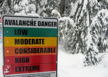
The Sierra Avalanche Center is an excellent resource for avalanche education and forecasts for the Central Sierra Nevada. The avalanche advisory is updated daily during winter storm cycles.
Groom Reports

Snowmobile trail grooming updates are provided each winter. View current trail conditions by clicking below.
Fire and Smoke
Fire and Smoke Map
This map shows fine particle pollution from wildfires and other sources. It does not show air toxics or other pollutants.
Active Fires
Fire information and wildfire updates for federal response areas on the Tahoe National Forest.