Pamelia Lake Trail Area - Mt. Jefferson Wilderness
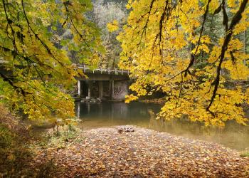
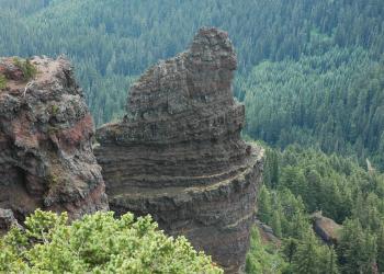
This unique landscape encompasses crystal clear streams, wildflower meadows, and rugged mountain views. This area sits on the western flank of Mt Jefferson (10,497 ft), and is a popular access route for climbers. Part of this trail area was burned in the 2006 Puzzle Fire. The fire changed the area dramatically and hazards remain.
The area contains a number of lakes, streams and springs. Hiking along the Hunts Creek trail and the Pacific Crest National Scenic Trail offers stunning views of the Cascade Crest and Mt Jefferson. Cross-country travel skills are necessary to access the high lakes and mountain peaks.
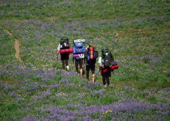
Backpacking, day hiking, mountaineering and horseback riding are the most common forms of recreation in the area during the short summer season, after
At the Pamelia Trailhead, located just off Highway 22 the Pamelia Lake Trail #3439 climbs approximately 800 feet in elevation, at which point it intersects the Hunts Creek Trail #3440 that then goes north and south. Both ends of the trail connect to the Pacific Crest National Scenic Trail, providing a popular 13.5-mile, day-long loop for hiking or riding. Stunning views of Mt Jefferson are offered from Grizzly Peak (5,799 ft), accessed by hte Grizzly Peak Trail #3428; the location of a historic fire lookout that has since been removed. Visitors should obtain a detailed map of the area before planning a trip, and inquire in advance about trail conditions, particularly early in the season.
Facilities at the trailhead include parking, bathrooms, picnic tables, and wilderness and interpretive information about the area.
Know Before You Go
- Central Cascades Wilderness Permits are required for both day use and overnight use when using the Pamelia Lake trailhead.
- Visitors must practice "Leave No Trace" skills, including properly disposing human and pet waste and packing and carrying out all trash.
- Campfires are permitted in the area and must be at least 100 feet from any lake, stream or wet area and below 5700' elevation.
At a Glance
Fees: | Recreation.gov processing fees for a Central Cascade Wilderness Permit are $1/permit for day use and $6/permit for group/overnight use. |
---|---|
Permit Info: | Central Cascades Wilderness Permits are required between June 15 and October 15 for both day and overnight use at Pamelia Lake trailhead. Check out Recreation.gov for more information or call 1-877-444-6777. |
Closest Towns: | Detroit, OR |
Water: | No potable (drinking) water |
Information Center: | Detroit Ranger District 44125 North Santiam Highway SE Detroit, OR 97342 503-854-3366 |
General Information
General Notes:Map of Mt. Jefferson - Pamelia Lake Trail Area
Activities
Day Hiking
Recreation areas with activity Day Hiking:- Bingham Ridge Trail #3421
- Bingham Ridge Trailhead
- Grizzly Peak Trail #3428
- Hunts Creek Trail #3440 - Hunts Cove
- Lake of the Woods Trail #3493
- Minto Mountain Trail #3448
- Minto Mountain Trailhead
- Pamelia Lake Trail #3439
- Pamelia Lake Trailhead
- Woodpecker Trail #3442
- Woodpecker Trailhead
Backpacking
Recreation areas with activity Backpacking:- Bingham Ridge Trail #3421
- Bingham Ridge Trailhead
- Grizzly Peak Trail #3428
- Hunts Creek Trail #3440 - Hunts Cove
- Lake of the Woods Trail #3493
- Minto Mountain Trail #3448
- Minto Mountain Trailhead
- Pamelia Lake Trail #3439
- Pamelia Lake Trailhead
- Woodpecker Trail #3442
- Woodpecker Trailhead
Horse Camping
Recreation areas with activity Horse Camping:Horse Riding
Recreation areas with activity Horse Riding:- Bingham Ridge Trail #3421
- Hunts Creek Trail #3440 - Hunts Cove
- Lake of the Woods Trail #3493
- Minto Mountain Trail #3448
- Pamelia Lake Trail #3439
- Woodpecker Trail #3442