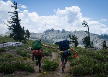
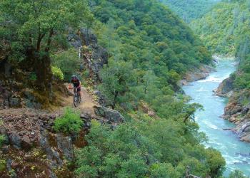
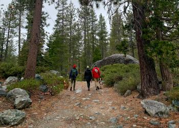
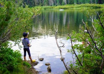
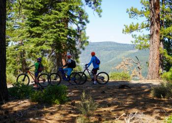
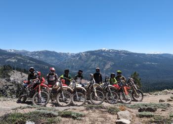
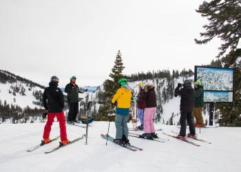
Recreation


Discover an Area by Activity

Select an activity to find an area to visit.

Explore the Tahoe!

With breathtaking mountain peaks, lush meadows filled with wildflowers, historic mining towns, destination vacation spots at Goodyears Bar, Downieville, Sierra City, Truckee, Yuba River, the Lakes Basin Area and the Jackson Meadows Region, the Tahoe National Forest is one of the most popular recreation forests in the US.

Roads and facilities may be closed due to storm damage.

Skip to the recreation map and conditions report

  • In winter, there are outstanding winter sports opportunities including world renowned downhill ski areas and extensive snowmobile and cross-country ski trails to experience.
  • In the summer, an extensive array of hiking trails (including a portion of the Pacific Crest Trail) , OHV, equestrian and mountain biking trails provide access to many lakes, rivers, and mountain tops.
  • Check the alerts/notices page for fire restrictions, closures, etc. before your trip

Developed recreation sites including campgrounds, boat ramps, picnic areas, nature trails and even a fire lookout or two that can be rented for overnight occupancy.

Travel Corridors

The recreation information is primarily organized by travel corridor. The main travel corridors are: Interstate 80, Highway 49, Highway 20, Highway 89 (North and South), Foresthill Divide Road, Mosquito Ridge Road, Bowman Road, Marysville Road, and Gold Lakes Road. Activities such as camping and hiking will also have related links to boating, biking, trailheads, parking, and OHV riding in the same corridor.

Accessible Recreation Facilities

Our accessible recreation guide lists facilities and recreation opportunities by Ranger District with features that are accessible for people with disabilities. (Not all locations/facilities listed are 100% accessible.) Because we are continually adding new accessible sites, please call ahead to the Ranger District for more information. The facilities listed meet federal accessibility standards (32-inch minimum width for doorways, adequate room for turning etc).

Recreation Map

Map showing recreational areas. Map Information

Recreation Conditions Report

Area Name Status Area Conditions
American River Trail Open Open Access from Mumford Bar. Logs may be across trail.
Bear Valley Campground Open Open No Fees, No Services
Big Bend Group Campground Closed Closed No water available. Please bring your own water for the duration of your stay.
Big Reservoir Campground Closed Closed Call (530) 367-2129 for more information.
Big Trees Nature Trail Temporarily Closed Temporarily Closed Access only from Foresthill Rd or 11 Pines, Mosquito Ridge Rd closed
Bowman Road Open Open Snow starts around mile post 6. Travel not recommended past that point.
Burlington OHV System Closed Closed DAY USE ONLY. See Motor Vehicle Use Map for additional information.
Cal Ida Campground Open Open
Calpine Fire Lookout None None Popular rental with reservations booked approximately 6 months in advance.
Canyon Creek Campground Closed Closed
Carlton Flat Campground Open Open
Carr Lake Campground None None PG&E Operated; Opening & closing dates subject to change. Contact: pge.com/recreation
Castle Valley Road Closed Closed
Cold Creek Campground Closed Closed
Cottonwood Creek Campground Closed Closed
Dark Day Campground Open Open
Diablo Campground Closed Closed Snow
East Meadow Campground Closed Closed NID operated.
Foresthill OHV Area - (530)-478-6254 x228 Open Open For status please call: (530)-478-6254 x228 Status recording is updated as conditions change. Loop 6, of the Foresthill OHV system, is closed at the lower bridge, due to major bridge damage by a large tree that fell this spring. The trail is still open on both sides, but the bridge is impassable.
French Meadows Campground Closed Closed Access only from Foresthill Rd or 11 Pines, Mosquito Ridge Rd closed
Garden Point Campground Open Open
Giant Gap Campground Open Open
Goose Meadow Campground Closed Closed Expect full campgrounds unless you have a reservation.
Granite Flat Campground Closed Closed Expect full campgrounds unless you have a reservation.
Grouse Falls Overlook Trail Open Open Access only from Foresthill Rd or 11 Pines, Mosquito Ridge Rd closed
Grouse Ridge Campground Open Open Be aware of snow. Road is very muddy with deep ruts
Hallelujah Trail Open Open
Hampshire Rocks Campground Closed Closed
Indian Springs Campground Closed Closed
Jackson Meadow Reservoir Closed Closed
Joshua M. Hardt Memorial Trail at Sugar Pine Open Open
Lake of the Woods Closed Closed
Lindsey Lake Campground None None PG&E Operated. Opening & closing dates subject to change. Contact: pge.com/recreation
Little Lasier Meadow Horse Camp Closed Closed
Little Truckee Summit OHV/Snowmobile Staging Area Open Open
Loch Leven Trail Not Cleared Not Cleared
Lower Little Truckee Campground Closed Closed
Madrone Cove Campground Closed Closed Closed until further notice for hazard tree removal and construction.
Manzanita Day Use, Swim Area Picnic Site Open Open
Meadow Knolls Group Camp None None PG&E Operated. Opening & closing dates subject to change. Contact: pge.com/recreation. RVs, trailers and campers OK, Rough road, No water
Meadow Lake Campground None None
Meadow Lake Shoreline Campground None None
Mumford Bar Trail Open Open
North Fork Campground Closed Closed
Parker Flat Staging Area - (530)-478-6254 x228 Open Open For status please call: (530)-478-6254 x228 Status recording is updated as conditions change.
Pass Creek Campground Closed Closed Please contact NID at (530) 265-5302
Pioneer Trail None None Closed from White Cloud to Bear Valley due to CalTrans road work. Read More.
Ralston Picnic Site Temporarily Closed Temporarily Closed Access only from Foresthill Rd or 11 Pines, Mosquito Ridge Rd closed
Rucker Lake Campground None None PG&E Operated. Opening & closing dates subject to change. Contact: pge.com/recreation
Schoolhouse Campground Open Open
Shirttail Campground Open Open
Sugar Pine Boat Ramp Temporarily Closed Temporarily Closed
Sugar Pine Staging Area - (530)-478-6254 x228 Open Open For status please call: (530)-478-6254 x228 Status recording is updated as conditions change. Loop 6, of the Foresthill OHV system, is closed at the lower bridge, due to major bridge damage by a large tree that fell this spring. The trail is still open on both sides, but the bridge is impassable.
Upper Little Truckee Campground Closed Closed
Western States Trail Not Cleared Not Cleared Not cleared
White Cloud Campground Open Open

Spotlights

Burlington OHV System

trail bike graphic

Currently closed due to moisture and snow.

The Burlington Motorcycle Trail System includes 50 miles of winding, narrow trails.  The staging area is 0.1 mile from Highway 20 on the Chalk Bluff Road.

Link to map

Parker Flat Staging Area - (530)-478-6254 x228

During the winter months, the American River OHV system may be closed after periods of heavy rain when soil moisture levels would likely result in trail damage if riding were to occur. For the most up to date information, please call (530)-478-6254 x228

Closure notice: Loop 6, of the Foresthill OHV system, is closed at the “lower bridge”, due to major bridge damage by a large tree that fell this spring.  The trail is still open on both sides, but the bridge is impassable.

Staging area for Foresthill OHV Trails with limited camping available (camping subject to closure per forest order).

Beginning fall of 2020, the Sugar Pine Off-Highway Vehicle (OHV) Wet Weather Management Plan will be implemented for OHV Roads and Trails on American River Ranger District. This will increase OHV riding opportunities by adopting a more flexible open/close strategy for riding in Foresthill CA. This soil-moisture condition-based approach will help Trail Managers determine when existing OHV roads and trails should be opened or closed in the Sugar Pine Motorized Trail System area. The associated operating plan will minimize resource damage caused by travel during wet weather periods. The removal of the fixed wet weather seasonal closure dates are expected to reduce future sediment delivery and improve water quality. Up to date closure status can be found at the voicemail (530)-478-6254 x228. During fall and winter months, please check this number frequently to get up to date OHV riding opportunities and closure status

Recreation Areas

Highlights

A boy holding a fish

A Boy Fishing