

Welcome to Mt. Hood National Forest
The Mt. Hood National Forest encompasses 1.1 million acres. There are four ranger districts on the Forest that include a wide variety of ecosystems centered around Mt. Hood, the tallest mountain in Oregon: Barlow, Clackamas River, Hood River, and Zigzag Ranger Districts. This volcanic mountain is 11,125 feet tall and beloved across the state. The Forest has about 80 campgrounds, 20 sno-parks, and several commercial ski resorts including the iconic Timberline Lodge, a National Historic Landmark. Approximately one-third of the Forest is designated wilderness. The Forest also provides about one-third of the state's drinking and agricultural irrigation water.
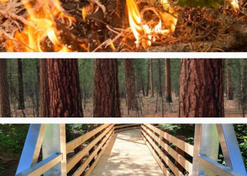
Fire restrictions in effect!

Campfires prohibited on Mt. Hood National Forest; portable cooking stoves and propane firepits still allowed. Find out more info before heading out to the forest.
Plan Your Visit
Mt. Hood Climbing Conditions

The Mt. Hood Climbing Rangers issue a conditions report Tuesday and Friday mornings from spring through early summer. Remember, Mt. Hood is a technical, physical climb and requires careful planning.
Firewood
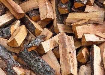
Personal use firewood permits are now available for the season on Mt. Hood National Forest through November 30.
All woodcutters must obtain a firewood permit to cut and haul firewood from the Forest. Permits are available at a district office or by submitting a firewood permit application.
Road Conditions

With thousands of miles of Forest Service Roads across the Mt. Hood, conditions can vary and natural events can occur unexpectedly. Always plan ahead before visiting. Contact a local district office for details.
Some Forest Roads close seasonally. Refer to our free Motor Vehicle Use Maps for more information.
Northwest Forest Plan & Amendment
The Northwest Forest Plan covers 24.5 million acres of federally managed lands in California, Oregon, and Washington. It was established in 1994 to address threats to threatened and endangered species while also contributing to social and economic sustainability in the region. Over 30 years later, the Northwest Forest Plan needs to be updated to accommodate changed ecological and social conditions.
