
Recreation
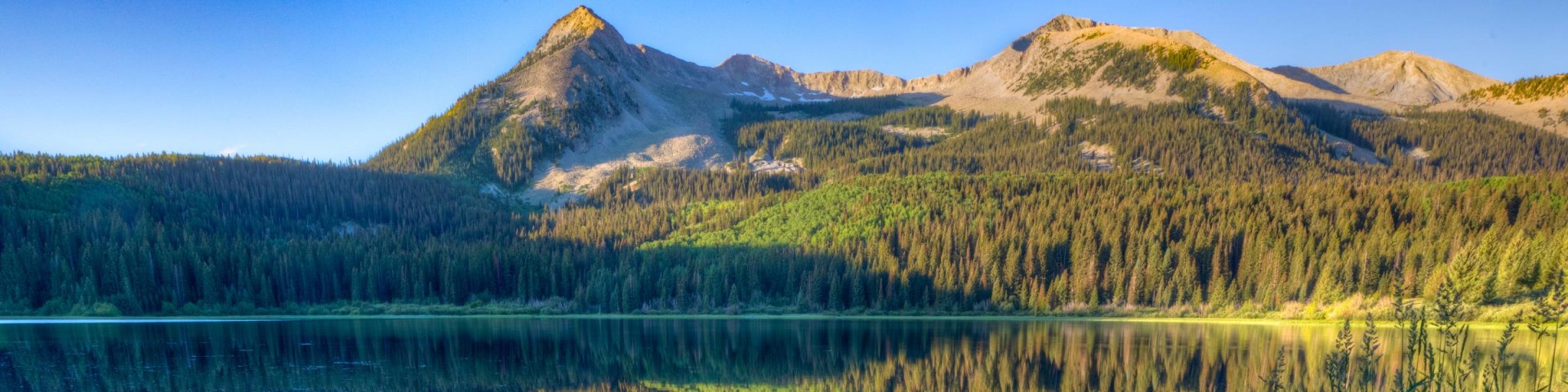
Grand Mesa, Uncompahgre and Gunnison National Forests offer scenery and an abundance of opportunities for outdoor recreation. Over 3,500 miles of trails and routes provide access to areas of rugged beauty and solitude. Many were carved by indigenous peoples, early explorers, and miners, and offer an experience that connects users to the land and to the past. The mountains, plateau, and mesa that make up the forest will always provide a scenic backdrop and thus a component of the quality of life in the area.
We invite you to visit our forest and enjoy the beauty, history and challenges it has to offer. Recreation, motor vehicle and quad maps are available. View a Ranger District location map.

Bear Pen Gulch #124
The Bear Pen Gulch Trail #124 begins at Forest Service Road #500, Love Mesa Road, and ends at Forest Service Road #501, Cabin Bench Road . The trail descends into Bear Pen Gulch and travels east…
Bear Pen Spur 1B #124.1B
The Bear Pen Spur 1B Trail #124.1B begins at Forest Service Road #500, Love Mesa Road, and ends at an intersection with the Bear Pen Gulch Trail #124. The trail descends into Bear Pen Gulch and heads…
Beaver #516
The Beaver Trail #516 serves as a connecting route for Porter Flat Road, FSR #266 from the old Buzzard Campground on the northern section to the southern section near Lenna Peak. What is now the…
Beaver Cow #608
Forest Trail #608 (Beaver Cow Trail) is 1.7 miles long. It begins at Forest Road #586.3E and ends at Forest Trail #472. The Beaver Cow Trail is open for the following uses: hiking, horseback riding
Beaver Creek #464
Forest Trail #434 (Beaver Creek Trail) is 11.1 miles long and is in the West Elk Wilderness. The lower 2.75 miles is no longer maintained. The maintained trail segment begins at Forest Trail #601 and…
Beaver Dam #627
The Beaver Dam Trail #627 follows at a moderate grade along the Beaver Dam Drainage and is a route which ties together the Mesa Creek Road and the Long Canyon Trail. It travels through a mixture of…
Beaver Lake Campground - Ouray RD
Site Open
Beaver Lake Campground sits south of Beaver Lake with 11 camping sites nestled under spruce trees. Some sites have view of lake, open meadow and towering cliffs, while tent sites, located on a dead…
Beaver Lake Day Use Area/ Fishing Site
Site Open
Beaver Lake Day Use area is a very popular fishing site, both for lake fishing and for stream fishing along Fox Creek that is a short walk west of the lake. Day use parking fee if enter Beaver Lake…
Beaver Ponds #516
The Beaver Pond Trail #516 begins at the Beaver Ponds Trailhead and ends at the ponds. It climbs gently through dense aspen stands. This is an excellent day hike in the fall season. A good choice…
Beaver-McIntyre #472
Forest Trail #472 (Beaver-McIntyre Trail) is 2.0 miles long. It begins at Forest Road #586 and ends at Forest Road #812. The trail is open for the following uses: hiking, mountain biking, horseback…