
Cold Springs Trailhead
Overview
Cold Springs Trailhead is located along Seven Mile Road (County Road 640) at about 9,950 feet in elevation.
Natural Features
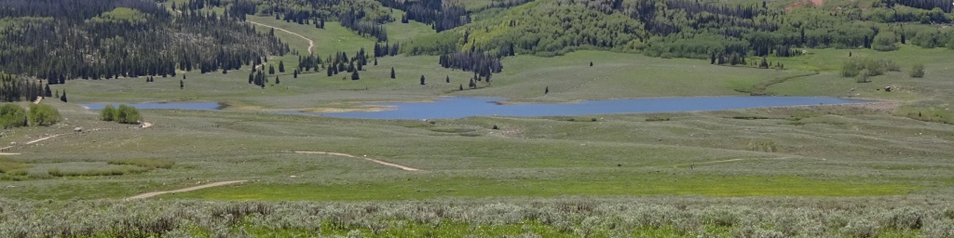
Cold Springs Trailhead is in a beautiful meadow with incredible views of Mount Terrill and the Lost Creek drainage. Fall colors in the area can be spectacular.
Facilities
There is paved parking and an information kiosk at the site.
Recreation
Camping, hunting, wildlife viewing, hiking, and OHV riding on designated routes are fun activities available nearby. The trailhead provides access to Paiute side trail 56 and several Gooseberry 50" ATV trails. Please travel on designated routes. Fishing, camping, hiking, OHV riding and wildlife viewing are activities available nearby. Please pack-out all you pack-in.
Fall colors near Cold Spring Trailhead

Reservations
General Information
May - November
- Pack out all trash and follow leave no trace principles.
- Use existing sites and park only on durable surfaces (not vegetation)
- Avoid creating new trails or campsites
- Store food properly in bear-proof containers.
- Stay on designated roads, and trails as shown on kiosk and designated forest service maps.
- All OHVs are required to be registered and display a permit or sticker for riding on public lands.
- Yield to hikers, horses and non-motorized users.
- Pets must be leashed at all times within this recreation area. This policy is in place to ensure the safety and enjoyment of all visitors and to protect wildlife.
- Clean up dog waste and dispose of it properly.
- Keep dogs from chasing, harassing, and disturbing wildlife or other visitors.
- Yield to other hikers, horses, and other trail users by stepping off the trail and controlling your dog.

Address: 115 East 900 North Richfield, UT 84701
Phone: (435) 896-9233
Hours: Monday - Friday, 8am - 4:30pm (Closed on federal holidays)
Getting There
Elevation
9,950
Directions
Cold Springs Trailhead is located 22 miles southeast of Salina Utah. In Salina at the junction of Main Street and State Street, head south on State Street for approximately 2 miles until you reach I-70. Turn left (east) onto I-70 east-bound from Salina, for approximately 6.5 miles. Exit I-70 at Gooseberry Road (Exit 63), and then turn right (south) on the Gooseberry Road (County Road #640), a two-lane paved road, for about 20.8 miles. Turn right into the trailhead. lat. 38.713723, long. -111.681537. See link below for google maps directions.
Parking
Paved parking area
Facility and Amenity Information
Accessibility
Restrooms
Restroom information is not currently available for this site.
Water
Potable water is not available at this site.
Picnic Tables
Picnic tables are not available at this site.
Horse/Pack Animal Information
Horse/Pack animals are allowed at this site.
- There are no corrals or hitching posts at this location.
- Horse trails are available nearby
- Please stay on designated trails.
- Use certified weed-free hay to prevent the spread of invasive plant species.
- Tie horses to trees in a way that won't damage the tree.
Recreation Opportunities
OHV Trail Riding Info
Most ATV/OHV trails in the area are limited to vehicles 50 inches or less in width.