
Hiking
Hiking is a wonderful way to see and experience the many wonders of our nation's forests. Visit your forest's ranger distrrict office, our All Maps page, or National Forest Store to obtain a trail map to help you plan your route based on your ability, available time, and interest. Please follow these safety tips to ensure a safe journey:
Links:
Backpacking
Whether you're roughing it in a tent or planning a family picnic, there are many ways to make sure that your experience is fun and safe.
Be prepared
- Pack a first aid kit. Your kit can prove invaluable if you or a member of your group suffers a cut, bee sting or allergic reaction. Pack antiseptics for cuts and scrapes, tweezers, insect repellent, a snake bite kit, pain relievers, and sunscreen. Tailor your kit to your family's special needs.
- Learn ABC - Airway, Breathing, & Circulation. Know how to perform CPR and basic first aid. Recognizing serious injuries will enable you to attend to a victim until medical help arrives.
- Bring emergency supplies. In addition to a first aid kit, you should also have a map of the area, compass, flashlight, knife, waterproof fire starter, personal shelter, whistle, warm clothing, high energy food, water, water-purifying tablets, and insect repellant.
Check the elements
- Check the weather report before you leave home. When you arrive at the site, keep on eye on the skies for changes and, if possible, carry a compact weather radio. In inclement weather, take shelter until the bad weather passes. Stay dry - wet clothes contribute to heat loss.
- Forest and grassland home pages post alerts you should know before you go. Many of our forests and grasslands also post alerts on social media.
General Hiking
Be Prepared
- Being prepared includes knowing how to be a responsible hiker. Learn more on our Responsible Recreation page.
- Stay on marked trails.
- Don’t hike alone. Let the slowest person in your party set the pace. This is especially important when children are a part of your group.
- Leave your itinerary with a friend or family member and check in with them upon your return.
- Develop an emergency plan before you start your trip. Make sure everyone knows what to do if they become lost or a medical emergency arises. Give children whistles with the instructions to "stop and blow" if they become lost.
- Take frequent rests or vary your pace to maintain your energy level.
- Drink plenty of water, even on cool, wet days. Never drink your entire supply between refills.
- Wear appropriate clothing, including sturdy boots that are broken in and are comfortable.
- Consider using a hiking pole or walking stick to help maintain your balance in unlevel or hazardous areas.
- Be aware of your surroundings, and pre-plan your approach before hiking through more hazardous areas. Wet surfaces can be a hazard and even more so if it's on a slope.
- Consider what you'll do if you start to slide or fall so that you are prepared.
- If falling, do not try to catch yourself; try to avoid landing on your hands, elbows or knees. Landing on the side of your body is much safer.
- If the slope is such where you know you are going to slide, lowering your center of gravity, by sitting down and sliding on your feet or bottom, is safer.
- If sliding while standing up, keep your weight over your feet and bend your knees—do not lean back or forward while sliding.
Day Hikes
Be Prepared
If on a day hike, extra weight wears you down and reduces your agility over uneven terrain. Pack as light as possible. Leave the extras behind, but consider bringing these essentials:
- Map
- Sunglasses and a hat
- Sunscreen
- Flashlight
- Waterproof matches
- First aid kit
- Water and water-purifying tablets
- High-energy bars, granola, candy, or fruit
- Extra clothing. Temperatures can change dramatically, particularly if there is an elevation change. For every 1,000 feet of elevation gain, the temperature often drops three to five degrees.
Search for Hiking Opportunities
74 Mountain #153 Trailhead
Site Open
Trailhead for Mogollon Trail #153 and access into the southwestern portion of the Gila Wilderness. Nine (9) miles of this trail, from trailhead to junction with Trail Canyon Trail was logged in the…
Adobe Springs Trail #804
The 4.8-mile (one way) Adobe Springs Trail #804 connects Trails End Trailhead with White Rocks Trail #27. From Trails End Trailhead, Adobe Springs Trail heads west, generally following the East Fork…
Aeroplane Mesa #705 Trailhead
Site Open
Trailhead for the Aeroplane Mesa - Trail #705 and access into the northern portion of the Gila Wilderness located at the Aeroplane Mesa Campground.
Aeroplane Mesa Campground
Site Open
Aeroplane Mesa Campground is a great location for hikers and horseback riders to access the wilderness. The area is relatively open and 'park-like' with grass interspersed with trees.
Aeroplane Mesa Trail #705
The 3.8-mile (one way) Aeroplane Mesa Trail #705 begins at Aeroplane Mesa Campground, providing access to the Gila Wilderness, Middle Fork Trail 157, and the Middle Fork Gila River. Along the way,…
Airstrip Mesa Trail #35
The 4.2-mile Airstrip Mesa Trail #35 connects from Forest Road 210 up and over a ridge to the west and across Forest Road 4025P. From here, the trail descends into Trout Creek, crosses the creek, and…
Aldo Leopold Wilderness
Site Open
The United States Congress designated the Aldo Leopold Wilderness in 1980 and it has a total of 202,016 acres. All of the wilderness is in New Mexico and is managed by the Gila National Forest. The…
Allie Canyon #100 Trailhead
Site Open
Small parking area for Allie Canyon Trail #100 located along New Mexico Highway 35, just south of the Wilderness Ranger District office.
Allie Canyon Trail #100
The 7.6-mile (one way) Allie Canyon Trail #100 begins at Allie Canyon Trailhead, just south of the Wilderness Ranger District Office climbs west from Highway 35 to the Continental Divide National…
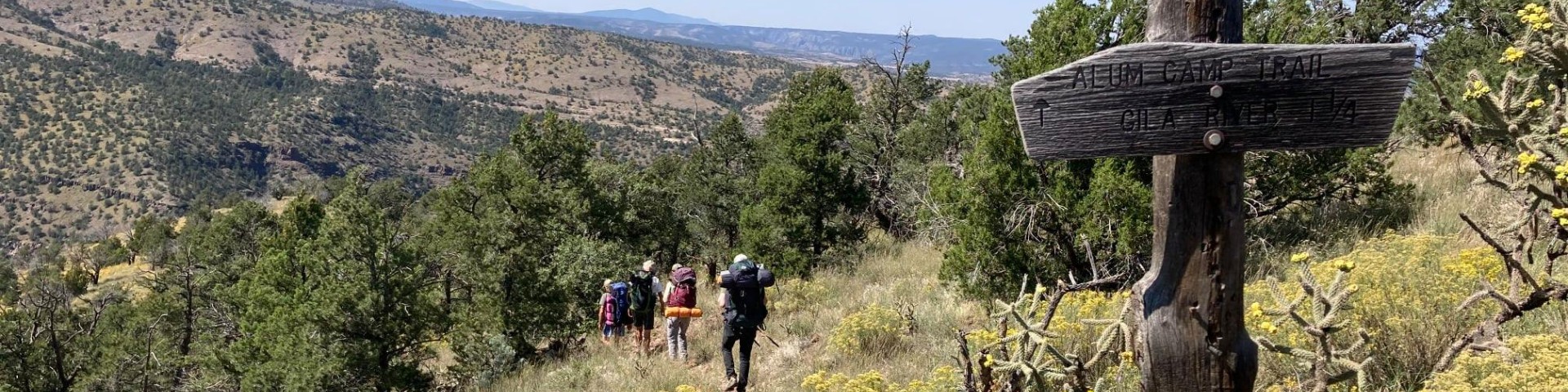
Alum Camp #788 Trailhead
Site Open
Trailhead for Alum Camp Trail #788.