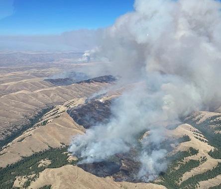
Wildfires know no boundaries.
They can easily cross between federal, tribal, state, and private lands, making it crucial for all communities to know their respective wildfire risks and the actions to take to protect themselves and their neighbors. Last year, wildfires burned nearly 400,000 acres of tribal lands, including reservations and other tribal lands, with additional acreage burned on state lands and other tribal lands.
The U.S. Department of Agriculture’s Forest Service recently updated the Wildfire Risk to Communities interactive online tool to include tribal and trust lands in all 50 states. This addition allows users to find data about wildfire risk and vulnerable populations for more than 600 tribal areas representing more than 122 million acres. This is the first time that wildfire risk in tribal areas is consistently mapped across the U.S.

“We expanded the project to not only identify where communities are at risk, but actions communities can take to mitigate that risk, from the homeowner all the way up to landscape planning,” said Jim Menakis, Forest Service branch chief for fire ecology. “Tribal communities can use this information to apply for grants, prioritize mitigation projects, plan wildfire risk reduction activities and build community awareness. Adding this data about risks to tribal areas also significantly strengthens how we implement the National Cohesive Wildland Fire Management Strategy and equips more communities with the tools they need as wildfires becomes more frequent and dangerous.”
The scale and destructiveness of today’s largest wildfires have far outpaced the scale of efforts to protect homes, communities and natural resources, a trend that will only worsen as fuels become drier under the effects of a changing climate. To confront this challenge, the Forest Service has developed a 10-year strategy to confront the wildfire crisis by dramatically increasing fuels and forest health treatments by up to four times current levels in the West.
The Wildfire Risk to Communities tool is best for considering risk collectively across a community and is not designed for considering risk at the local, neighborhood or individual home scale.
The website’s resources are designed as a starting point to help spark conversation and awareness about wildfire risk, a community’s relative wildfire risk profile and actions the community might take to manage and mitigate wildfire risk.