

Getting the dirt on forest management activities
MICHIGAN—Soils staff from the Eastern Region’s Great Lakes national forests, with assistance from Natural Resources Conservation Service, are currently working on a project to better understand the effects of forest management activities on soils. The project links Forest Soil Disturbance Monitoring Protocol to both quantitative soil and vegetation parameters within an ecological context.
For more than a decade, the USDA Forest Service has used the Forest Soil Disturbance Monitoring Protocol to consistently monitor effects of land management operations on soils across the country. The protocol is intended to be a quick, primarily qualitative assessment to place soil disturbance into discrete classes (0-3).

Complementary to the protocol, the outcomes of a new project known as Dynamic Soil Properties would provide additional quantitative validation to determine if land management activities have negatively impacted soil quality.
This study may help determine the role of compaction at various sites with similar ecological conditions (across multiple national forests), the magnitude of post-treatment impacts, and soil recovery rates over the last 20 years. Also, the results from this study can help to inform land management practices and provide a solid basis for NEPA documentation for multiple national forests.
The complexity of the soils on the upper Great Lakes national forests provides the opportunity to assess soil condition and site recovery across a variety of ecological sites. Detailed soil sampling and vegetation monitoring are underway on these land bases.
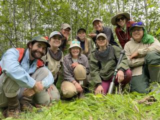
While a range of soil textures from sand to clay are included in the study, the Ottawa National Forest contributes the largest representation of clay textures, which are very difficult to sample. In light of this challenge and in support of the project, soils staff from the Superior, White Mountain, and Green Mountain national forests, GeoCorps participants, and staff from the Natural Resources Conservation Service recently convened on the Ottawa in Michigan to collect the needed soil samples and field data.
During that time, the group successfully sampled eight sites, collecting 144 bulk density samples and describing 10 soil pits. Additional collaborative work toward this project will resume in July with assistance from the Chippewa and Hiawatha national forests, as well as the Ottawa’s botany staff.
“It’s been great to collaborate on this project with so many people,” says Amy Amman, Ottawa National Forest soil scientist. “I’m very much looking forward to learning about and applying the outcomes of this work.”