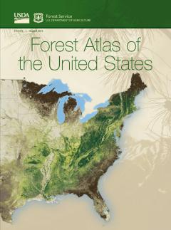
Telling the story of America's forests
WASHINGTON, DC—Get ready for a visually stunning, coast-to-coast journey through America’s unique and diverse forests.
Through an elegant array of maps, charts, illustrations, poignant images and narratives, the new Forest Atlas of the United States tells stories about the value of our nation’s 823 million acres of forests and woodlands, and the challenges that they face. The atlas combines inventory and monitoring information spanning the nation’s entire forested landscape collected from the 1870s through the present day. This information has been gathered from over 355,000 ground plots and includes more than 19 million observations of individual trees alongside two decades of satellite imagery.
The atlas has a companion online digital map library that houses the wealth of cutting-edge scientific data used to develop the book’s maps and charts.
The atlas describes pressing fundamental, practical and environmental aspects of forests. It explains where trees and forests grow and why, who owns them, the benefits they provide, and what influences their health and productivity. It also catalogs the many animals that call them home.
A quick flip through its pages will draw you in, rouse your curiosity in the natural world and inspire you to consider all the ways forests are important to you.

