

Forest Service, NASA upgrade online active fire mapping tool
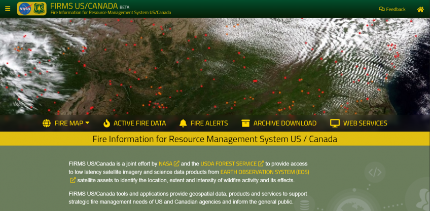
UTAH—Today, the USDA Forest Service, in partnership with the National Aeronautics and Space Administration, is releasing a new online active fire mapping tool to better support fire suppression efforts in North America. The new Fire Information for Resource Management System US/Canada application will provide wildfire management teams and the public real-time access to data, maps and visualizations of active wildfires across the nation.
Using NASA data, Forest Service’s Geospatial Technology and Applications Center tailored the app to meet the needs of wildfire response analysts and at-risk communities. The application provides wildfire managers, fire prevention personnel and the public real-time access to data, maps and visualization products of active wildfires across all forest lands. Examples of visualization products include 2-D and 3-D time-lapses of smoke, predictions of smoke/fire movement, fire temperature over time and more.
According to GTAC director Deb Oakeson, wildland fire response is an interagency effort. Among other roles, the Forest Service helps to identify large wildfire incidents in coordination with other federal, tribal, state, and local partners.

“NASA values its ongoing partnership with the Forest Service that is improving our ability to use real-time data to respond to wildfires. This joint effort to update GTAC’s Active Fire Mapping applications by leveraging NASA’s data both enhances our global reach and focuses it on the needs of the public and U.S. and Canadian operational fire management activities,” said Robert Wolfe, chief of the Terrestrial Information Systems Laboratory at NASA-Goddard Space Flight Center.
Wildfire agencies and the public are ensured continual access to the legacy platform for about a year as they transition to the upgraded tool. Meanwhile, the Forest Service and partners will implement additional enhancements to the new application based on feedback.
The history of federal forest management dates to 1876, when Congress recognized the need for oversight of the quality and conditions of forests throughout the country. This mission area has since evolved with the development of the Geospatial Technology and Applications Center, which applies new interactive visualizations, geospatial science, technology and more to wildfire management.