
Silver City Ranger District
The Silver City Ranger District is the southern-most district on the Gila National Forest. It comprises three areas, the Burro Mountain region, the area surrounding Silver City, and the portion just west from Emory Pass of the Black Range. These areas combine to form 406,768 acres of National Forest lands that support a diversity of uses including scientific research, mining, domestic livestock grazing, timber harvest, and a variety of recreation activities. Part of the district travels through the Trail of the Mountain Spirits Scenic Byway. Cherry Creek and McMillan Campgrounds are located along this byway on State Highway 15.
There are a multitude of recreation opportunities in this district. The Silver City Ranger District has a number of developed campgrounds and numerous undeveloped campgrounds and picnic areas. There are many trails which vary drastically in length and difficulty and accommodate hikers, backpackers, mountain bikers, and horseback riders. Several recreation sites make the Silver City Ranger District unique such as Little Walnut, Burro Mountains, Fort Bayard and the Gila River Bird Area. Silver City, NM is a Continental Divide Trail Gateway Community and is home to events such as CDT Trail Days.
Silver City boasts four gentle seasons. The average annual temperature is 54 degrees. May is the driest month of the year while July is the wettest. The annual average precipitation is 15.69 inches.
Contact the district office at 575-388-8201
General Information
Recreation facilities include baseball and soccer fields, all-weather track, tennis courts, health and fitness clubs, an indoor and outdoor swimming pools, an 18-hole golf course, a bowling center and parks. Organized youth and adult sports activities are numerous. Trout fishing, hunting, hiking, horseback riding, bicycling and camping activities abound.
Other area recreation facilities and attractions are: Western New Mexico University (WNMU) Museum, City of Rocks State Park and Historic Pinos Altos.
Special annual events include the Wild, Wild West Pro Rodeo, Tour of the Gila Bicycle Race, Annual Blues Festival, Christmas Lighted Parade, 4th of July Celebration, Weekend at the Galleries, Farmer’s Market, Grant County Fair, among others and several theatrical and musical presentations at the University Theatre.
Check with the district for updated local driving conditions. Remember to keep a “weather emergency kit” in your car that should include matches, drinking water, blanket or sleeping bag, a small shovel, hand saw or axe, tow chain or strap, and energy bars.
Use caution when driving on the district, the area may be subject to sudden flash flooding or muddy, impassable roads. Be careful when parking vehicles and avoid parking over tall dry grass or weeds. Remember to bring drinking water or be prepared to filter or treat all water from snowmelt, springs, rivers, or creeks. River levels can change rapidly during spring - watch for suddenly rising river or stream levels. Water can still be difficult to find in some areas - remember to bring drinking water if camping in remote areas. Be alert for lightning and approaching storms, especially in the afternoons during summer.
Please be considerate of all persons choosing to recreate on the forest. Remember to be Bear Aware and continue to watch for snakes. Rabies is also a fact of life in southwestern New Mexico. Make sure all pets (including horses) accompanying you have current vaccinations. Never encourage wild animals to approach you, your pets, or campsite. Never feed wild animals.
Passes & Permits
There are no passes or permits necessary for use and enjoyment of the Fort Bayard area trails. The Little Walnut and Gomez Peak picnic areas are reservable for a fee through www.recreation.gov
Complexes
Fort Bayard is the site of an old military fort that was active during the mid- to late 1800s. Today, it includes a set of old buildings no longer in use. The extended area contains a tight network of nonmotorized trails and access points between Highway 180 and Signal Peak. The area is popular for hiking, bicycling, and horseback riding.


Trailhead for access to the Fort Bayard Trail System: Dragonfly - Trail #720, Servis Corrals - Trail #725, Old Highway 260 - Trail #260 and Crosscountry Course - Trail #722

Trailhead at Fort Bayard for access to the Woodhaul Wagon Road Trail #55 and the Fort Bayard Trail System.
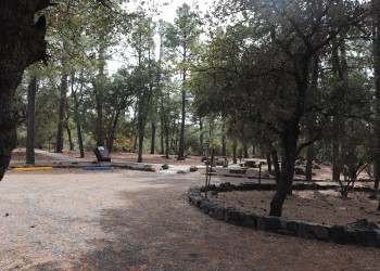
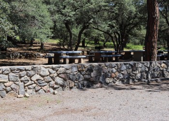
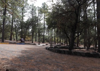
Individual and group picnic areas and a dense network of trails offers stacked loops, peak ascents, and dozens of options for trail length and difficulty.
Trailhead providing access to the Gomez Peak Trail System is a popular non-motorized use area for hikers or mountain bikers as a day use site.
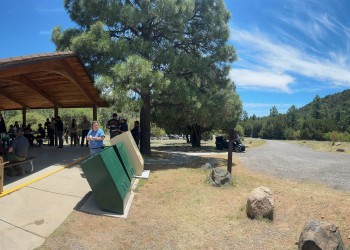
Please NOTE: Water is not available at the group or family picnic areas at Little Walnut.
Please NOTE: Water is not available at the group or family picnic areas at Little Walnut.
Please NOTE: Water is not available at the group or family picnic areas at Little Walnut.
Trailhead on Little Walnut Road, north of the Little Walnut-Gomez Peak Day Use Area, for access to the Continental Divide National Scenic Trail (Trail #74 on the Gila