

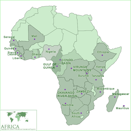
Africa program
Botswana has a rich history of natural resource management and a diverse network of protected areas and national parks, important to the world's natural heritage. Its forested reserves—all within the Chobe District of northwestern Botswana and the Kavango–Zambezi Transfrontier Conservation Area—are geographically unique, support important wildlife habitat and populations, and serve ecologically critical functions for biodiversity conservation and carbon sequestration. Botswana’s forests serve as buffers around protected areas and also play a critical role in watershed management, located near the perennial rivers of the Zambezi, Kwando, Linyanti and Chobe. Recurrent challenges in forested areas include social encroachment and incompatible land uses; human-wildlife conflict; wildlife poaching for bush meat and illegal trafficking; unmanaged anthropogenic fire; unmanaged mineral extraction; and the degazetting of forest reserves located in critical watersheds and wildlife corridors.
Drawing on the Agency’s technical expertise and with support from the USAID Africa Bureau, the U.S. Forest Service’s International Programs office is pursuing partnership opportunities with the Government of Botswana’s Department of Forestry and Rangeland Resources, Forest Conservation Botswana and local non-governmental organizations to further natural resource conservation. In 2019, the U.S. forest Service began providing technical assistance in support of a new desert protected area in southwestern Botswana, as well as leading trainings in illegal logging to sub-Saharan professionals at the International Law Enforcement Academy.
Cameroon is endowed with rich natural resources and extraordinary ecological diversity. Volcanoes, savannahs, and varied coastal zones comprise some of the country’s exceptional landscapes. Perhaps most importantly, a vast portion of the Congo Basin rainforest, covering about 48% of Cameroon’s land area, lies within the country’s borders.
These extensive forest resources, coupled with a growing economy and strategic port, contribute to the country’s importance as a key regional and global player in facilitating trade, conserving biodiversity, and combatting climate change. However, finding a balance between sustainable natural resource management and economic growth continues to be a challenge.
In Cameroon, the U.S. Forest Service International Programs works at both the national and local levels to promote sustainable forest management. Leveraging expertise as a world leader on forest inventory design and implementation, the U.S. Forest Service provides technical knowledge to support Cameroon in addressing increasing environmental pressures and land-use change by supporting its Reducing Emissions from Deforestation and Forest Degradation (REDD+) process. Through coordination with the REDD+ Steering Committee, the U.S. Forest Service is supporting the design and implementation of a comprehensive national forest monitoring system adapted to the country’s unique opportunities and challenges. This includes technical support to the National Office for Climate Change and other technical institutions identified as key actors for the Monitoring and Reporting and Verification National Framework. The U.S Forest Service is also exploring a partnership with urban councils and the Ministry of habitat and urban development to share its long technical expertise on urban forestry.
The U.S. Forest Service is also collaborating with the Carbon Institute, an affiliate of University of California San Diego, to support the Regional Center for Agricultural Education to be a regional hub for expertise in the measurement and management of carbon stocks. By building the capacity of university professors and ministry technicians in cutting-edge carbon accounting methods, the U.S. Forest Service is ensuring that Cameroon can provide valuable expertise that will help strengthen reporting requirements to international bodies, as well as offer support to similar programs and projects across the region.
Accordion contenThe Democratic Republic of the Congo stretches over 900,000 square miles, has over 75 million inhabitants, and contains 60% of the Congo Basin’s forests. It is the largest country in the Congo Basin, but is also one of the world’s least developed. This presents a critical challenge, and opportunity, for biodiversity conservation, sustainable development, and climate change mitigation.
The Democratic Republic of the Congo spans diverse ecosystems, including active volcanoes, glaciers, savannah grasslands, and rich primary rainforests. It is the only home of the charismatic and endangered eastern lowland gorilla, the bonobo, one of our closest genetic relatives, and the elusive forest okapi, often described as a cross between a zebra and giraffe. Widely regarded, as one of the richest countries in the world in terms of minerals and natural resources, there is great potential for large-scale development and growth. However, this potential is currently hindered by institutional and governance challenges and recurring political instability.
Drawing on a range of expertise covering the many dimensions of forest, resource, and land management, the U.S. Forest Service has been working with the government of the Democratic Republic of the Congo, local and international NGOs, universities, and other technical partners on land use planning and forest zoning, forest inventory and monitoring, fire and rangeland management, community forestry, sustainable ecotourism, and capacity development. Since 2008, the U.S. Forest Service has had in-country staff based in the Ministry of Environment and Sustainable Development’s Department of Forest Inventory and Zoning.
Supporting national-level processes and providing technical training in the field, the U.S. Forest Service’s current technical assistance includes holding trainings on forest inventory and monitoring, soil sampling in peatland forests, developing a guide on participative land use management planning, training communities on sustainable fire management in the Mai Ndombe Province and developing hiking trails and other alternative ecotourism activities in Kahuzi-Biega and Virunga National Parks.t.
The Federal Democratic Republic of Ethiopia is one of the world’s oldest continuous civilizations and viewed by many as the cradle of humanity. The landscape and topography that have nurtured this civilization are incredibly diverse—from high Afro-alpine vegetation to desert and semi-desert scrublands to four large river systems. The Great Rift Valley bisects the country and provides habitat to hundreds of endemic plant and animal species. Ethiopia is one of the world’s fastest growing countries, home to almost 97 million people. It also hosts the African Union headquarters and many other international organizations, elevating its importance globally.
Ethiopia’s climate, geography, and geopolitical location in the western escarpment of the Great Rift Valley and the Horn of Africa increases its vulnerability to both natural and human-caused disasters including earthquakes, floods, drought, terrorism, seismic events, and refugees seeking protection and assistance. In addition, drought, soil erosion, deforestation, overgrazing, population pressures, and climate change are all threats to Ethiopia’s natural resources and the rural people who rely on them.
Since 2008, the U.S. Forest Service has been collaborating with partners in Ethiopia, including the National Disaster Risk Management Commission and the City of Addis Ababa Fire and Emergency Prevention and Rescue Authority to enhance disaster management and build capacity in disaster response. The program focuses on adapting components of the U.S. National Incident Management System, including: multi-agency coordination systems, emergency operations centers, the incident command system, and comprehensive emergency preparedness and response planning. Since its inception, the program, with the support of USAID/Ethiopia -- Assets, Livelihoods in Transition and the Office of U.S. Foreign Disaster Assistance -- has trained over 1000 emergency management specialists in Ethiopia in six regions around the country.
In 2018, the U.S. Forest Service provided technical assistance to the U.S. Agency for International Development’s Pastoralist Areas Resilience Improvement and Market Expansion project to enhance resiliency of pastoral communities across the country. Technical program areas include rangeland management planning, remote sensing analysis for land use/land cover, and long-term vegetation monitoring to assess rangeland health. Recently, a Forest Service technical team conducted a workshop focused on sharing knowledge and convening stakeholders to develop and refine a community range monitoring protocol. The U.S. Forest Service also has two long-term advisors in Ethiopia supporting climate change mitigation efforts through clean energy programming to support the national climate resilient green economy strategy.
Gabon sits in the heart of the Congo Basin, an area that features the second largest rainforest in the world, including the largest undisturbed or intact forest areas globally. An oil-rich country, Gabon is quickly developing a dynamic economy with strong national leadership supporting green growth and low emissions development. A relatively urban country with low population density, the Gabonese forests cover about 80% of the country and hold extraordinary sights from hordes of mandrills over 1,000 strong, to surfing hippos, and beach-loving elephants.
The U.S. Forest Service supports the Gabonese National Parks Agency as it works to develop and implement national park management plans in areas with high and unique biodiversity. The U.S. Forest Service provides technical assistance to strengthen the ability of park managers to manage and improve ecotourism infrastructure and facilities in several national parks with the aim of generating sustainable revenue and supporting local livelihoods.
Through support to Conservation Justice, a local non-governmental organization, the U.S. Forest Service is also working to reduce illegal logging activities by providing trainings for prosecutors, judges, and investigation teams at the provincial level. These trainings are centered on how to carry out investigations into suspected illegal logging activities, how to build comprehensive cases, and how to prosecute offenders.
The U.S. Forest Service has been working with the Ghana Forestry Commission for several years on various natural resources management issues, including wildfire and protected area management, reforestation, and sustainable livelihoods. Technical exchange and capacity building activities have grown in recent years in collaboration with the U.S. Agency for International Development (USAID).
Current activities focus on Ghana’s Western Region, which is one of the fastest growing areas of the country and in all of West Africa. Land use pressures including demand for conversion of forests to agriculture, cash crop development, harvesting of mangroves and other forest species for charcoal and timber production, artisanal mining, and urban development all pose significant threats to forests in this region. High unemployment rates compound these pressures, exacerbating unsustainable natural resource management practices, and threatening ecosystem services provided by the region’s forests.
Under an agreement with USAID in Ghana, the U.S. Forest Service managed the Coastal Sustainable Landscapes Project (CSLP). Working in the six coastal districts of Ghana’s resource-rich Western Region, CSLP activities targeted landscape-level engagement with communities, non-governmental organizations, Government of Ghana agencies, the private sector, and international partners. To confront the growing threats to livelihoods and biodiversity, the CSLP sought to promote low emissions development in Ghana’s Western Region by strengthening community-based natural resource management and monitoring. The project focused on increasing tree cover through agroforestry and reforestation, improving livelihoods through natural resource focused livelihood interventions, and improving awareness of climate change topics of relevance for communities in the region. Improved land management and livelihoods will reduce pressure on intact areas of forest reserve, protecting their biodiversity, allowing for ecotourism opportunities and enhancing the value of other ecosystem services within local communities.
Situated on the western coast of Africa, the Republic of Guinea borders Guinea-Bissau, Senegal and Mali to the north, and Sierra Leone, Liberia, and the Ivory Coast to the south. With an economy largely dependent on agriculture, Guinea is also known for its mineral wealth and hosts large deposits of bauxite, diamonds, and gold. Pressures from mining, timber trade, and poor farming practices have transformed Guinea’s once contiguous forest landscape into forest patches scattered among savanna.
The U.S. Forest Service, with funding from U.S. Agency for International Development engages in natural resource management training for community groups, regional stakeholders, and government institutions. In this capacity, the U.S. Forest Service has partnered with the Mano River Union, an international organization comprised of the governments of Guinea, Sierra Leone, Liberia, and the Ivory Coast.
Kenya’s forests are considered to be the most diverse in East Africa, an ecological superlative that is correlated with the country’s topographic heterogeneity. The country features montane rainforest, lowland rainforest, coastal mosaic forest, mangrove forest, and woodland-savannah mosaics. The coastal mosaic forests are thought to be the last refuges of an ancient forest that once stretched between the Atlantic and Indian Oceans. While rich in diversity of forest types and constituent wildlife, Kenya’s forests are limited in extent and highly fragmented.
Kenya’s forest cover –roughly 5.6% –is low compared to its neighbors. The primary drivers of deforestation and land use change include over-grazing, high population growth, unsustainable wood harvesting (particularly for energy), and agricultural expansion. The government of Kenya has prioritized forest conservation and restoration, a commitment reflected in the Kenya Constitution that sets a 10% target for national forest cover.
Kenya’s forests play a significant role in the country’s water cycle. The forests of Kenya’s “Water Towers” –mountainous areas that include Mount Kenya, the Aberdare Range, the Mau Forest Complex, Mount Elgon, and the Cherangani Hills –are critical to the country’s rural and urban water supplies and energy supply (roughly 70% of which originates from hydro-power).
Thanks to a strong partnership with the Kenya mission of the U.S. Agency for International Development, the U.S. Forest Service has an extensive history of supporting a range of natural resource management issues in Kenya, including fire suppression and prevention, institutional strengthening, invasive species control, watershed management in the context of climate change, and rangeland management, particularly at the delicate nexus of wildlife, livestock, and people. Much of this support has focused on forest management in the Water Tower catchment ecosystems and community engagement in the arid landscapes of northern Kenya.
Liberia’s forests constitute the largest remaining blocks of the Upper Guinean Forest Ecosystem, a threatened global hotspot for biodiversity, home to many rare and endangered flora and fauna. The forests play a vital role in the nation's economy. For more than a decade, with support from the U.S. Agency for International Development, the U.S. Forest Service has provided technical support to the Liberian Forestry Development Authority and other government agencies to sustainably manage the country’s wide array of natural resources.
The U.S. Forest Service, in collaboration with the Liberian Forestry Development Authority, has supported a national climate assessment and climate model targeted at government agencies that require weather and climatic data for governance and planning purposes. In addition, the U.S. Forest Service provides assistance to education-related agencies to better integrate environmental themes into adult education and grade-school curriculums.
In 2016, the U.S. Forest Service began to provide support to the Forestry Development Authority’s efforts to improve data on forest products for Liberian decision makers in the governmental and non-governmental realms. The ongoing effort, drawing upon the research capabilities of the University of Liberia, aims to better identify, track, and maintain data on the value and impacts of the bushmeat, charcoal, non-timber forest products, and domestic timber markets in the country. These markets have been identified as key for sustainable natural resource management. In 2017, U.S. Forest Service began providing assistance to the Forestry Training Institute of Liberia, to support instructors in their delivery of the new community forestry curriculum developed with USAID support. For several years, the U.S. Forest Service has advised the U.S. Agency for International Development’s mission in Liberia on forestry and natural resource management issues. Through a participating agency service agreement, the U.S. Forest Service has provided a long-term forestry advisor to the mission as the country aims to improve natural resource management activities. Supporting projects related to community forestry, extractive industries, and climate change topics remains a priority of the government-to-government collaboration.
The U.S. Forest Service has been working with partners in Madagascar on various natural resources management issues, including forest inventory, management and restoration as well as ecotourism planning and management. Technical exchange and capacity building activities have largely been financed and undertaken in collaboration with the U.S. Agency for International Development (USAID).
Current activities focus on forest restoration and management efforts both in terrestrial and coastal, mangrove forests in Madagascar. In partnership with the Government of Madagascar, community, non-governmental and academic partners, the U.S. Forest Service is providing targeted technical expertise aimed at conserving the country’s unique biological diversity while improving livelihoods and building resilience to a changing climate. In addition, support to community and non-governmental partners has sought to increase sustainability of eco-tourism activities that help conserve threatened species while improving community capacity to manage such activities into the future. The diverse set of partners engaged in U.S. Forest Service activities combined with the unique and varied set of expertise leveraged by U.S. Forest Service experts has led to strong, strategic impacts in Madagascar.
Landlocked between Zambia, Tanzania, and Mozambique, Malawi runs north-south along the Great Rift Valley, stretching parallel to the eponymous lake that accounts for much of its total area, and about three-fourths of its eastern boundary. Miombo woodlands and forest-grassland mosaics are the dominant ecosystems, with montane grasslands characterizing a sizable portion of the northern highlands. Precise figures are elusive, yet Malawi’s forest cover likely ranges from 17% to 21%, with most of the remaining intact forest lands occurring in the northern region.
Much of Malawi’s land is heavily degraded, despite nearly a quarter of it falling under protected area status (e.g., forest reserve, game reserve, or national park). Agricultural expansion (both subsistence and commercial, with tobacco the primary crop), production of fuelwood and charcoal, uncontrolled fire, and weak governance comprise the primary drivers of land use change. Malawi’s population, growing at one of the highest rates in the world, is almost entirely dependent on woody biomass for energy. Given its reliance on rain-fed agriculture, Malawi is particularly vulnerable to the effects of climate change, the impacts of which are exacerbated by Malawi’s sustained high rate of deforestation.
With support from the Malawi office of the U.S. Agency for International Development, the U.S. Forest Service has worked on a variety of natural resource management issues in Malawi for close to a decade, collaborating with partners from the Government of Malawi, civil society, private sector, academia, and community level. Much of this technical cooperation has centered on fire prevention and suppression, institutional strengthening, climate change adaptation and mitigation, and protected area management, with community outreach and engagement serving as a cross-cutting theme. More recently, the U.S. Forest Service partnered with African Parks at Nkhotakota Wildlife Reserve to restore critical habitat, enhance tourism potential, and improve local livelihoods in border communities.
After a prolonged civil war in the 1980s and early 1990s, Mozambique has transitioned to a more stable, democratic government with a market-based economy. Yet, with 70% of the population reliant upon subsistence farming, Mozambique remains one of the poorest countries in the world. Development pressures are a major threat to the country’s rich endowment of natural resources. While forests cover 50% of the country and provide the bulk of the population’s energy needs, expanding agriculture has put a strain on the sustainability of these resources and is the principal threat to biodiversity in many regions of the country.
The U.S. Forest Service, over the course of two decades, has provided technical support to the Government of Mozambique in areas including: protected area and fire management in Gorongosa and Niassa National Parks; natural resource mapping; community forestry; and carbon stock measurement and inventory of mangroves in the Zambezi River Delta. Currently, the U.S. Forest Service is supporting the work of ESPANOR, a local non-governmental organization in the Zambezia Province, in the development and implementation of a community nursery and reforestation initiative. Through model nurseries integrating economic tree species with native forest species, and with targeted technical support from U.S. Forest Service restoration experts, ESPANOR hopes to promote forest conservation for long-term watershed health and community resilience.
The Republic of the Congo (ROC) is one of six Central African countries that include part of the Congo Basin forest, the second largest area of contiguous tropical forest in the world. The ROC’s forests cover much of its landscape, and play a major economic and ecological role for the country. The northern forests in ROC harbor the highest known western lowland gorilla densities, which are critically endangered. Congo is also home to more than 400 mammal species, 1,000 bird species, and nearly 10,000 plant species, of which 3,000 are found nowhere else
A number of threats pose risks to the extent and integrity of the forests of the ROC, including the unsustainable extraction of timber and mineral resources, agricultural expansion, an active bush meat trade, and increasing development pressures due to population growth.
The U.S. Forest Service seeks to strengthen the institutional and technical capacity of the Ministry of Forest Economy, focusing on forest inventory and monitoring, fire management, sustainable ecotourism development, and institutional capacity development. With activities at the national level as well as in the field, the U.S. Forest Service collaborates with a range of local and international NGOs and universities.
To support the implementation of the Republic of the Congo’s National Forest Monitoring System, the U.S. Forest Service, through the U.S. Department of State’s Climate Fellow program has embedded a technical advisor in the Ministry of Forest Economy who is specifically working on the development of a REDD+ Measurement, Reporting, and Verification System.
The fourth smallest country on the African continent, Rwanda’s size (equivalent to Massachusetts) belies its stature as an ecological gem of the Albertine Rift. The mountainous country – known as the Land of a Thousand Hills – features a wealth of diverse ecosystems from montane rainforests that include some of the world’s last remaining mountain gorillas to the woodland savannah of Akagera National Park. The long-term conservation of these globally significant resources will require careful management as Rwanda, the second-most densely populated country in Africa, continues to grow and develop its economy.
The U.S. Forest Service has worked in Rwanda for over a decade, cooperating with in-country partners to conserve the country’s rich natural heritage while also providing for its growing population. Since 2005, the agency has worked with the International Gorilla Conservation Programme, Wildlife Conservation Society, Government of Rwanda, and local communities on issues related to water monitoring, fire management, and climate change adaptation. In 2017, the U.S. Forest Service partnered with the Rwanda Wildlife Conservation Association (RWCA), supporting their mission to protect Rwanda’s endangered species, most notably the Grey Crowned Crane.
The U.S. Forest Service anticipates a long-term partnership with RWCA, supporting their work in ecotourism, education and outreach, habitat restoration, and combating illegal wildlife trafficking.
Home to some of the world’s most iconic natural treasures -- Serengeti National Park, Mount Kilimanjaro, Lake Tanganyika, and Ngorongoro Crater --Tanzania features tremendous ecological diversity. It is one of ten “Tier One” countries under the USAID Biodiversity Policy (2015), meaning it has the highest biological criteria rank on the Global Environment Facility’s Global Benefit’s Index for Biodiversity and contains globally significant eco-regions.
Tanzania has some of the largest tracts of Miombo forest in East Africa– roughly 38% of Tanzania is forested (around 86.5 million acres / 35 million hectares) and, of that forestland, nearly 90% is Miombo woodland. Other forest types include mangrove, montane, acacia, and coastal woodland. Nearly a third – about 42 million acres / 17 million hectares – of Tanzania’s forests occur outside of protected areas; these are the areas of Tanzania in which deforestation and forest degradation tend to be the highest.
Tanzania is also home to vast grasslands that double as prime habitat for some of the last great migrating herds of ungulates (and the predators that follow them), and prime rangeland for millions of pastoralists. Much of Tanzania falls within an arid to semi-arid climate and access to water is often the driving determinant of land use.
The U.S. Forest Service has worked in Tanzania for over a decade, partnering with the Tanzania office the US Agency for International Development (USAID) to work extensively with the Government of Tanzania and other in-country parties, such as African People & Wildlife (APW), Jane Goodall Institute, African Wildlife Foundation, Mpingo Conservation & Development Initiative (MCDI), and Wildlife Conservation Society. U.S. Forest Service support has centered on a broad range of natural resource management issues, including watershed assessment, ecosystem restoration, land use planning, wildlife management, and fire suppression and prevention. Recent collaborative efforts in Tanzania have centered on improving livelihoods through community engagement in conservation. For example, in northern Tanzania, the Forest Service works with the APW to ensure the long-term provision of water through improved livestock management, and, in southeastern Tanzania, the Forest Service partners with the MCDI to support community management of small-scale, sustainable timber operations in some of the most remote corners of the country.
Situated squarely in the Great Rift Valley, Uganda features a diverse ecological landscape of dense montane forests and lowland woodland savannahs, interspersed by Great Lakes. A number of these Great Lakes –notably Lake Victoria and Lake Albert –drain into the White Nile, which merges with the Blue Nile to form the Nile River. Uganda’s rich landscape reflects the country’s status as an ecological crossroads between Central and East Africa. From west to east, Uganda’s ecology transitions with the elevation gradient, shifting from the dense rainforest emblematic of the Congo Basin to the woodland savannah endemic to much of East Africa. Virunga and Rwenzori mountain ranges run along much of Uganda’s western boundary with the Democratic Republic of the Congo and include a network of national parks –Bwindi Impenetrable Forest, Kibale Forest, Mgahinga Gorilla, and Rwenzori–that are home to iconic species like the chimpanzee (Pan troglodytes) and mountain gorilla (Gorilla beringei). Kidepo Valley National Park, tucked neatly into Uganda’s northeastern corner between South Sudan and Kenya, features a rugged savannah landscape and fauna more typically associated with protected areas in Eastern and Southern Africa.
Drivers of land use change in Uganda include the expansion of small-scale, subsistence farming; weak governance; and an ever-increasing population density – Uganda’s population growth rate consistently ranks among the highest in the world.
The U.S. Forest Service has worked in Uganda for over a decade. With support from the Uganda office of the U.S. Agency for International Development, protected area management –mainly infrastructure and tourism development –has provided the primary means of technical cooperation between the U.S. Forest Service and in-country partners, notably the Uganda Wildlife Authority, the National Forestry Authority, and the Africa Wildlife Foundation. More recent engagements between the U.S. Forest Service and the Government of Uganda have focused on institutional strengthening of the National Forestry Authority and the development of core data and capacities to improve forest management
Zambia is a landlocked country in southern Africa with a diverse landscape of high plateaus, hills, and mountains that are dissected by major river valleys. A combination of extensive burning late in the dry season, continued population growth, unsustainable wood extraction (for timber and charcoal), and agricultural expansion have significantly increased the rates of deforestation and environmental degradation. Bush fires are a common occurrence in large woodland savannas and grasslands, and approximately 25% of Zambia’s land base burns annually.
While deforestation and other land-use changes cause most of Zambia’s greenhouse gas emissions, in recent years, the government has significantly increased investment in the forestry sector, demonstrating commitment to reducing emissions from forest degradation and conserving forested resources for the benefit of Zambian communities.
The U.S. Forest Service, with support from the U.S. Agency for International Development and the U.S. Department of State, provides technical assistance and capacity building for climate change adaptation and mitigation, fire management, land use/land cover mapping, and community-based reforestation.
Regional And Cross Cutting Work
Africa contains approximately 131 million hectares of wetlands, with peatlands comprising 5 to 6 million hectares and mangroves approximately 3 million hectares. The importance of wetlands for biodiversity, as well as the myriad of other ecosystem services they provide, including their role in carbon cycling, is widely acknowledged. The societal benefits derived from wetlands are significant in Africa, where coastal inhabitants rely heavily on mangroves for their livelihoods. While progress has been made to advance relevant policies, as well as to map and document mangroves and wetlands across Africa (e.g. via support from Ramsar Convention; initiatives led by IUCN and Wetlands International), information about the wetlands of Africa remains relatively scarce.
This relative scarcity is particularly acute with regard to characteristics of the wetlands and the socioeconomic considerations for their sustainable use. The USFS SWAMP program in Africa, active for more than seven years, has been engaged with pioneering research into the carbon stocks of mangrove forests, and is currently applying that with support to nations and communities on carbon reporting, restoration best practices, community management and sustainable harvest models, and regional knowledge sharing. Past and current countries of activity include Tanzania, Mozambique, Ghana, and Senegal.
SilvaCarbon is an interagency technical cooperation program of the U.S. Government to enhance the capacity of select tropical countries to measure, monitor, and report carbon in their forests and other lands. Drawing on the expertise of multiple U.S. agencies and a global network of partners, SilvaCarbon provides targeted technical assistance to build country capacities for measuring, monitoring, and managing forest and terrestrial carbon. SilvaCarbon agencies include the US Agency for International Development (USAID), US Department of State, US Forest Service (USFS), US Geological Survey (USGS), US Environmental Protection Agency (EPA), National Aeronautics and Space Administration (NASA), National Oceanic and Atmospheric Administration (NOAA), and Smithsonian Institution.
Since its inception in 2011, the SilvaCarbon Africa program has been focused on supporting national forest monitoring and inventory efforts in the Democratic Republic of the Congo, the Republic of the Congo, and Cameroon. Due to its vast and bio-diverse forested areas, Central Africa is widely recognized as a global priority for sustainable forest management. U.S. Government agencies implementing SilvaCarbon activities in Central Africa include the U.S. Forest Service and the U.S. Geological Survey, which work in collaboration with a number of other partner institutions. In 2019, Ethiopia and Zambia were added to the Africa program, to support the World Bank’s Initiative for Sustainable Forest Landscapes (ISFL) and build capacity of sub-national actors in forest- and other land-sector carbon monitoring and inventory approaches.