For many residents of California’s Bay Area and surrounding communities, the Stanislaus National Forest is their first interaction with a forest, an alpine lake or even a campground. Located between Yosemite and Lake Tahoe, the 1 million acres of forest, 78 lakes, 811 miles of streams and rivers along with thousands of miles of hiking trails, is a continuum of natural beauty.
This forest is not just an escape from the hustle and bustle of city life. It is also one of the first landscapes the Forest Service selected as a part of its 10-year Wildfire Strategy, investing millions of dollars into protecting communities and improving resilience in America’s forests.
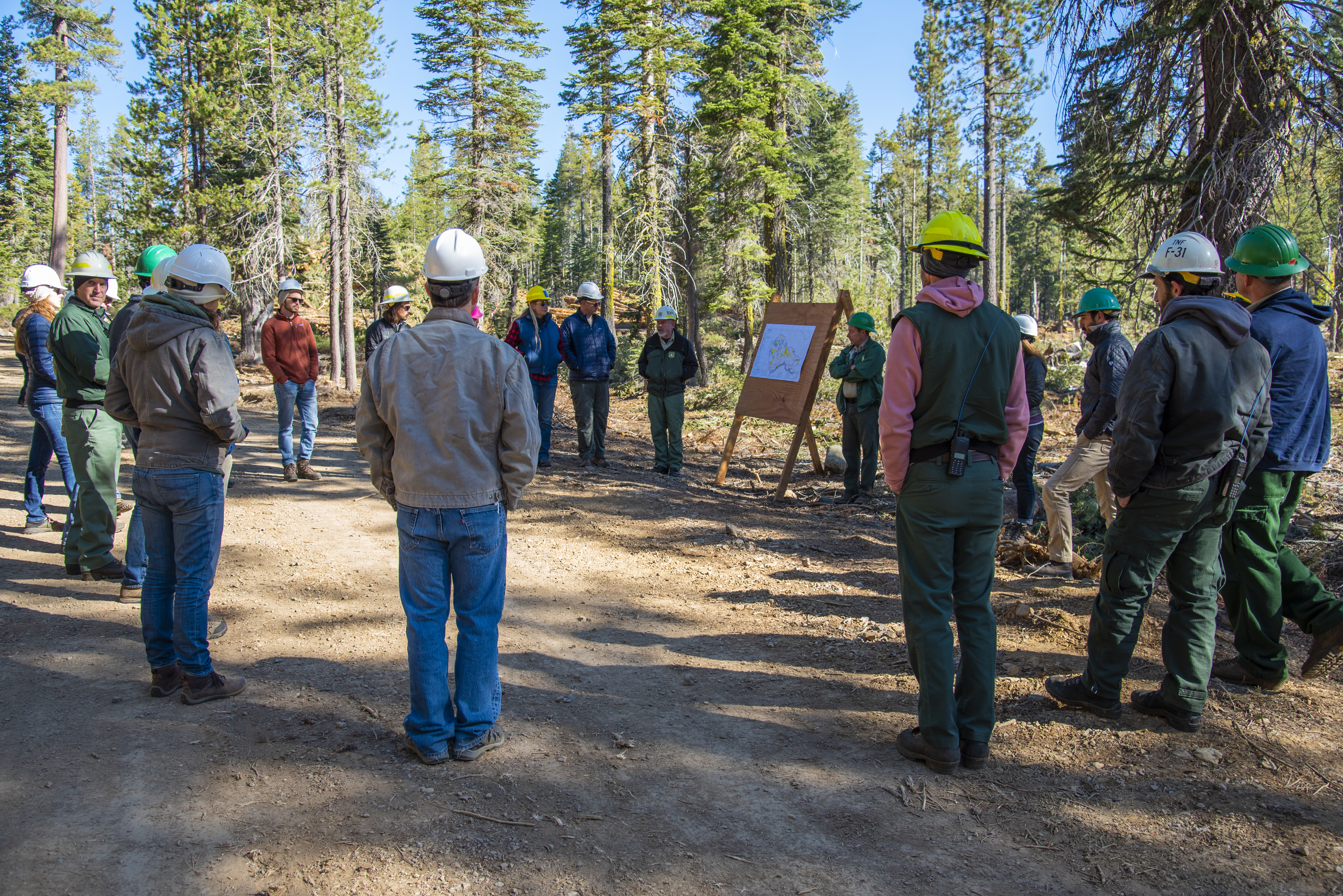
One of 10 landscapes identified in the Forest Service's 2022 initial landscape investment as part of the Wildfire Strategy, the 10-year Stanislaus Landscape Project will look to treat more than 245,000 acres through a full suite of necessary methods including the use of prescribed fire at the landscape scale. It was selected as a fireshed where the greatest impact can be made on reducing wildfire risk and protecting communities.
Focusing efforts along California Highway 108, fire and land managers utilized natural topographical features (rivers, ridges and roads) in the forest to help guide the project's operations. These defined spaces were then prioritized for the increased benefit to communities, habitat, and resources. In early 2023, the Forest Service added 11 additional landscapes.
“Working with the county of Tuolumne, who we partnered with through a master stewardship agreement, contracts are already being awarded to continue working through additional PODs,” Stanislaus National Forest Resource Management Staff Officer Michael Jow said. “We are entering into year two of what is expected to be a 10-year plan.”
Confronting the Wildfire Crisis: Initial Landscape Investments

The Forest Service is working with other federal agencies, including the Department of the Interior and with tribes, states, local communities, private landowners, and partners to treat entire areas across all jurisdictions. The Wildfire Crisis Strategy calls for treating up to 20 million acres on national forests and grasslands and supporting treatment of up to 30 million acres of other federal, state, tribal, private and family lands.
As we enter the second year of the strategy, the Stanislaus Landscape Project is applying a full suite of needed treatments; mastication, biomass removal, machine, and hand piling for burning, hand thinning, timber harvest, hazard tree removal, prescribed fire and fuel break construction and maintenance, to restore forest resilience at a landscape scale. Combined, these efforts will reduce hazardous fuels and create a landscape that can better withstand disturbances such as wildfire, insects, disease and drought conditions, while also protecting local communities, providing for critical species habitat and supporting forest use and recreational opportunities.
Outcomes include reduced fire risk to several foothill communities, protection of power facilities, communication sites on private and public lands and road improvements for public recreation and access for emergency response.
Protecting the Stanislaus National Forest and the Wildland Urban Interface
Passing through the lowlands of California’s Central Valley, up through the oak savannas of the Sierra Nevada foothills until you’ve gained enough elevation and the mighty Stanislaus, an other-worldly explosion of pines, firs, cedar, and the world’s oldest known juniper tree, is before you.
Those who make their pilgrimage to the forest will also likely shop at local stores, dine at local restaurants, fill their cars at local gas stations supporting an economic engine primed for growth. These places, encompassed by the massive forest and wildlife, are a part of what’s called a wildland-urban interface—or a place where human-developed land meets the natural environment. This type of environment requires a custom approach to the unique landscape.

Within the Stanislaus Landscape, the newly signed Social and Ecological Resilience Across the Landscape (SERAL) project uses emerging models to demonstrate how vegetation treatments will help wildland fire play its natural role within the fireshed. This will lead to greater ecosystem integrity and protection of collaboratively identified high-value resources and assets (communities, California Spotted Owl and other habitat, water systems, powerlines, roads, communication sites and more).
“We truly believe with our use of cutting-edge technology, the creative use of partnership tools and our ability to bring seemingly divergent partners to the table for a common cause, this project can serve as a model for western forest management moving forward,” said Jow. “It has deliberately been designed to be modular and acknowledges that all landscapes are different and operations that focus on the on-the-ground type of events are destined to only work for the area in which they were intended.”
The Crux of SERAL and the Stanislaus Landscape Project is resiliency across the forest and the communities where many serve and live. The Sierra Nevada is a fire-dependent ecosystem that, for too long, has not been allowed to care for itself naturally. Forest Service efforts will provide the best opportunity available to bring fire back to the landscape and ensure that our forest can accept it in a sustainable, resilient way when there are natural fire occurrences. This work also provides an additional layer of security for the people who call this area home as a healthy forest diminishes the chances of catastrophic fire. These projects will also offer jobs, as the work involved is long-term and has the potential to lead to new industries, providing for the long economic viability of surrounding communities.