

Digital Mobile Sketch Mapping
Digital Mobile Sketch Mapping Screen Capture
DMSM is tablet hardware, software, and back end data support processes (ArcGIS Desktop Tools) that allow trained aerial surveyors, in light aircraft, and ground observers to record forest disturbances and their causal agents. DMSM replaces the legacy Digital Aerial Sketch Mapping (DASM) and will greatly enhance the quality and quantity of forest…
#AerialSurvey, #DetectionSurveys, #ForestHealthProtection, #Maps, #Data
Data and Application Development
Forest Health Advisory System Screen Capture
In addition to maintaining a national IDS spatial database, Forest Health Assessment and Applied Sciences Team (FHAAST) frequently develops or sponsors the construction of datasets that aid Forest Health Protection (FHP) Regions and Field Office personnel in conducting assessments of forest health.With the growing need to conduct complex spatial…
#ForestHealth, #ForestHealthProtection, #Data
National Forest Damage Agent Range Maps
The maps are an integration of various sources, reviewed by regional authorities. For major forest damage causing insects and diseases, they display a historical record of county-level detections, highlighting the past three years of activity. For exotic insect or disease threats where rate of recent range expansion is of prime interest, the maps show a 3-year history of first -ever detection…
#ForestHealthProtection, #ForestHealth, #Maps, #Data
Forest Atlas of the United States

This compendium details the types of forested lands in the United States and the services they provide. With maps, charts, and photos, it uses Forest Service research data to show where our forests are located, the ecosystems they are a part of, and how we can maintain these critical natural resources.
#Forests, #Data, #Research
National Forest System Statistics for Fiscal Year 2024
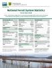
This annual summary of the National Forest System details the infrastructure maintained by the agency. It includes road and trail miles, land acreage, number of facilities and vehicles, and more.
#Data, #DeferredMaintenance, #Infrastructure
National Insect & Disease Risk and Hazard Mapping
The National Insect and Disease Risk Map (NIDRM) is a nationwide strategic assessment and database of the potential hazard for tree mortality due to major forest insects and diseases. The goal of NIDRM is to summarize landscape-level patterns of potential insect and disease activity to inform management and…