USDA, RMRS, AWAE logo USDA RMRS AWAE RMRS
  • ABOUT W&W
    • About Us
    • Scientist Profiles
  • RESEARCH
    • Aquatic Ecology
    • Atmospheric Sciences
    • Biogeochemistry
    • Climate Change
    • Engineering
    • Fire & Fuels
    • Fisheries
    • Geomorphology
    • Hydrology
    • Invasive Species
    • Plant Physiology
    • Sediment & Erosion
    • Spatial Analysis
    • Watershed Processes
  • PROJECTS, TOOLS, & DATA
    • Click for Complete List of W&W Projects, Tools, & Data
    • The Aquatic eDNAtlas Project
      • eDNAtlas Sample Results
      • Supporting Science
      • FAQ & Field Protocol
      • eDNA Sampling Grid
      • Project Background
      • Contacts
    • Bull Trout eDNA Project
      • eDNA Sampling & Supporting Science
      • Participating in the Bull Trout eDNA Survey
      • Bull Trout eDNA Sample Sites
      • The Status of the Bull Trout Survey
      • Partners
    • Cold-Water Climate Shield
      • Presentations & Publications
      • Digital Maps & ArcGIS Shapefiles
      • Data Sources & Documentation
      • Trout Distribution Monitoring
      • Related Links
        • NorWeST: Regional Database & Modeled Stream Temperature
        • SSN & STARS
        • Stream Temperature Monitoring & Modeling
        • U.S. Stream Flow Metric Dataset
    • Cutthroat trout-rainbow trout hybridization
    • Fire & Aquatic Ecosystems
      • Management Questions
      • Publications
        • Manuscripts & Reports
        • Fire & Aquatic Bibliography
        • Science Briefings
          • Adaptation for Wildland Aquatic Resources
          • Climate Change & Wildfires
          • Wildfire Impacts on Stream Sedimentation
      • Workshops
        • 2009
          • Agenda
          • Topics & Contacts
        • 2002
          • Author Profiles
          • Special Issue in Forest Ecology and Management
          • Downloadable Papers
      • Links
      • Photo Gallery
    • Geomorphic Road Analysis & Inventory Package (GRAIP)
      • Introduction
      • Case Studies
        • Legacy Roads
        • Watershed Studies
      • Publications
        • Manuals
        • Selected Articles
        • Science Briefings
        • Posters
      • Downloads & Software
        • Database Update (2013)
        • Data Dictionary 5.0
        • Terrain Analysis (TauDEM)
      • Supporting Information
        • Calculating Base Rate
        • List of Equipment
      • Photo Galleries
        • GRAIP
        • Legacy Roads
        • Other Roads
      • Links & Models
        • FishXing
        • WEPP
        • SEDMODL2
        • STREAM TEAM
        • Water-Road Interaction Technology Series
      • Training Opportunities
      • Jobs & Summer Employment
      • Frequently Asked Questions
      • Contacts
    • National Stream Internet
      • Workshops and Presentations
      • NSI Hydrography Network
      • Databases of Stream Reach Descriptors
      • Databases of Stream Measurements
      • SSN Bibliography
    • NorWeST: Regional Database & Modeled Stream Temperature
      • Project Boundary
      • Data Downloads
        • Stream Temperature Database
        • Modeled Stream Temperatures
      • Interactive Map
      • Publications
        • Supporting Research
        • Science Briefings
        • Posters & Presentations
        • Blogs & Newsletters
      • Supporting Information
        • Reconditioned NHD Plus
        • Regional Climate Downscaling
        • Climate-Aquatics Blog
        • 2011 Climate-Aquatics Decision Support Workshop
      • Related Links
        • Cold-Water Climate Shield
        • SSN & STARS
        • Stream Temperature Monitoring & Modeling
        • U.S. Stream Flow Metric Dataset
      • Contacts & Contributors
    • Sediment Transport
      • Idaho & Nevada
        • Publications
        • FAQ & Contact Us
      • Colorado & Wyoming
        • Publications
        • FAQ & Contact Us
    • Spatial Statistical Modeling of Streams (SSN & STARS)
      • Frequently Asked Questions
      • Software & Data
      • GIS Layers
      • Publications & Presentations
      • Latest Releases
      • Authors & Contacts
      • Other Software
      • News
    • Stream Temperature Monitoring & Modeling
      • Protocols and Resources
      • Interactive Maps
      • Modeling
        • Air Temperature Model
        • Multiple Regression Model
        • Spatial Statistical Model
        • SSN & STARS
        • NorWeST
      • Resources
        • Climate Change Resource Center
        • Climate-Aquatics Blog
        • Climate-Aquatics Workshop
        • Temperature Data Macro
      • Publications
        • Publications & Presentations
        • Science Briefings
    • Understanding the diversity of Cottus in western North America
      • Current Contributions
      • Phylogeny and Maps
      • Publications and Posters
      • Contact
    • Valley Bottom Confinement
      • Download Valley Bottom Shapefiles
      • Download VCA Script & Toolbox
      • Publications
    • Water Erosion Prediction Project (WEPP)
      • Forest Management
        • Disturbed WEPP
        • Disturbed WEPP Batch
        • ERMiT
        • ERMiT Batch
        • WEPP FuME
        • Tahoe Basin Sediment Model
      • Road Erosion
        • WEPP: Road
        • WEPP: Road Batch
      • Fire Effects
        • Disturbed WEPP
        • Disturbed WEPP Batch
        • ERMiT
        • ERMiT Batch
        • WEPP FuME
      • WEPP Climate Parameter Files
        • Rock:Clime
      • Peak Flow Calculator
      • Additional WEPP Resources
    • U.S. Stream Flow Metric Dataset
      • Dataset Downloads
      • Publications
        • Macroscale Hydrologic Modeling
        • Comparison of VIC/MC1 Models to Observed Gage Data
        • Science Briefing
      • Contacts
        • Charlie Luce
        • Seth Wenger
      • Links
        • NHD Plus
        • University of Washington Climate Impacts Group
        • Trout Unlimited Science Page
        • Climate-Aquatics Blog
      • Related Websites
        • SSN & STARS
        • Reconditioned NHD Plus
        • NorWeST Stream Temperature
        • Stream Temperature Modeling & Monitoring
  • PUBLICATIONS
    • Search Publications (TreeSearch)
    • Recent W&W Publications
    • All Available W&W Publications
    • Publications by Project or Research Subject
      • Biogeochemistry
      • Environmental DNA
      • Climate Change
      • Engineering
      • Fire & Aquatic Ecosystems
      • Geomorphic Road Analysis & Inventory Package (GRAIP)
      • Glacier Lakes Ecosystem Experiments Site (GLEES)
      • Invasive Aquatic Species
      • NorWeST Stream Temperature Regional Database & Model
      • River Bathymetry Toolkit (RBT)
      • Sediment Transport
        • Idaho/Nevada
        • Colorado/Wyoming
      • Spatial Statistical Modeling of Stream Networks (SSN & STARS)
      • Stream Temperature Modeling & Monitoring
      • Threats Assessment for Western Riparian Ecosystems
    • Science Briefings
      • Search by Title
      • Search by Researcher
      • Search by Subject
    • General Technical Reports
      • Search by Title
      • Search by Researcher
      • Search by Subject
  • CONTACT US
    • Locations
      • Albuquerque Forestry Sciences Lab
      • Boise Aquatic Sciences Lab
      • Flagstaff Forestry Sciences Lab
      • Fort Collins Biogeochemistry Lab
      • Fort Collins Forestry Sciences Lab
      • Missoula Fire Sciences Lab
      • Moscow Forestry Sciences Lab
    • Employee Profiles
    • Jobs & Employment
    • Website Feedback
    search only W&W
Home    Projects    The Aquatic eDNAtlas Project  FAQ & Field Protocol

FAQ & Field Protocol

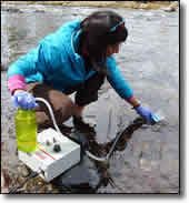
Image shows filter equipment in a stream for the Aquatic eDNAtlas Project, using the Field Sampling Protocol. Questions and Answers and FAQ about sampling points along rivers in the field are also included on this page.


We invite biologists representing organizations with an interest in or responsibility for natural resources—state and federal agencies, tribes, universities, non-governmental organizations, and consulting firms—to participate in developing the national eDNAtlas database for aquatic species. To that end, the National Genomics Center for Wildlife and Fish Conservation (NGC) will help our partners develop robust, reliable eDNA-based datasets on their species of interest based on samples collected following the NGC protocol, analyzed in our laboratory, and made available via the eDNAtlas. These partnerships can take a number of forms, depending on the information already available for your species of interest. Answers to frequently asked questions are provided on this page to help facilitate a dialogue regarding new partnerships and interested parties are encouraged to contact us for more detailed discussions.

Sample collection protocol: Carim KJ, McKelvey KS, Young MK, Wilcox TM, Schwartz MK. 2016. A protocol for collecting environmental DNA samples from streams. Gen. Tech. Rep. RMRS-GTR-355. Fort Collins, CO: U.S. Department of Agriculture, Forest Service, Rocky Mountain Research Station. 18 p.

Project background and general information

FAQ on conducting an eDNA sampling survey

Contacts | Contact Form

Posting results from other labs

1. Does an eDNA assay exist for your species?

If an eDNA assay has been developed at the NGC, or was developed at another laboratory and optimized for analysis at the NGC, skip to the next step. If there is no assay for a species, the NGC can assist with assay development. You can see a list of assays that are developed or under development at the NGC. Because the scope and difficulty of building a reliable assay is different for each species, and the number of available assays from the NGC and other laboratories is rapidly growing, we invite you to contact us for more details. We'll also provide you with an outline of the steps to follow in working with the NGC to build an assay for your species.

2. Do you know where you want to sample?

The NGC can help you design a eDNA sampling campaign tailored to the species, life stage, and habitat of interest, whether at the scale of a local watershed or across a species’ range. To help you identify locations to sample, we have developed a GIS layer of predefined sample sites at a ~1-km interval along the 1:100,000 scale National Hydrography Dataset (version 2) streams. Each site includes spatial attributes such as stream discharge and elevation to guide the choice of sample sites along environmental gradients. Visit the eDNA sampling grid page for more information. To see where samples have already been collected; please visit the eDNAtlas page.

3. Do you have eDNA sampling equipment?

Many of our partners have already invested in the water pumps and associated equipment necessary to collect eDNA samples. For those that do not have this equipment, we operate an “equipment library,” i.e., you can reserve a pump and accessories for use during a particular time. The number of pump sets is limited and demand is high, so it’s important to reserve one early in the year. The length of time that a pump can be loaned is dictated by the scope of your project. It’s also critical to return the pump and supplies when you are done to permit others to start their sampling. If you want to buy your own pump set—which gives you more flexibility with respect to when you sample—we can give you the equipment specifications.

Regardless of whether you own or borrow equipment, we require the use of NGC-provided field kits—filter cups and supplies—for the collection and storage of eDNA samples. This ensures standardization among the thousands of samples analyzed at the NGC, provides a consistent benchmark in our interpretation of your results, and guarantees the sterility of the supplies.

We regret that we cannot provide eDNA sampling equipment or field kit supplies unless eDNA samples are being analyzed at the NGC.

4. Are you ready to collect eDNA samples?

When collecting eDNA samples, we require that you follow our simple, extensively field-tested eDNA sampling protocol for flowing waters to ensure consistency in our estimates of species presence from your samples. Using this easy-to-learn sampling protocol, it takes about 15 minutes for a single person to collect and label a field sample. Collected samples are portable, readily stored while in the field, can be processed in the lab in as little as 3 days, and are permanently archived for reanalysis of other species in future years. The NGC protocol’s ease of use has led to its adoption by biologists from partner agencies across the U.S. and it has been used to sample thousands of sites. We recognize that sampling under other circumstances, e.g., near lake bottoms, in turbid environments, or from sediment, often requires a different approach. For sampling in standing waters, please contact us to discuss variations on this technique (for an example, click here).

Once an eDNA sample is collected, it must be properly cataloged, and every sample must be labeled with:

  • Water body name.
  • Site ID (if on a stream or river; this is downloadable from the eDNA sampling grid).
  • Geocoordinates (field-measured with a GPS and recorded in either UTM or decimal degrees). Do not copy the coordinates from the eDNA sampling grid. Those are an estimate of where the sample should be taken. Please record where the sample actually was taken).
  • Sampling date.
  • Your name.

Samples returned without this information will not be processed.

Once sampling is complete, return the pump set (if borrowed), the used field kits (for re-sterilization), the collected samples, and a spreadsheet of sample data in the following format, with the following data columns: water body name — site ID—actual location sampled (GPS-identified field coordinates in UTM or decimal degrees)—date sampled—name of the sampler—the organization they represent. We suggest you use the downloadable data as a template. Samples submitted without a spreadsheet in the correct format will not be processed.

To see where samples have already been taken to prepare your own field collection, please see the eDNAtlas page.

There is a short video available on the protocol for collecting environmental DNA samples from streams.

5. Would you like to have existing samples analyzed for additional species?

Because each sample contains the DNA of many species and can be stored indefinitely, these samples represent a biodiversity archive of aquatic taxa. Many of them have been analyzed for only one or a few species, and may be available for analyses involving other species. At your request, we will contact the original collector for permission to analyze their samples for additional species. Please make these requests by identifying the specific sample site IDs from the eDNAtlas results database.

6. Do you have an agreement in place with the NGC?

Costs vary for assay design and sample analysis, depending on the species of interest, environment that is sampled, whether a sample is new or has been previously analyzed, and reporting requirements. We have financial instruments that allow us to work with most organizations. We also work with many partners as co-PIs on proposals to implement eDNA sampling surveys. Please contact us for an estimate of current costs, to develop a financial agreement, or to engage us in a proposal.

7. Can eDNA results from other laboratories be integrated to the eDNAtlas?

Many laboratories process eDNA samples but most lack geospatial database capabilities for displaying and distributing results like those provided by the eDNAtlas. Data from other laboratories can be integrated to the eDNAtlas database for distribution through this website if it meets certain standards associated with field sample collection protocols, assay specificity, sensitivity, and availability to other laboratories. For small datasets (e.g., < 100 eDNA sample results) data can be integrated to the eDNAtlas database at no cost assuming the contributors provide the information in the necessary format. At present, we do not accept data from metabarcoding studies. If you are interested in integrating your eDNA results with the eDNAtlas, please contact us.


Resources

Aquatic eDNAtlas Sample Results Map
Aquatic eDNAtlas Supporting Science and Peer-Review publications
Aquatic eDNAtlas Project - Field Sampling Protocol
eDNA Sampling sites coordinates to prepare for field work

The eDNAtlas

Supporting Science

FAQ & Field Protocol

eDNA Sampling Grid


Related Websites

The National Stream Internet

NorWeST: Regional Database & Modeled Stream Temperature

SSN & STARS: Tools for Spatial Statistical Modeling on Stream Networks

Climate Shield Cold-Water Refuge Streams for Native Trout

Stream Temperature Modeling and Monitoring

Climate-Aquatics Blog

U.S. Stream Flow Metric Dataset

National Genomics Center for Wildlife and Fish Conservation

Sculpins of the West - A molecular taxonomy of Cottus in western North America

The Range-Wide Bull Trout eDNA Project

Cutthroat trout-rainbow trout hybridization


  Home    Projects    The Aquatic eDNAtlas Project  FAQ & Field Protocol  

Find W&W and follow us on your favorite social media site:

facebook
twitter
youtube
email


  |  RMRS Home  |   W&W Home  |   Disclaimers  |   Freedom of Information Act (FOIA)  |   Privacy Notice  |   Quality of Information  |   Print This Page  |