Forest Atlas of the United States
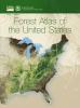
This compendium details the types of forested lands in the United States and the services they provide. With maps, charts, and photos, it uses Forest Service research data to show where our forests are located, the ecosystems they are a part of, and how we can maintain these critical natural resources.
#Forests, #Data, #Research
Learning on the fireline: Fire Tigers of Clemson

(Adapted from CompassLive)
Mentorship is a major part of the program – every student has the opportunity to spend time with experienced fire managers. (USDA Forest Service photo by Helen Mohr)
The only way to understand the nuances of working a fireline is by being on one. The six-year-old Fire Tigers…
#Fire, #Students, #Forestry, #Research
Right seed in the right place: Forests of the future
Brad St. Clair on a field trip to look at Douglas fir and other rare conifers in the Sierra Madre Occidental near Durango, Mexico. Photo courtesy Sally Aitken, University of British Columbia.
OREGON—Research geneticist Brad St. Clair is planning for the future. An accomplished scientist at the Pacific Northwest Research Station, St. Clair has…
#InsideTheForestService, #Forestry, #Research, #PlantingTrees
From Forests to Faucets: Where does your drinking water come from?

Watersheds are land areas, also known as basins or drainage areas, where rainfall flows to streams and rivers and then to outlets, like an ocean or bay. National forests and grasslands are home to watersheds that provide clean drinking water for millions of people. Photo credit: Eric Vallery, USDA Forest…