

Rocky Mountain Region Viewing Area
LOCATION and PHOTOS
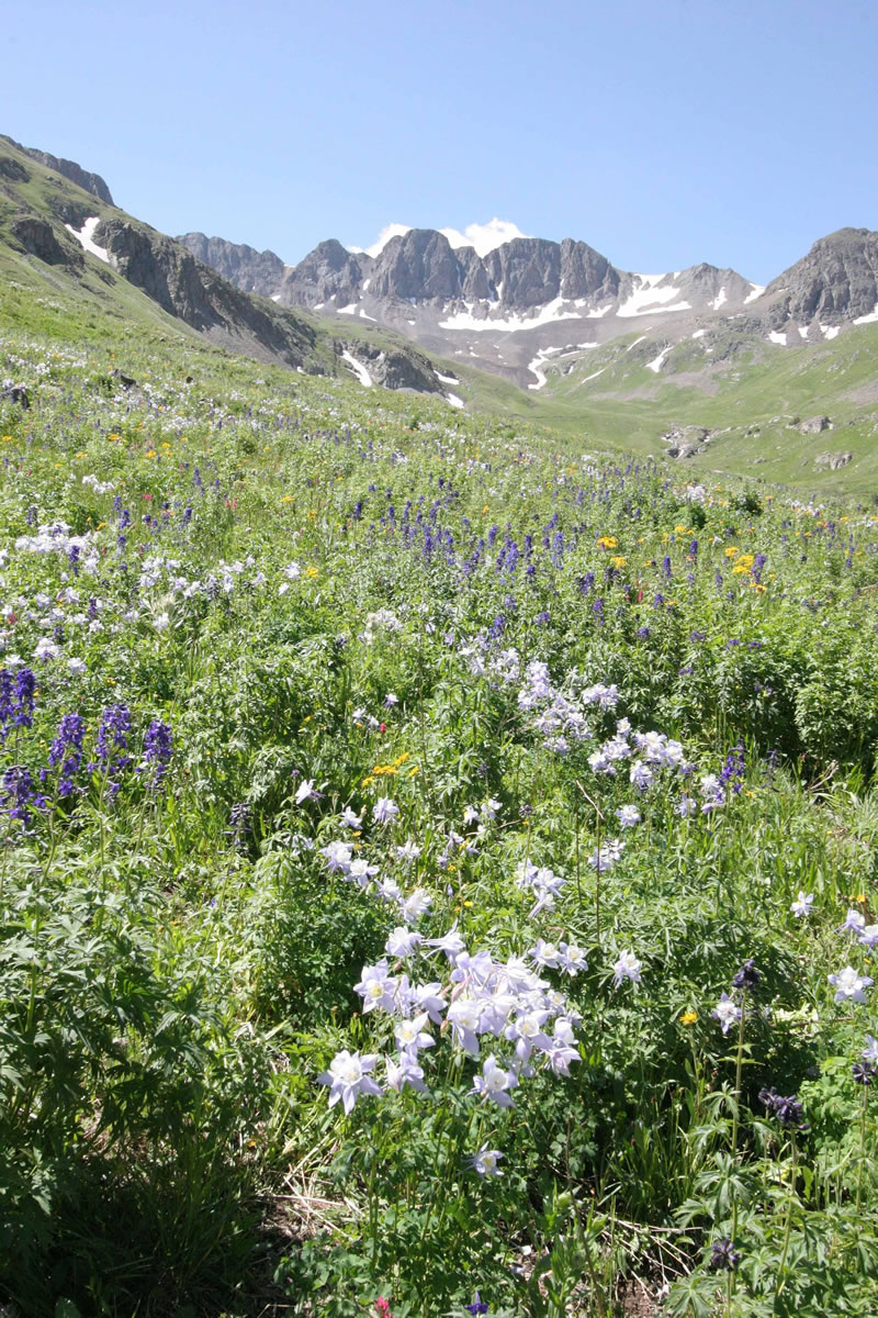 American Basin. Photo courtesy U.S. Forest Service.
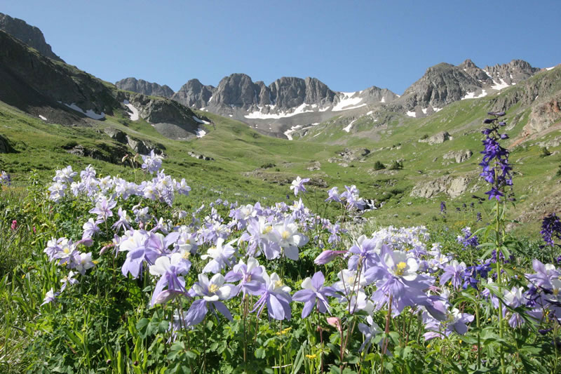
 American Basin. Photo courtesy U.S. Forest Service.
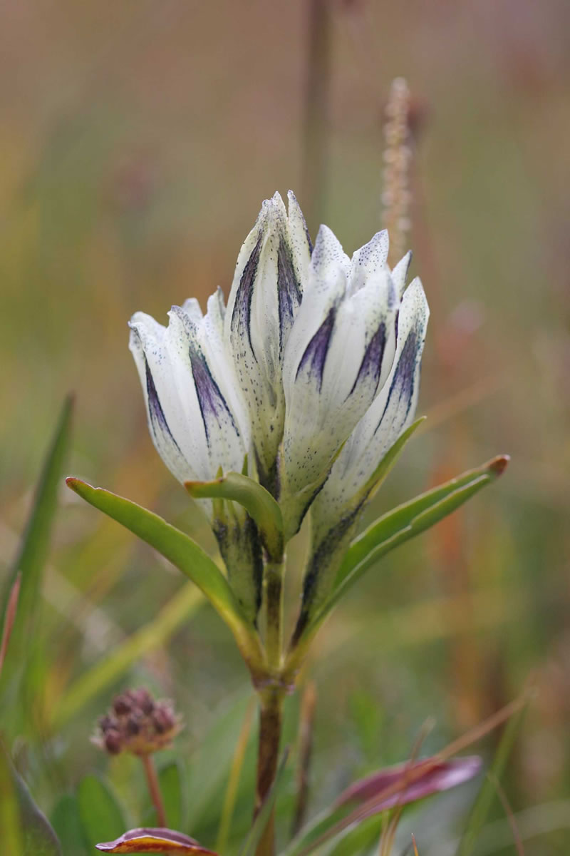 Arctic gentian. Photo courtesy U.S. Forest Service.
 Columbine. Photo courtesy U.S. Forest Service.
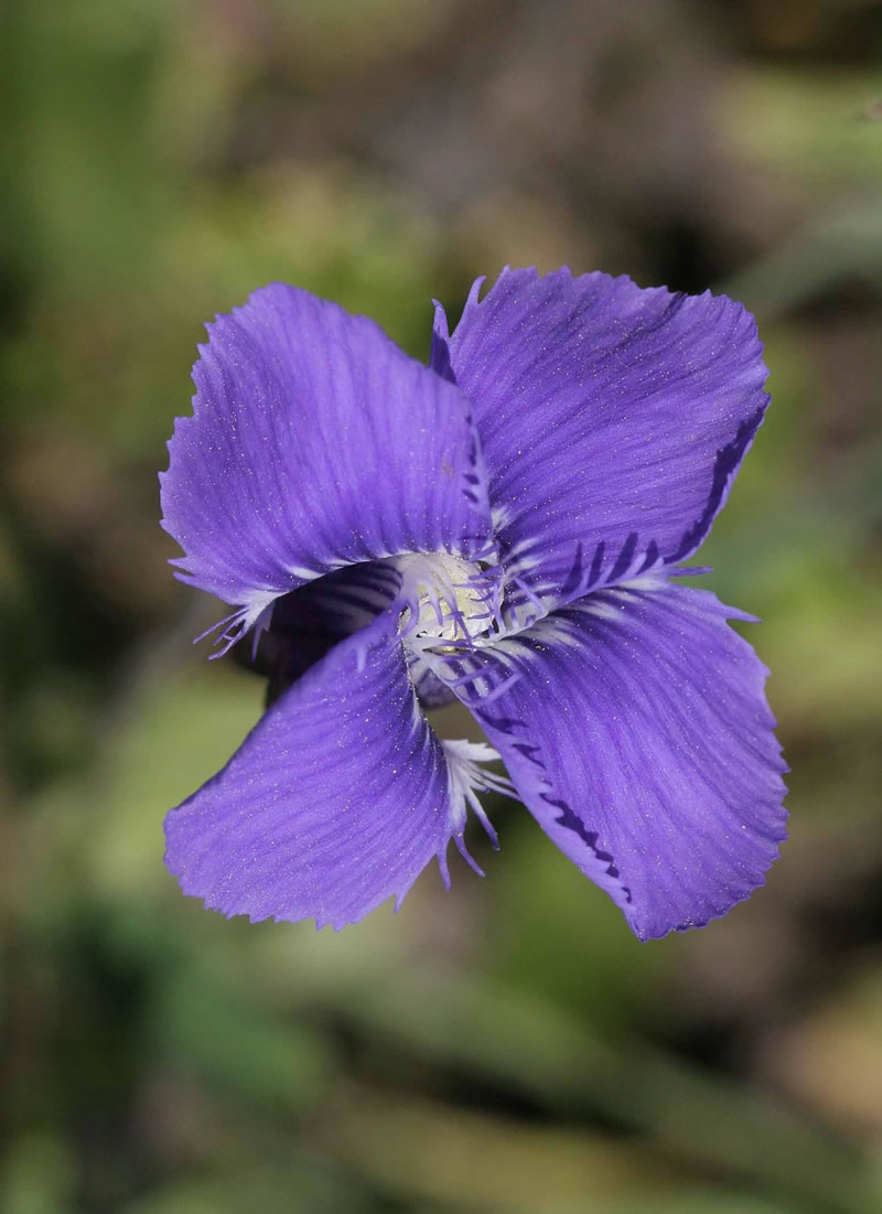 Fringed gentian. Photo courtesy U.S. Forest Service.
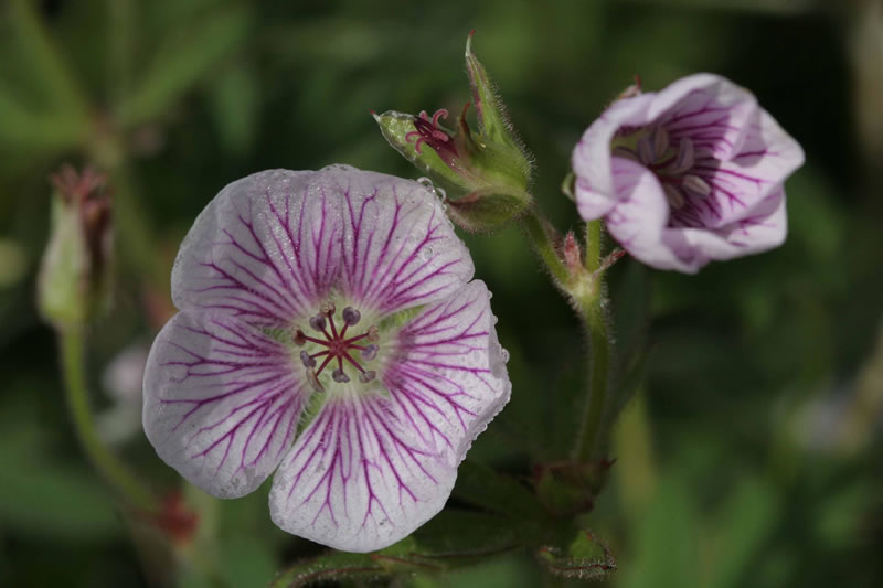 Wild geranium. Photo courtesy U.S. Forest Service.
American Basin
Forest: Gunnison National Forest
District: Gunnison Ranger District
Description: American Basin is a high alpine basin surrounded by vertical cliffs. It is well known for its spectacular display of alpine wildflowers in mid-July to early August. Accessible by vehicle, a foot trail starts in the valley and goes up to Handies Peak. Elevations range from 11300 to over 14,000 feet at the peak. In a brief but dazzling show of wildflowers such as Marsh Marigold, Parry’s Primrose, Colorado columbine, owl’s clover, larkspur, monks hood, Sneezeweed, Old Man of the Mountain, king’s crown, rose crown, elephant’s head, gentians and many others may be enjoyed. American Basin is located on the Alpine Loop Backcountry Byway. The entire Alpine Loop has several other fine wildflower viewing areas. Parts of Cinnamon and Engineer Passes have exquisite pockets of alpine flora.
Viewing Information: The best time to visit is mid-July to early August. The road to the basin is best navigated with a jeep or ATV but an experienced driver with a high clearance vehicle can navigate to the entrance of the basin in 2-wheel drive. Access with four-wheel drive is to the trailhead within the basin. Both Jeeps and ATVs can be rented in Lake City. For the latest on the flowering stage, call the Lake City Visitor Center at (970) 944-2527 or 1-800-569-1874. It will take roughly one hour to reach the basin from Lake City.
Safety First: Most of American Basin is above timberline. Thunderstorms often develop in the afternoon in the Colorado high country. Visiting early in the day and being back near or in your vehicle by afternoon is advisable. Be aware of high altitude sickness, which can be life threatening, and drink plenty of water. If you are not acclimated, do not overexert. There are no services available. Be sure to take water and a lunch for your visit.
Directions: Drive south on Colorado 149 from Lake City for about two miles, then turn right on Hinsdale County Road 30 for about 16 miles. Turn left off CR 30 to enter the basin. Two-wheel drives are advised to park in the first parking lot as they enter the basin and walk the rest of the way, about 1 mile to the trailhead. As part of the Alpine Loop, the return trip (longer) to Lake City can be over Engineer Pass. Check with the Visitor Center in Lake City for maps.
Ownership and Management: U.S. Department of the Interior, Bureau of Land Management, Gunnison Field Office. (970) 642-4940. This site is about 2.5 miles off of the National Forest.
Closest Town: Lake City, Colorado (18 miles).