Rocky Mountain Region Viewing Area
LOCATION and PHOTOS
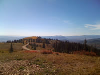
 Dispersed campsite along National Forest System Road (NFSR) 60 with nearly a 360 degree view. Photo by Veronica Orwan.
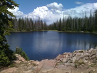
 Summit Lake is located at Summit Lake Campground. It has access to restrooms, drinking water, handicap accessible, a Trailhead, and camp sites with a daily fee. Photo by Veronica Orwan.
 Lady’s slipper (Cypripedium fasciculatum). Photo by Katie Heard.
Buffalo Pass
Forest: Routt National Forest
District: Hahns Peak/Bears Ears and Parks Ranger Districts
Description: This approximately 15-mile stretch of scenic dirt road crosses the diverse habitats within the Park Range of the Rocky Mountains. It rises from sagebrush and gamble oak habitat to lodgepole pine, quaking aspen, and spruce-fir dominated forests. The elevation ranges from 6,700 feet in Steamboat Springs to 10,400 feet at Summit Lake Camp Ground. This road offers spectacular views of the Yampa and North Park valleys below, multiple alpine lakes within walking distance, access to the Mount Zirkel Wilderness, multiple disperse camping sites and Summit Lake Campground with restroom facilities. Additionally, there are numerous hiking, horseback and motorized vehicle trails to suite a range of outdoor activity needs.
Viewing Information: Because of the high elevation of Buffalo Pass, the viewing season for wildflowers is compressed, and they are best seen from late June to early August. Common species found along this area include: common yarrow (Achillea millefolium), orange agoseris (Agoseris aurantiaca), heart leafed arnica (Arnica cordifolia), marsh marigold (Caltha leptosepala), paintbrush (Castilleja species), fireweed (Chamerion angustifolium), purple marshlocks (Comarum palustre), fleabane (Erigeron peregrinus), glacier lily (Erythronium grandiflorum), strawberry (Fragaria virginiana), geranium (Geranium species), golden-aster (Heterotheca villosa), bluebells (Mertensia species), Rocky Mountain pond-lily (Nuphar lutea ssp. polysepala), elephanthead (Pedicularis groenlandica), lousewort (Pedicularis racemosa), Whipple’s penstemon (Penstemon whippleanus), Jacob’s-ladder (Polemonium pulcherrimum), buttercups (Ranunculus species), groundsel (Senecio species), phlox ( Phlox species), false hellebore (Veratrum species), Rabbit Ears gilia (Ipomopsis aggregata ssp. weberi), and Lady’s slipper (Cypripedium fasciculatum).
Safety First: As with most high elevation areas, be aware of rapidly changing weather conditions. Lightning storms often form in early afternoon, so be prepared for a quick departure, if necessary. Sunscreen is a good idea in the thin air at high elevation. The elevation itself can cause discomfort in some people. Be cautious of hazard trees on and outside of the road corridor. Dead trees can and do fall without warning and with little or no help from the wind. Everyone who visits the national forest needs to be very aware of their surroundings. More and more trees are expected to fall over the next several years. In addition, as always, be aware of other vehicles on the road and in parking areas. For current safety information go to the Medicine Bow-Routt National Forests' Outdoor Safety & Ethics web page.
Directions: Buffalo Pass is located on Forest Service road 60 between Steamboat Springs and Walden, Colorado. It can be reached on its western end via the town of Steamboat Springs, from County Road 36 to National Forest Road 60 or from the eastern end via the town of Walden, from State Highway 14 to County Road 24 West to National Forest Road 60. Although this road is in good condition, and passible for passenger vehicles at lower elevations, the conditions become rough for approximately four miles at the higher elevations. High clearance vehicles are recommended. Visitors are strongly encouraged to call ahead for road conditions and possible closure information.
Ownership and Management: U.S. Forest Service, Routt National Forest; Parks Ranger District (970) 723-2700, Hahns Peak/ Bears Ears Ranger District (970) 870-2299.
Closest Town: Steamboat Springs, Colorado.
For More Information: Routt National Forest maps are available from any district office for a small fee. Most offices also carry 7.5 min U.S. Geological Service (USGS) Topography maps that cover broad areas accurately. Call the Hahns Peak/Bears Ears Ranger District (970-870-2299), Parks Ranger District (970-723-2700), or Yampa Ranger District (970-638-4516) for more information.

