

Intermountain Region Viewing Area
LOCATION and PHOTOS
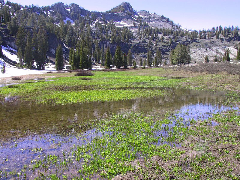
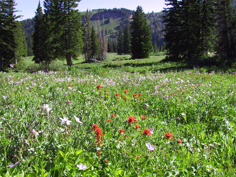 A Tony Grove meadow. Photo by Teresa Prendusi, U.S. Forest Service.
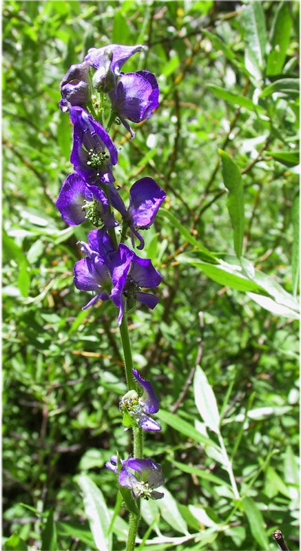 Aconitum columbianum. Photo by Teresa Prendusi, U.S. Forest Service.
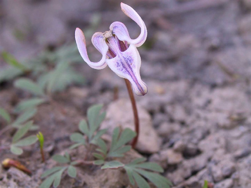 Dicentra uniflora. Photo by Teresa Prendusi, U.S. Forest Service.
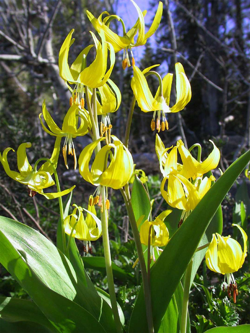 Erythronium grandiflorum. Photo by Teresa Prendusi, U.S. Forest Service.
 White Pine Lake trail. Photo by Teresa Prendusi, U.S. Forest Service.
Tony Grove Lake, Bear River Range
Forest: Wasatch-Cache National Forest
District: Logan Ranger District
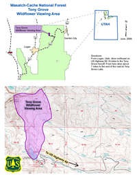
Description: A seven-mile paved road climbs to a height of 8,050 feet to reach Tony Grove Lake. An explosion of summer wildflowers greets visitors to this area during July and August. A colorful profusion of geraniums, paintbrushes, columbines, lupines, daisies, and mountain sunflowers stretch for miles across the meadows north of Tony Grove Trailhead. Powerful slow moving glaciers formed the original Tony Grove Lake. The size of the lake was augmented with an earthen dam built in the 1930’s. Tony Grove has unique geology and abundant plant and animal life on the Tony Grove self guided nature trail around the lake. Tony Grove Campground provides 37 campsites for those who wish to stay overnight, reservations are highly recommended. A fully accessible boardwalk and picnic area are located near the water. There are multiple single track trails that lead to different destinations, White Pine lake North East of Tony Grove or trails that lead to the top of the Cirque wall and the Mt. Naomi Wilderness.
Viewing Information: The best time to see wildflowers is usually mid-July through early to mid-August. There is a trailhead that takes you to either the Mt. Naomi Wilderness or to White Pine Lake. In addition, there is trail that circles Tony Grove Lake. All trails provide terrific wildflower viewing opportunities. The cost per vehicle is $10. Tony Grove Day Use weekley pass is $30, and a Day Use Season Pass $60.
Safety First: The Tony Grove area receives high recreation use throughout the summer and traffic can, at times, be heavy along the forest roads. Weather in the Bear River Mountain Range can change rapidly and can go from a reasonably warm summer day to winter-like conditions in a matter of hours. Bring appropriate clothing to stay warm and dry in this ever-changing environment.
Mosquitoes can be abundant throughout the summer months, so wear protective clothing (long sleeve shirt and long pants) and use insect repellent with DEET between dusk and dawn to reduce your risk to the virus. To date, no West Nile Virus has been noted in this area, but it has been found in Utah and could eventually enter these landscapes. The Utah Department of Health Office of Epidemiology maintains a website with current updates of West Nile activity in Utah. Please take necessary precautions while hiking outdoors. Wildlife encounters are highly likely. Moose are frequently observed around the lake and Bees and other pollinating insects enjoy the diverse wildflowers as well.
Directions: From Logan, Utah, drive northeast on US Highway 89, 19 miles to the Tony Grove turnoff. From here drive about 7 miles to the end of the road at Tony Grove Lake.
Ownership and Management: USDA Forest Service, Wasatch-Cache National Forest, Logan Ranger District
Closest Town: Logan or Garden City, Utah.
For More Information: